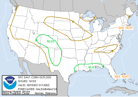
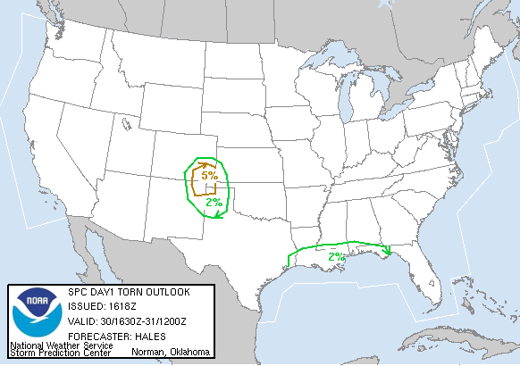
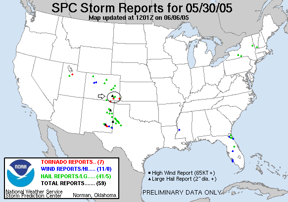
SPC Convective Outlook SPC Tornado Prob. NOAA Storm Report
May 30th , 2005 Kim / Pritchett, Colorado Supercells
Finally real storms on what had been a
slow start to our chase tour. We left Dalhart and ended up stopping in Des
Moines, NM with the idea that we would try to play the first storm that exploded
north of the Raton Mesa in Colorado, then drop south on the horrendous road
network to what we initially expected to be the better storms in New Mexico.
Eventually it looked like things were getting together up north so we headed
over the mesa to Branson. Finally storms started coming off the mesa and we
watched a storm nearly get it's act together east of Trinidad before deciding
that a monster storm that was off to our northeast was the dominant show and we
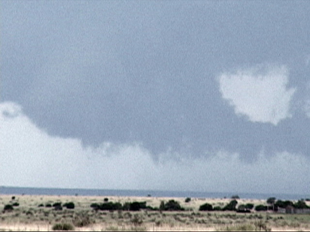
flew east on RT 160 then north of Kim to intercept. It was a TANK of a supercell
with a big block wall cloud and inflow pipes all over. Though it had very strong
mid-level rotation, it didn't have enough at low levels to produce a tornado. It
was a great storm to chase though.
After giving up chasing it north because of the poor road network, we stopped
briefly in Springfield before realizing that another storm had taken off and
been tornado warned back between Kim and Pritchett, CO. The storm had a
confirmed tornado on the ground and we got within a couple of miles of it and
waited. As it got dark, we got to within about 1/2 a mile of a violently
rotating meso but eventually had to run for it and couldn't see if it produced
again in the dark. I really though this one was going to produce a big tornado
directly to our west!
We ended up spending the night in Dalhart, TX, preparing for the following day's
chase in West Texas.
SPC
Convective Outlook SPC
Tornado Prob.
NOAA Storm Report
 |
 |
 |
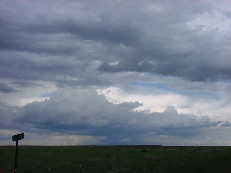 |
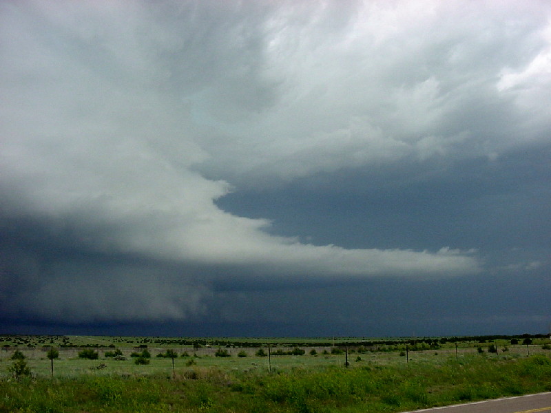
| Storms form off the mountains looking north from Branson, CO. | The first surface based storm of the day produces a large wall cloud east of Trinidad, CO. | An enhanced closer look at the wall cloud with a funnel on the Trinidad storm. | Looking to the east from our vantage neat Trinidad, we can see that the Kim storm has an overshoot and decide to go after it. |
 |
 |
 |
 |
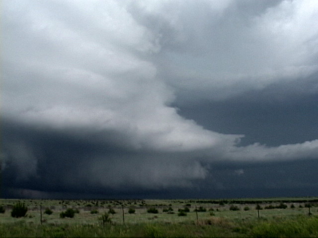
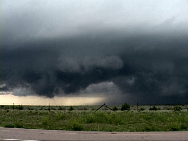
| On the approach, the storm has a large funnel cloud extending off the wall cloud. | Still approaching, awesome striations, vault, tail and wall cloud. | A closer look at the mid-level structure. | The storm cycled through several wall clouds, but never quite produced a tornado. |
 |
 |
 |
 |
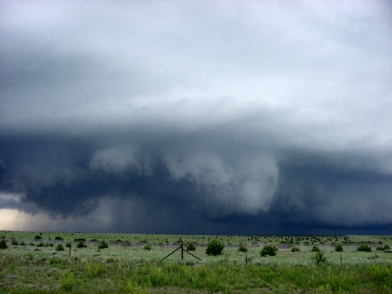
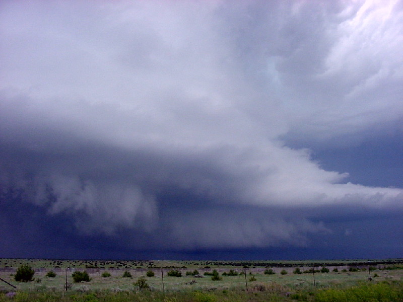
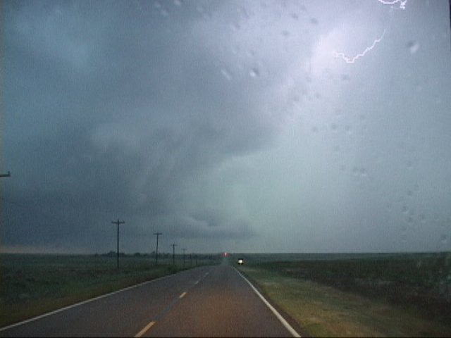
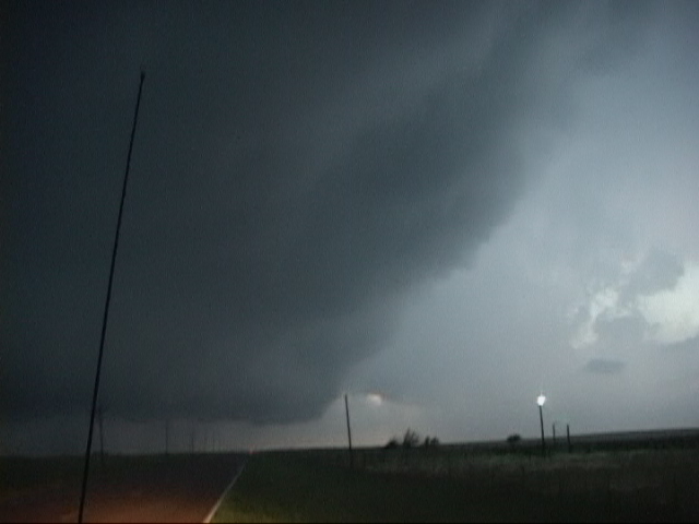
| Now up close, a better look at this butt-dragging wall cloud! | Violent rotation just to our west, but it never tightened up. | Now near dark, a tornado warned storm near Pritchett. What a vault area! These shots are all lightened in contrast to see the structure better. Closing in on this storm in the near dark was spooky! | |
 |
 |
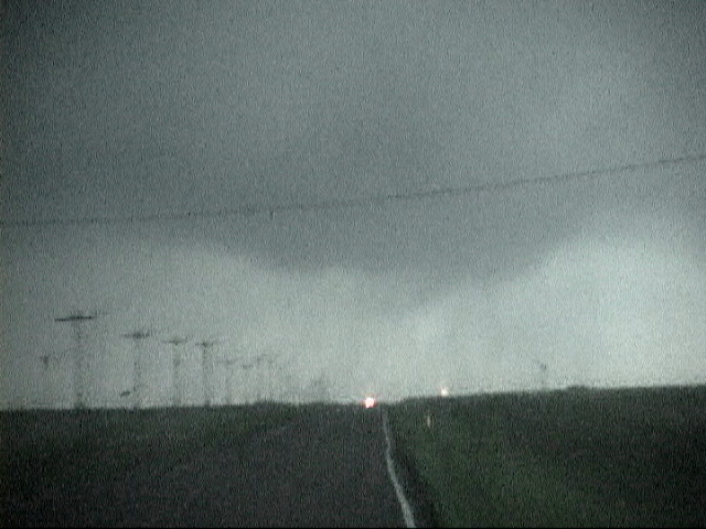
 |
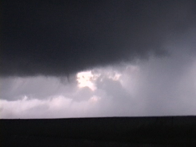 |
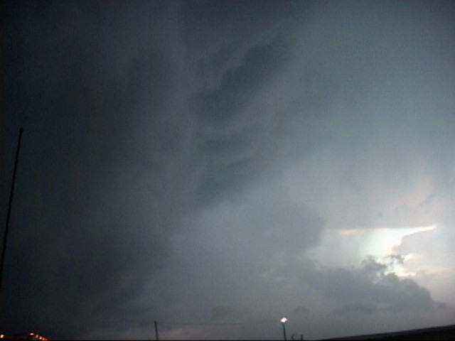
| Lightning illuminates the vault. This storm was dangerously electrified where we were. | We drive right under the vault area. | The meso passes over the road a short distance in front of us. | Violently rotating wall cloud less than 1/2 a mile away drops a small funnel but does not produce a tornado. |
 |
|||
|
Ominous lowering as we make our getaway in danger of getting cut off to our north by the hail core. |
All pictures (C) Richard Hamel 2017.