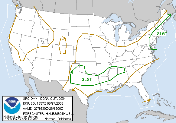
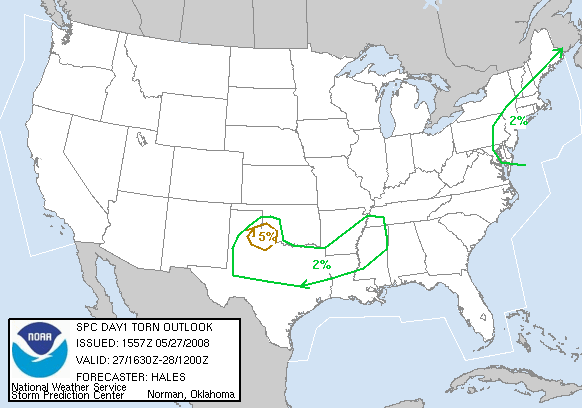
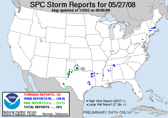
SPC Convective Outlook SPC Tornado Prob. NOAA Storm Report
May 27th, 2008, Altus, OK HP Storms
This day was
a lower stress chase day than the rest of the tour. Starting in Salina, KS, we
blasted south and west all the way to Snyder, OK, playing storms on the cold
front as the outflow boundary from yesterday's MCS in Kansas collided with it.
Wind support was minimal so we had low expectations for tornadoes.
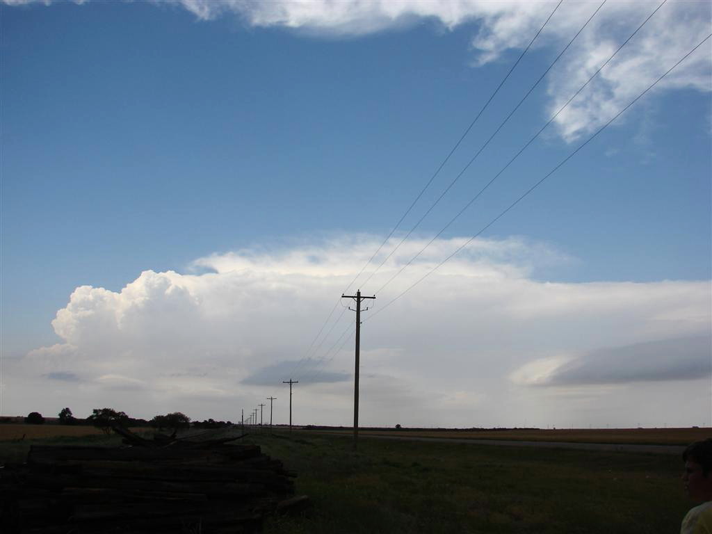
Once we got to Snyder, we were presented with a tough decision: To our north in
the probably better air an isolated LP storm that from our vantage looked pretty
good, and to our southwest a storm that had just gotten it's act together after
a cell merger that was in a good wind shear environment but was in danger of
having it's inflow cutoff by storms moving in from the south. We bounced back
and forth trying to decide which storm to target, and finally close to go for
the one to our west near Altus as there was a report of a funnel cloud and a
well defined notch area on radar.
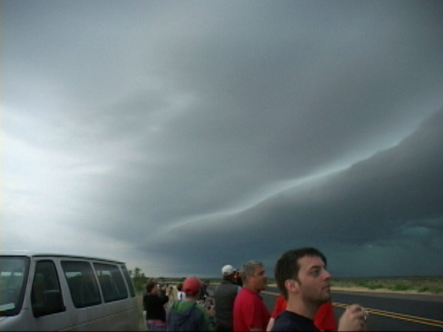
By the time we'd gotten to the south of the storm, it was an HP ice machine,
with a nice shelf area and RFD blowing dirt away from the storm. It was our
first scenic HP storm of the tour. As the storms congealed into a big line, we
headed south into Texas and eventually called it a night, driving along a
magnificent shelf cloud as we made our way to the hotel in Wichita Falls, TX.
Mileage for the day was 601.
SPC
Convective Outlook SPC
Tornado Prob.
NOAA Storm Report
 |
 |
 |
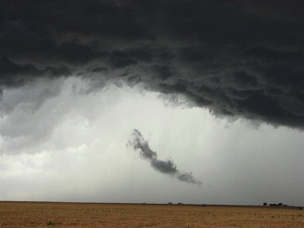 |
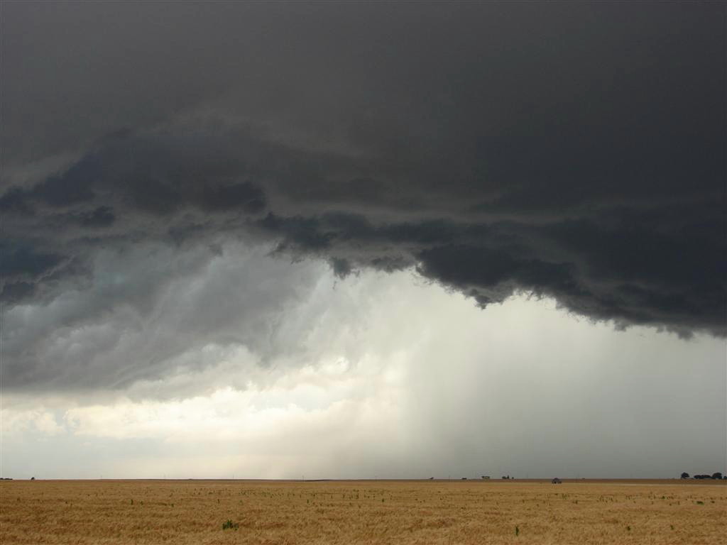
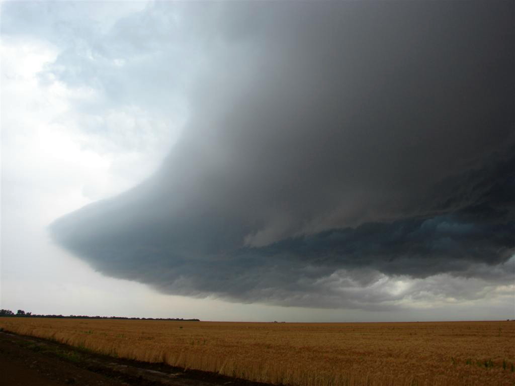
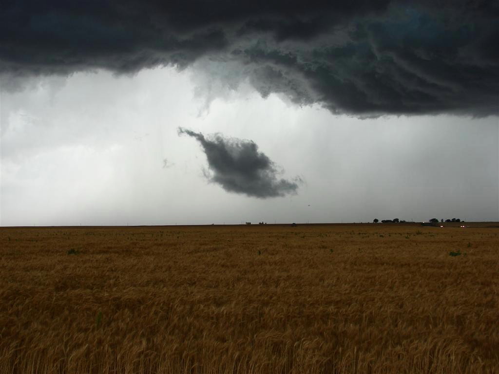
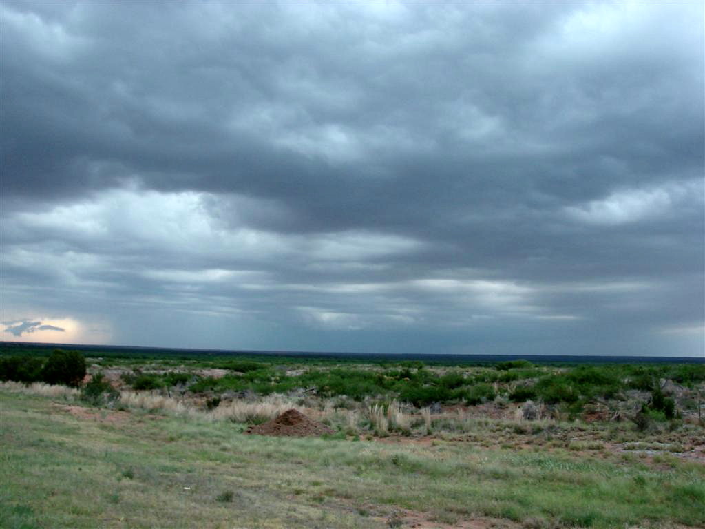
| Heading all the way to southwest Oklahoma, we stop in Snyder with this isolated storm to our north and an intensifying multi-cell storm to our west. It took us a while to make a decision but we elected to chase the storm to the west, since it was in the better atmosphere. | The storm quickly became high precipitation when it's inflow was interfered with by storms to the south, but it was picturesque! This is the main updraft area over a wheatfield. | And the impressive shelf cloud and vault region rapidly approaching our location. | Scud cloud being sucked into the updraft. |
 |
 |
 |
 |
| Very strong outflow winds kick up a dust storm to our south. | Out in the barren scrublands west of Vernon, TX. | ||
 |
 |
 |
 |
| As we head towards Wichita Falls, our stop for the night, we stop to film the awesome shelf cloud generated by the now long line of storms. |
All pictures (C) Richard Hamel 2017.