May 25th, 2012, La Crosse, KS Nighttime Tornadic Supercell
What a day!! The mood went
from optimistic, to excited, to frustrated, to really frustrated, and then to
maximum adrenaline! There were two plays for the day, the warm front around the
northeast Kansas / northwest Missouri border, and the dry line in west central
Kansas. The dry line play was the riskier because of the strong cap, but had the
better ingredients for isolated, rotating supercells if the cap did indeed
break. We started the day in Kearney, NE and headed down to Hays, KS where we
stopped for lunch. We then drifted down to La Crosse and parked for about 2
hours at the Barbed Wire Museum / Park and waited, with the triple point just to
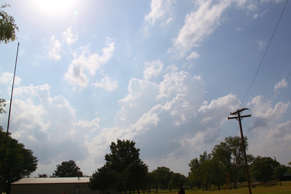
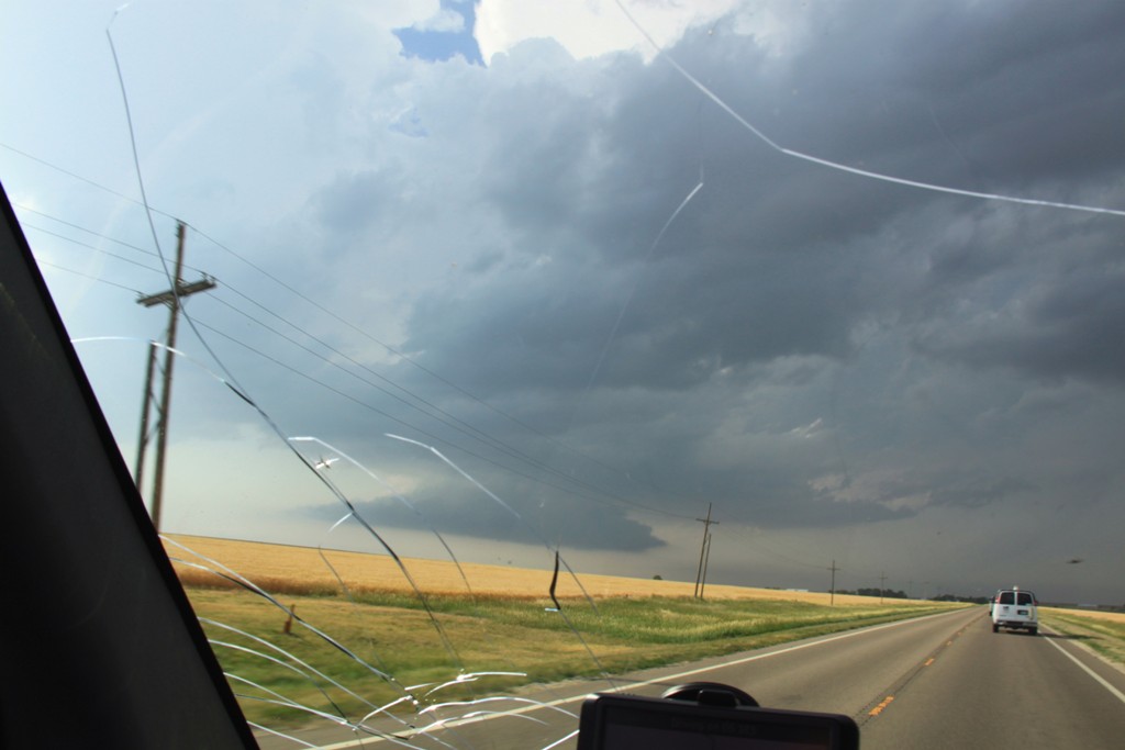
our west. After relaxing for a couple of hours, we began to see agitated cumulus
clouds to our west, and headed about a mile west out of town on a county road
for a better view. We watched as several towers tried to go up on the triple
point, hit the cap, sheared over and died, then kaboom!, one of them finally
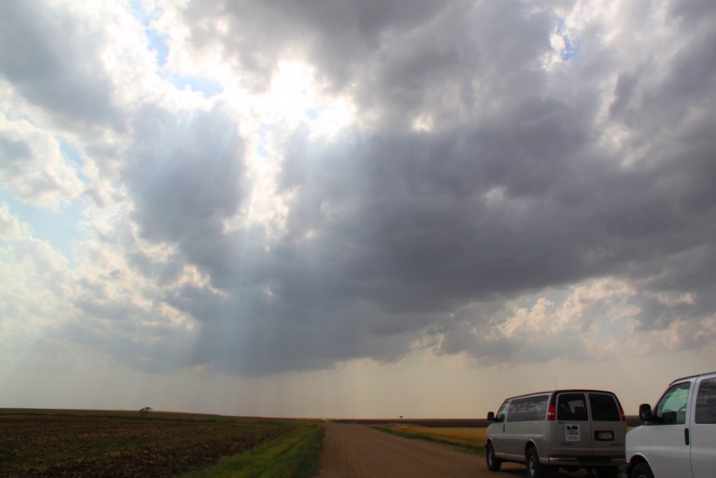
broke through and the chase was on. We blasted towards Liebenthal, KS and in
just minutes the storm had developed a fantastic base with an inflow band
flowing into the storm from both the front and rear flanks of the storm. We
ended up just on the north side of the base with the precipitation core to our
northeast and the base, which was already developing a lowering, just to our
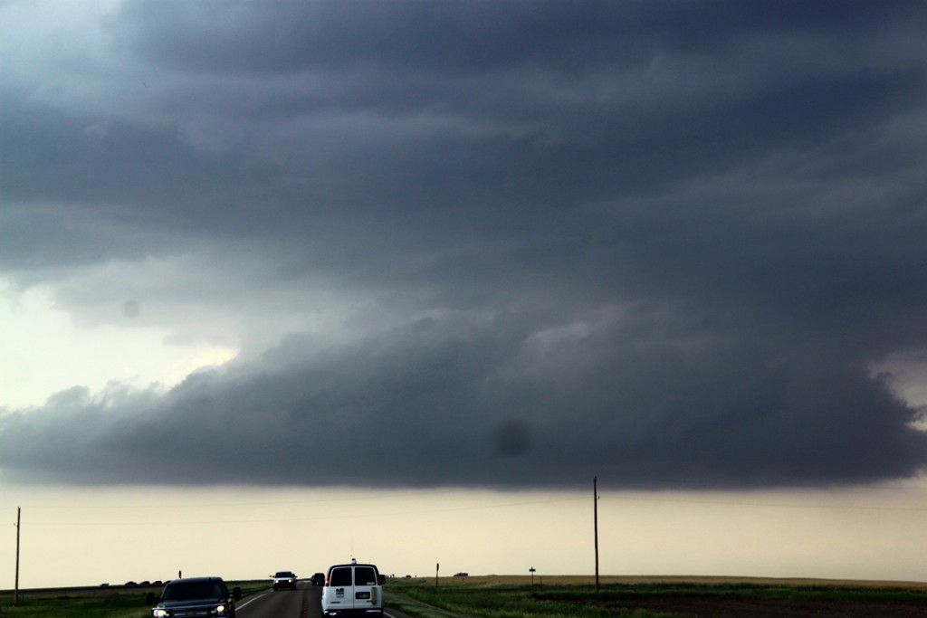
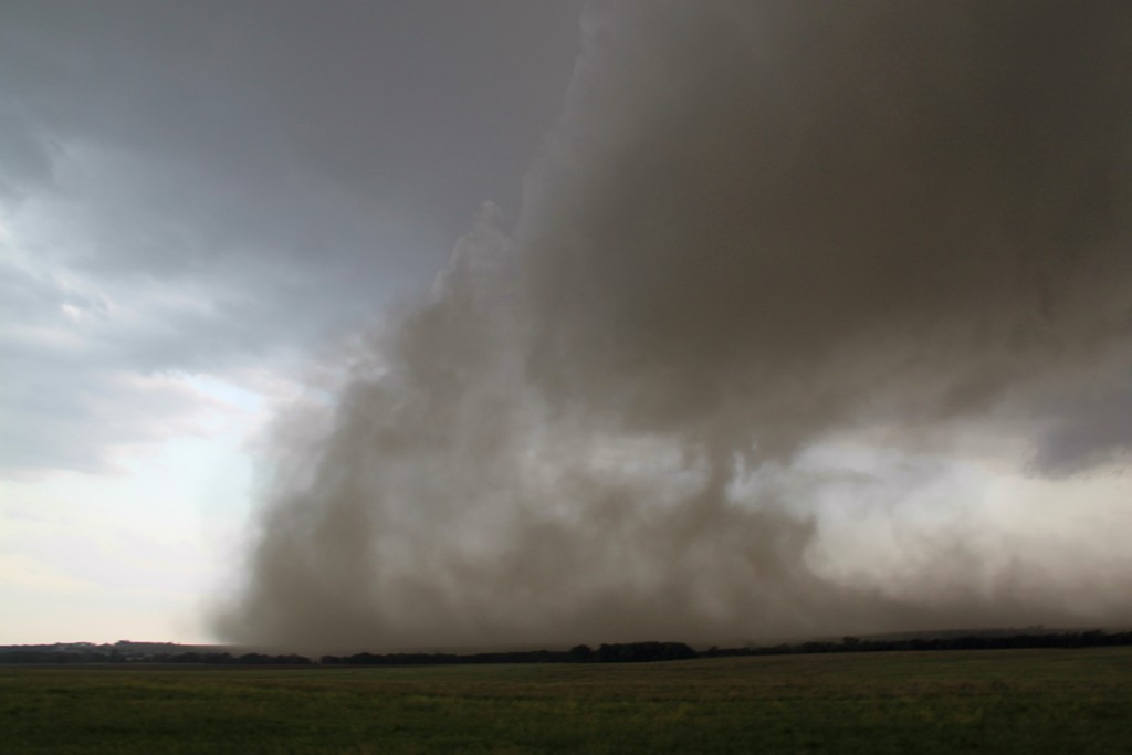
south. The storm quickly developed into one of the dirtiest I've chased, blowing
out an enormous RFD plume which got entrained in the updraft, resulting in
flying dirt everywhere. It was around this time that a tornado was reported
right on the front edge of the storm, with a big dust-bob and perhaps a nub
funnel coming in from the base. This was recorded officially by NWS as a
tornado, and some of my stills have me mostly convinced, so this was tornado #1
for the tour. The area of rotation rushed toward us, and we ended up driving
right through it as it crossed the Munjor road as we paralleled I-70 West-East.
I think I still had grit in my teeth that evening from all the dirt that was
flying around!! Along with a boatload of other chasers we chased the storm as
far as Russell, watching it struggle to stay organized.
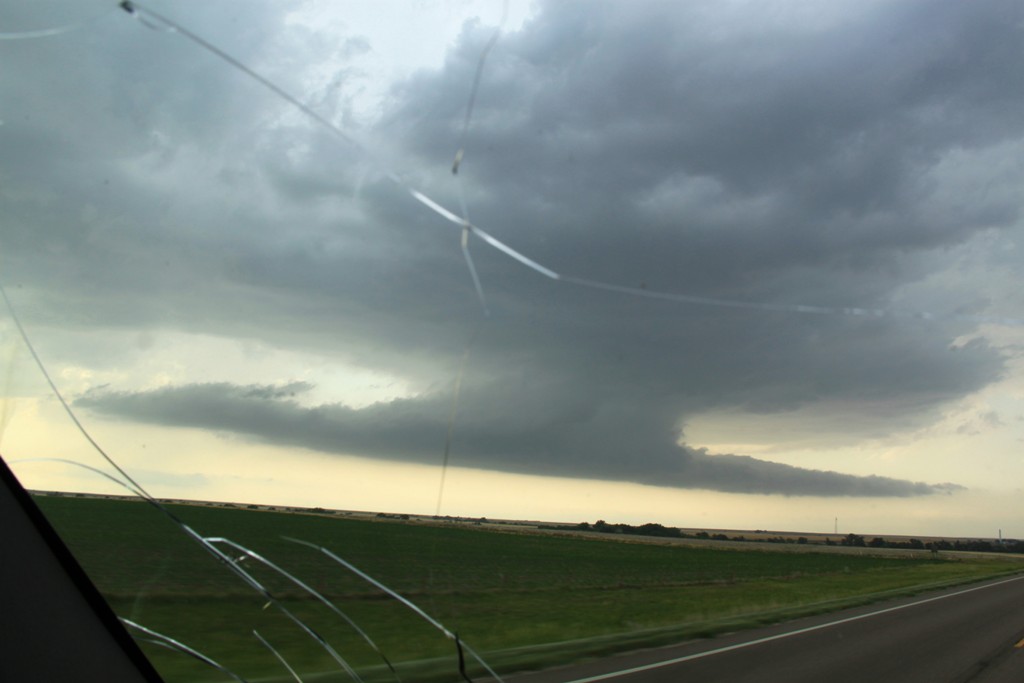
Finally, as the storm looked progressively worse, our attention was drawn to the
tail end of the 3 storm grouping that had developed along the front from the
triple point, and we calculated that we could get there before dark so we
blasted south on Rt. 281 to Rt. 4, then west back towards La Crosse. As we
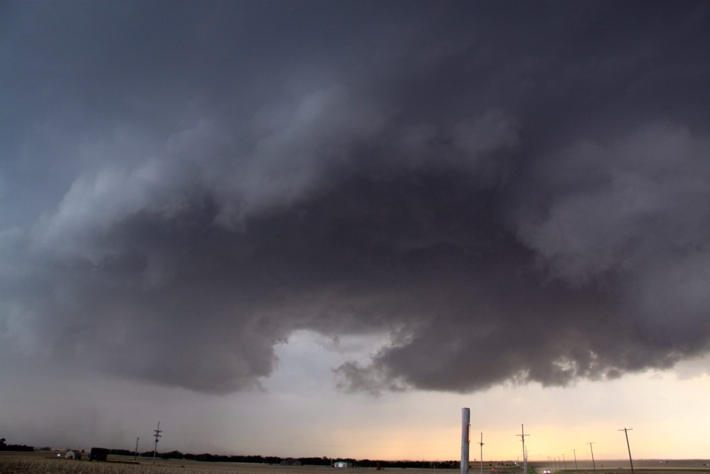
passed the middle storm, it developed a nice looking wall cloud and we became
really torn about sticking with the middle storm or continuing to our target
tail-end storm. But we grudgingly continued towards the tail-end storm, which
was just coming into view and was still tornado warned, though we could not see
the base through the front flank core. Here was a case where the fact that we
blew off the northern storm earlier than most, which would normally be a good
thing, actually ended up as a point of frustration: As we finally got to the
tail end storm, the base looked horrible, and then the middle storm started
dropping tornadoes!! Everyone who'd left the lead storm late was conveniently
right in the slot of that storm and got to see the tornadoes from that storm
(though in hindsight, aside from a neat looking ropeout from one of them, the
tornadoes were nothing exciting, and certainly nothing compared to what we were
about to see).
Meanwhile, we were in La
Crosse completely flummoxed about what to do! Do we head back to the middle
storm that we knew was tornadic, hoping to catch a glimpse just before dark, or
stay with the tail end storm, which was the true triple point storm and on radar
had clearly wrapped the boundary into it and thus should have the best
conditions for tornadoes? It looked horrible visually though, so we decided to
charge right back to Rt. 281 and try to get to the middle storm that we'd just
driven by! As it happened before we got back into La Crosse, someone looked out
the back window and alerted me that the lowering on the tail end storm was
looking better and we stopped again, conferred for a minute and decided that we
needed to stay with our tail end storm. We drove back west of town and found a
place to stop, ironically only about a mile north of where we watched the first
storm forming on the triple point several hours earlier.
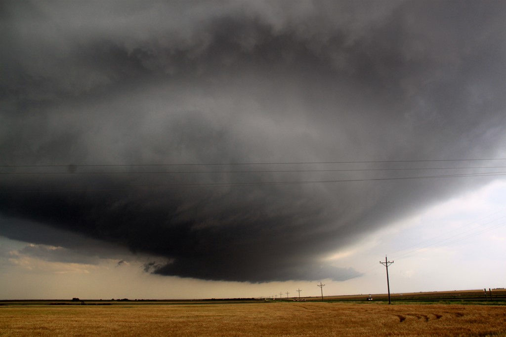
Soon we were rewarded with a spectacular structure show, as the updraft became
incredibly striated with inflow stingers entering the storm from 3-4 different
locations and a beefy block-wall cloud spinning like crazy heading directly at
us. The storm was highly electrified and we had CG's hitting all around us, so
we kept the guests in the van for the most part until the front flank core got a
little farther away. The bolts were of the positive variety, meaning that there
were no branches in the bolts and the thunder was not the cracking variety you
usually here but instead there was just the single BOOM as each bolt hit.
The storm looked like it
would tornado any second as it got darker and darker and we waited.....and
waited.....and waited.... 15-20 minutes as we got more and more frustrated until
finally, at about 9:20 PM a big cone tornado developed and quickly had a large
debris fan around it as it closed in and crossed Rt. 4 to our west only about a
mile away! We were in great position to watch for about 10-15 minutes as the
tornado approached our location but eventually we started getting hailed on and
retreated towards the town. We stopped again and continued to watch as the
tornado morphed into a tall stovepipe, again with a big debris fan. The town
sheriff came over and made us move (no question emergency officials were more
sensitive this year) so we quickly complied and got right to the edge of town
and stopped, then decided to move to the north side of town and watch the
tornado pass to the north of town. It didn't take long before the tornado was
right back into view, a tall, almost Campo looking tornado, still with a large
debris fan, continuously illuminated by the copious amount of lightning that was
banging away. The tornado sirens were screaming as the long stovepipe passed
just north of town and we got run over by the rear flank downdraft of the storm
as the tornado got just to our north. Then the rain cleared out and we were able
to leisurely watch the awesome tornado to the north, then northeast before it
finally roped out. A check of the time between my first Facebook post and my
last when it roped out: The tornado was on the ground for 54 minutes! Easily the
longest I've seen. A nice reward for the 60th tornado I've observed overall!
The fun was not entirely over for us though; as we found out that the road north
out of town was blocked by downed power lines, so we had to find another way out
to get north to our hotel way up in North Platte, NE. We found that the road
south into town was also closed (we found out later that the south side of town
was hit by a second tornado), so we headed east out of town towards Bison. Only
a mile out of La Crosse we caught back up to the storm and another big stovepipe
had formed, looking much like the last! We watched that one for few moments as
it drifted off slowly northeast peaking in and out of the rain before we headed
west through town, past the point where we originally saw the tornado touch down
and then north to Wakeeney and through to I-80 in Nebraska to North Platte.
A great chase day! When we stopped at the tail end storm and saw how bad it
looked and how the middle storm was now producing, it was the height of
frustration, only to end up seeing the best night time tornado I've seen, along
with two others. Although it seemed like we drove forever, the mileage total for
the day was "only" 553.8 miles.
Click Here to see the video of the La Crosse Tornado.
The NWS office in Dodge City, KS has a full report on the tornado:
NWS Dodge City Office May 25th La Crosse, KS Storm Report
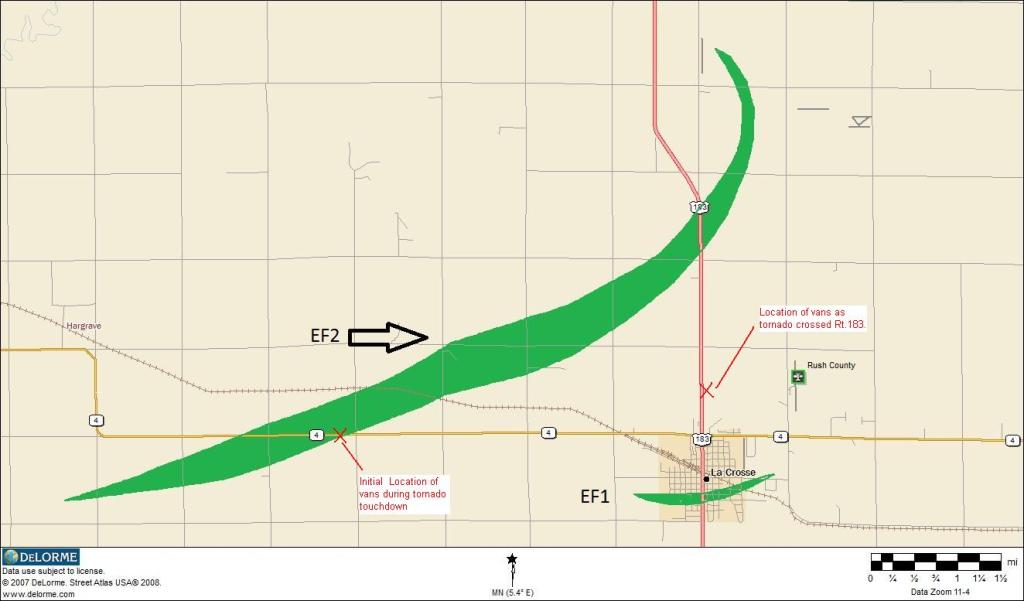
Here is a map of the damage path. The 2 "x's" mark the locations from which we observed the main tornado. Note that there was a brief EF1 tornado that went right through town to our south, doing some significant damage. We never even knew that one was there!

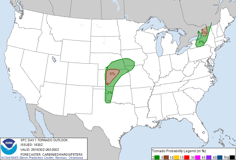

SPC
Convective Outlook SPC
Tornado Prob. NOAA Storm Report
 |
 |
 |
 |
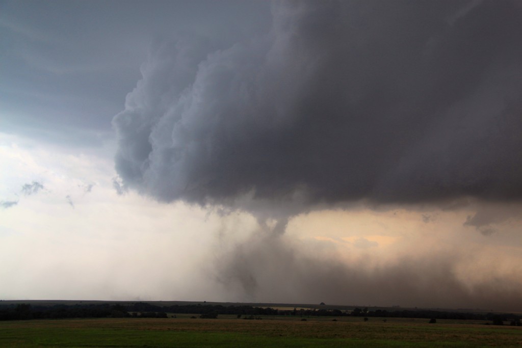
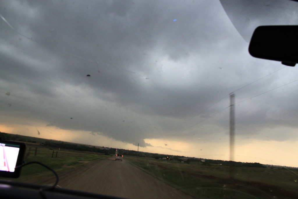
| After a long wait, the triple point starts to percolate just to our west. | Watching storms start to develop on a county road just west of town. | Finally the cap breaks! | In no time we have a developing supercell on our hands as we follow the storm north of town. Nice wall cloud developing and you can see the anvil above. |
 |
 |
 |
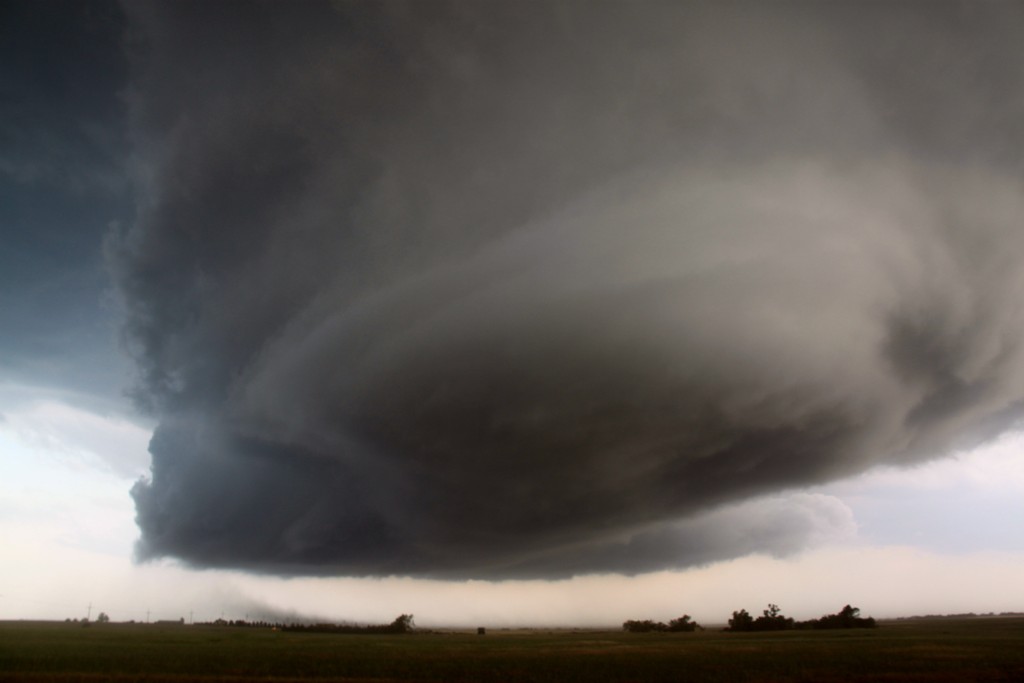 |
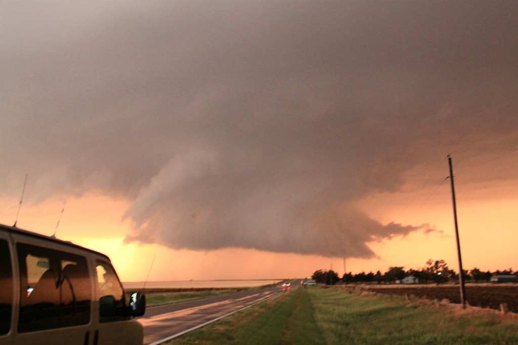
| Zooming right under the updraft. | The lowering quickly developed into a "moustache" cloud, sucking in inflow from both front and back. | Awesome structure once we got out ahead of the storm! | Here comes the mother ship! |
|
|
|
 |
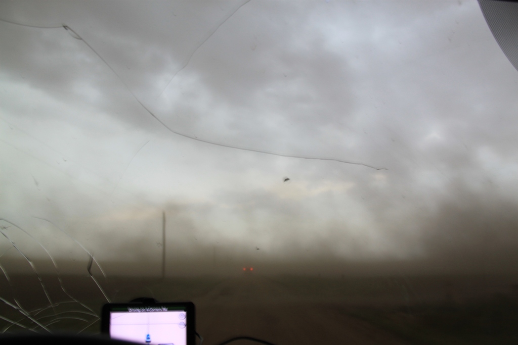 |
| This is a spotter reported tornado. We debated a long time about whether to count it or not but since NWS did, so did we. | Hard to tell with all of the RFD dirt entrained in the updraft. | The RFD gets out of hand. Dirt bath anyone? | We plowed right through the rotation near Munjor. If it ever was tornadic, was not very strong. That's right, we DOMINATED it! |
 |
 |
 |
 |
| Now near Russell, Kansas, a raggedy wall cloud, but the storm seemed to be losing organization. | Having blown off the lead storm to go for the tail end storm about an hour away, we passed another storm in the middle with a well defined wall cloud. It eventually produced several small tornadoes. | We headed back through La Crosse and stopped just west of town close to the rapidly rotating wall cloud. Ironically, we stopped only about a mile from where we'd waited for storms to form out on the county road just south of here almost 5 hours, and 150 miles of driving, earlier! | The wall cloud just over the road about a mile from us. The motion on the right side of the wall cloud was amazing, as was the lightning! |
 |
 |
 |
 |
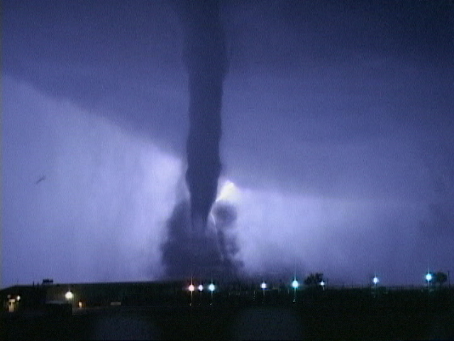
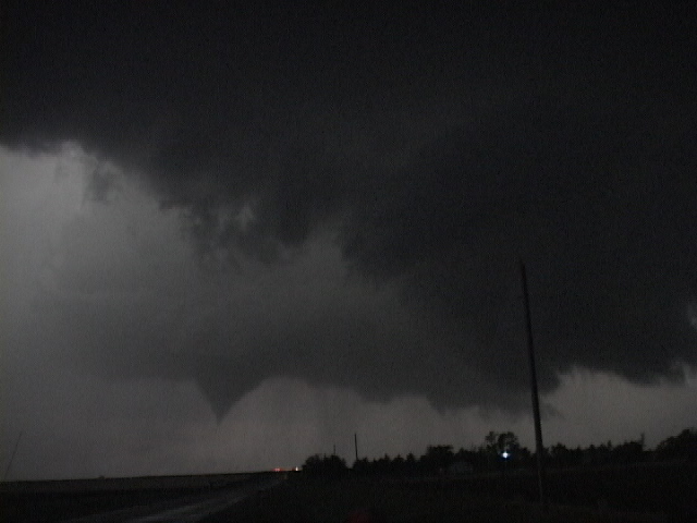
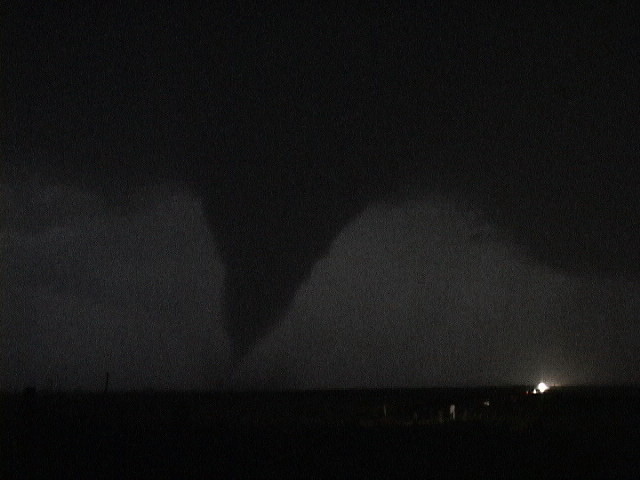
| After waiting seemingly forever and after one failed attempt at a tornado, the storm finally produces right at dusk! | Tornado finally touches down! Nice cone tornado along Route 4 about 7 miles west of town. | Tornado gets stronger and debris fan develops. At this point it was dark so all of the following pictures are illuminated by lightning. Luckily for us, the storm was VERY electrified so it was possible to see the tornado often. | Power flash as the tornado takes down some power lines. |
 |
 |
 |
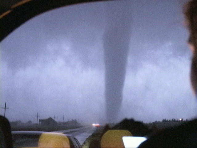
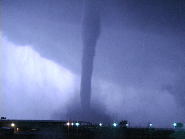 |
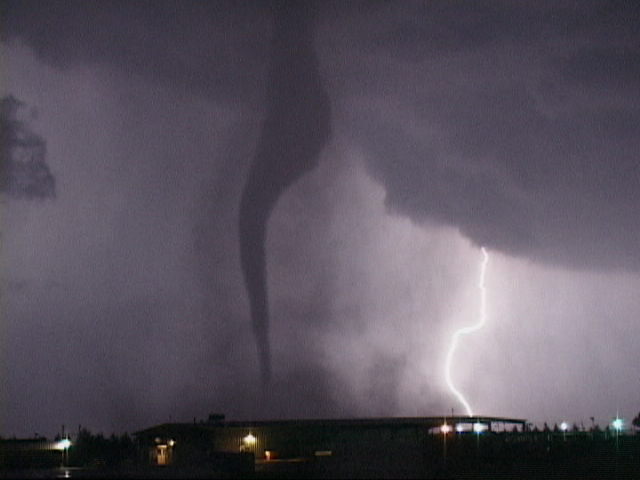
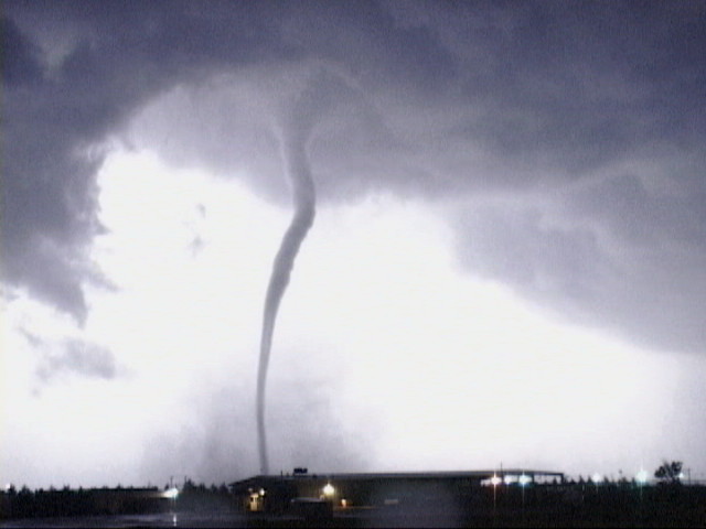
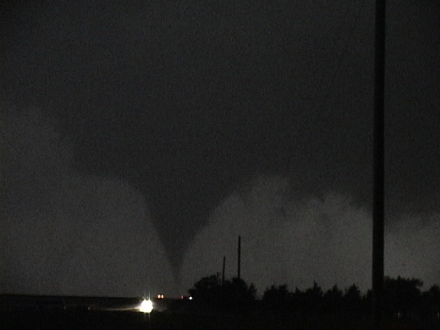
| Lightning illuminates what is now a BIG cone crossing route 4. | A little later we repositioned just to the north of the town. The tornado, now a long stovepipe, crosses Route 183 just north of us. Visible only by lightning and with the tornado sirens blazing, it was pretty spooky out there! | Lightning illuminates the tall stovepipe and it's big debris fan. | Better view. By now the tornado had eroded the entire wall cloud and extended all the way up to the updraft base. This has to have been the tallest tornado I've seen. |
|
|
|
|
|
| Lightning illuminates the debris fan. | The tornado begins to rope out, illuminated by a cloud to ground bolt in the background. The bolt and tornado are almost symmetrical. | Ropeout in progress. Look how TALL this tornado is! The tornado was on the ground for 54 minutes, by far the longest duration tornado I've witnessed. Over that time it traveled only about 10 miles. |
The last gasp of the La Crosse tornado. |
All pictures (C) Richard Hamel 2017.