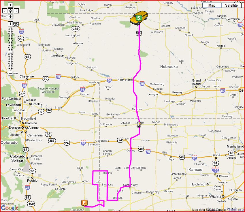
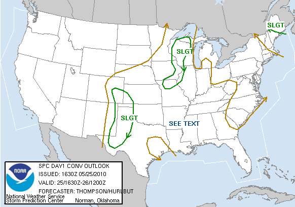
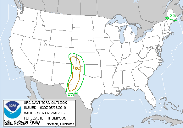
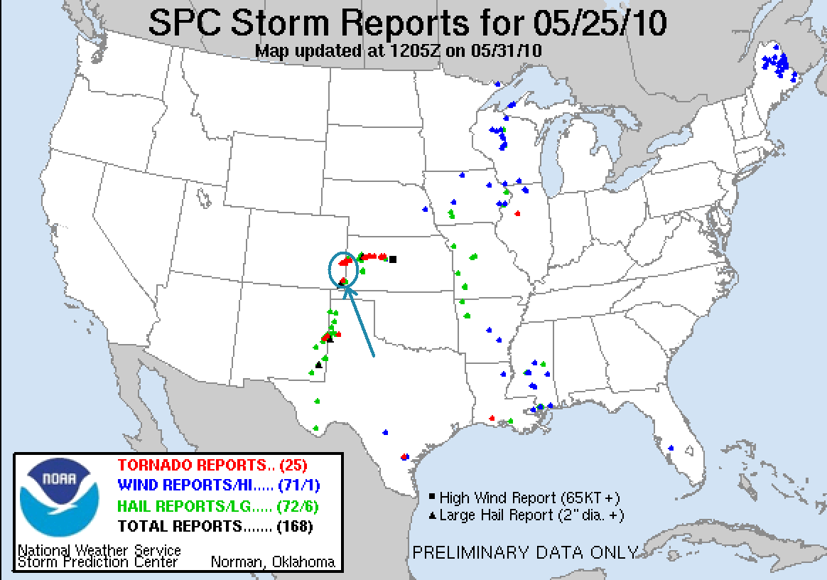
Chase Route SPC Convective Outlook SPC Tornado Prob. NOAA Storm Report
May 25th, 2010, Bartlett, CO Surprise Tornado
This was starting
to seem a little too easy! Starting the day in Valentine, NE, we had a long way
to go to get to our target area: Southwest Kansas / Southeast Colorado. The play
was to watch storms develop on the dry line and then cross the stalled front
into the highly unstable air to their east and go crazy.
We blasted down from Nebraska and managed to get to Scott City, KS in time for
storms to start firing on the dry line along the Kansas / Colorado border. We
proceeded to Garden City and then west to Lakin, then decided to head south
again towards Ulysses in order to target a storm which had a reported wall cloud
and had produced at least one funnel. This would end up costing us as the storm
we targeted croaked, while another storm to the north near Tribune produced
several landspouts that we missed as we reversed course in Syracuse and charged
to the north, but couldn’t get to the storm in time. Crossing directly to the
south of the meso of the now drying Tribune storm, we headed west into Colorado
and turned south at Sheridan Lake to target a cell that had just been tornado
warned about 80 miles to the south near Walsh, CO. The Tribune storm would much
later reorganize and produce tornadoes near Gove, KS.
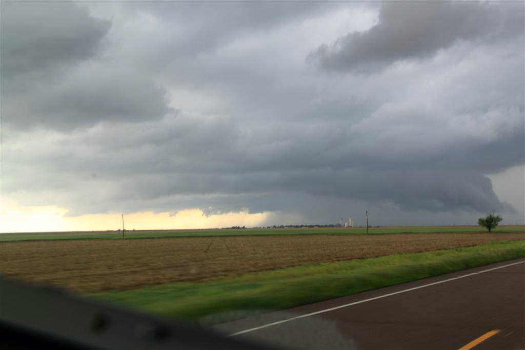
It seems that the forecasted 500 mb winds must not have verified, because all of
the storms appeared either anchored to the dry line or barely moving. As we
headed south to the Walsh storm then cut across the front of the anchored
supercell by turning east at Holly, CO, to our north was a beautifully
structured low precipitation supercell with a very low hanging wall cloud that
should have been dying but it kept it’s act together for a while, spinning away
as we drove from the northwest side of our target all the way to the southeast
side without it moving much at all.
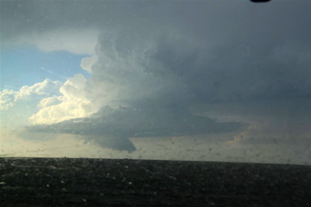
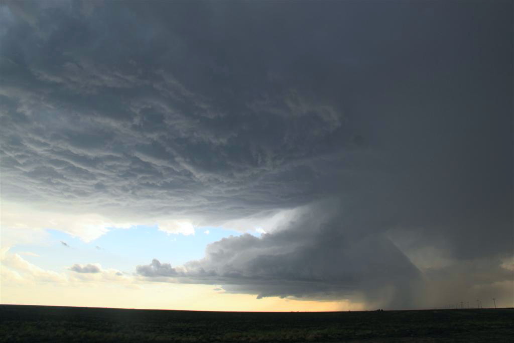
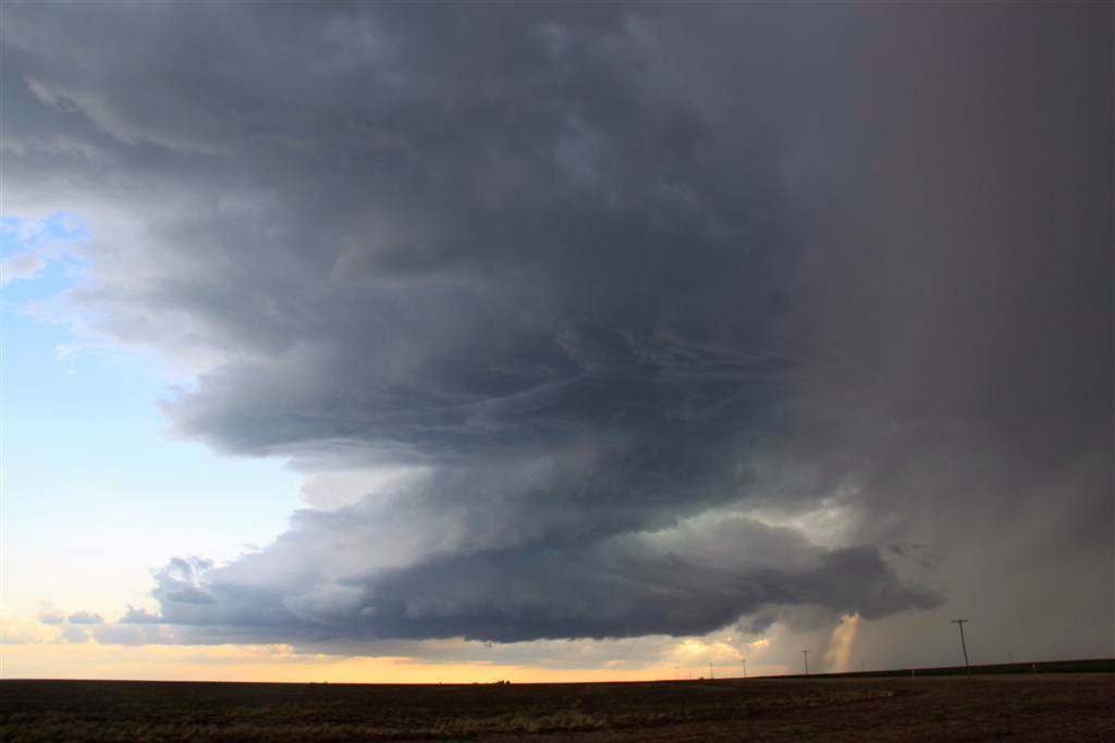
Our supercell was a nicely structured classic supercell with a broad base, but
without a well defined wall cloud. We jumped south from Manter, KS and stopped
to watch the structure north of Richfield while Roger took a group down a dirt
road west to try and get hail for his Boeing contract. While we waited the
updraft really reorganized and pretty soon there was a solid wall cloud with
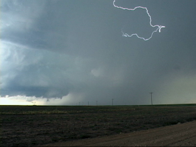
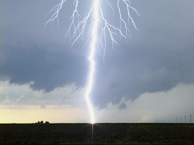
rapid rotation, but it couldn’t get down to the ground. The storm had beautiful
structure and was highly electrified. Unfortunately, Roger couldn’t get down the
road because of mud and had to come back.
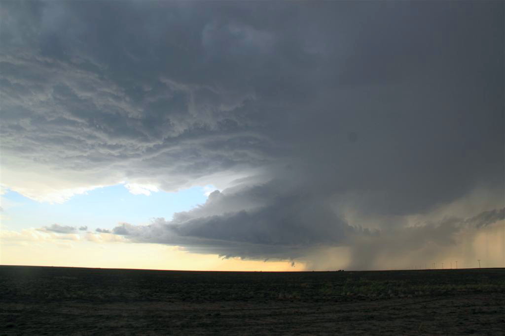
This led to a really bizarre (in a good way) occurrence that shows just how
lucky this trip was. We cut back across the still barely moving storm and headed
southwest, again skirting the core and this time getting a little bit of hail,
so that Roger could again look for big hail. After crossing back into Colorado,
we stopped in Bartlett and tried to proceed down a dirt road towards Stonington,
but it was too muddy, so vans 2 and 3 waited at the pavement while Roger eased
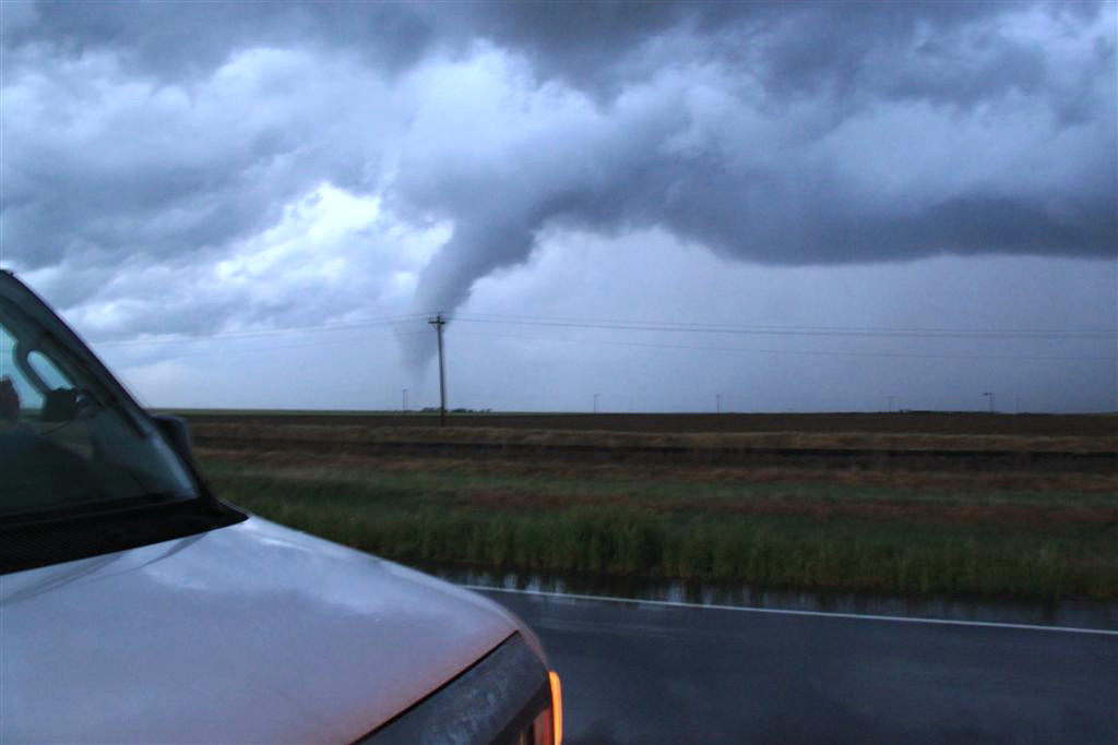
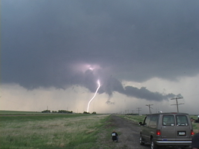
his van down the road to collect hail. About this time, it started raining
pretty heavily at our location as another cell coming up from the southwest
began to interact with ours. Shortly after that I noticed an area to our east
was spinning like a top. I mentioned it to Tom over the radio and though it
looked like a meso-cyclone I was not sure what I was seeing because it didn’t
make sense that it would be there. I continued to observe as the rotation got
closer, and abruptly the rain stopped. At this point I was starting to think I
should tell Tom that we should move a couple of hundred yards down the road just
to be safe, but as it looked to me like the rotation would pass to the east I
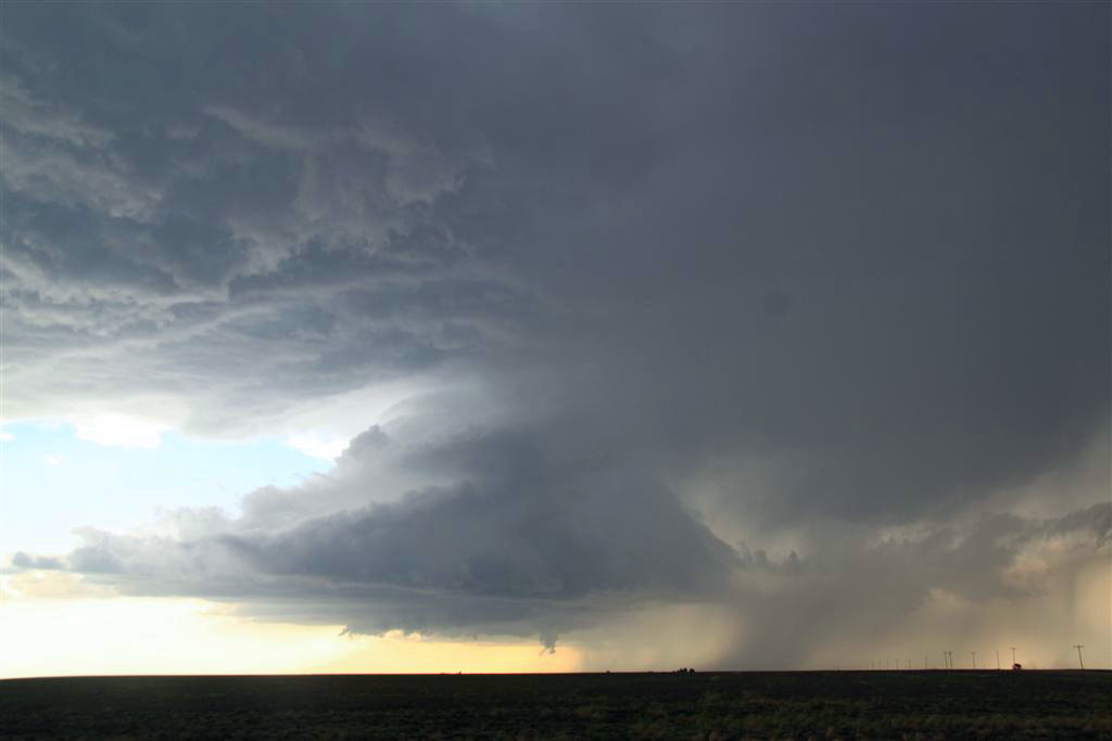
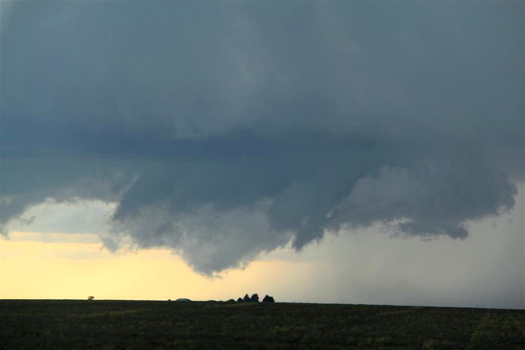
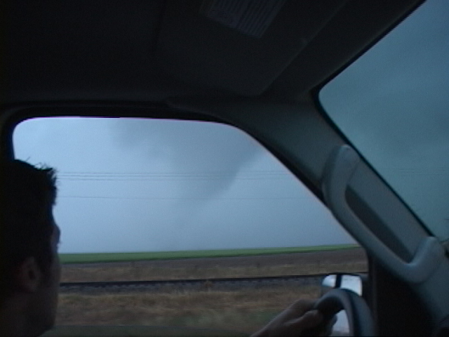
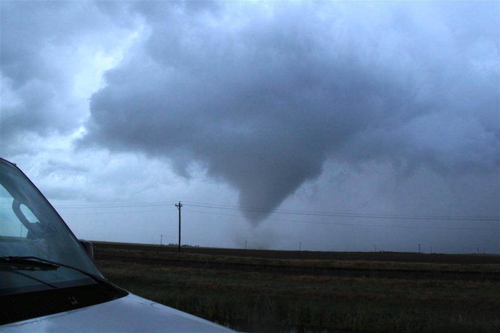
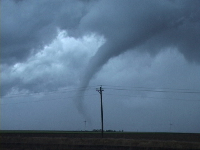
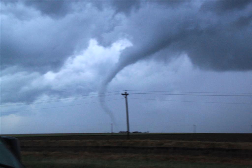
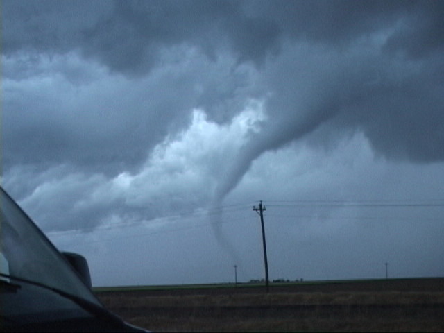
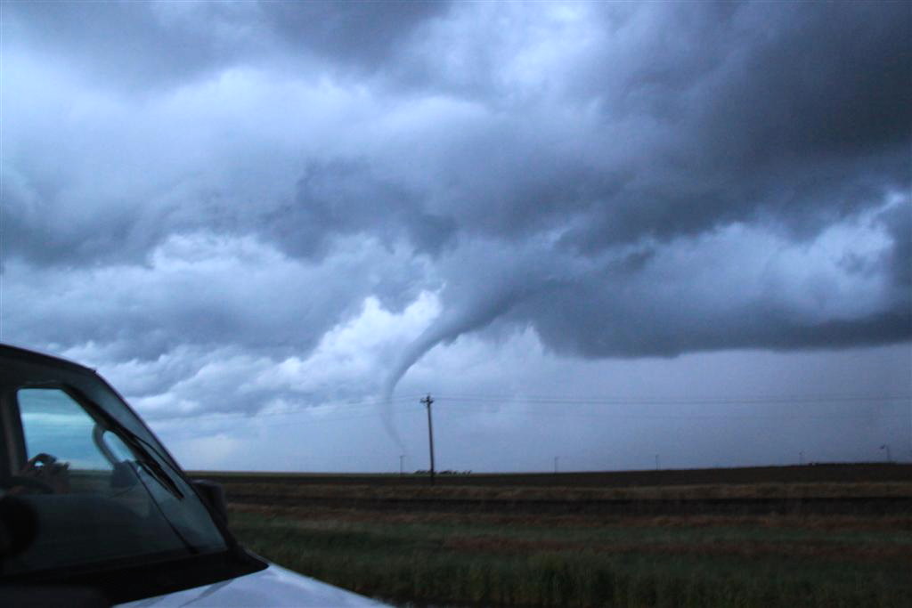
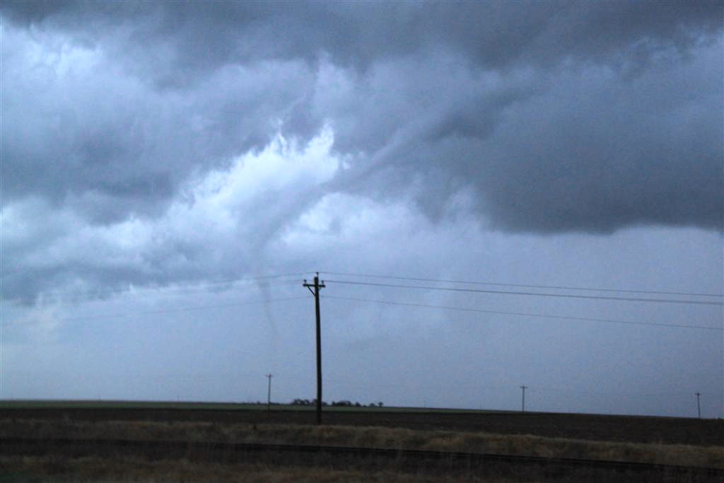
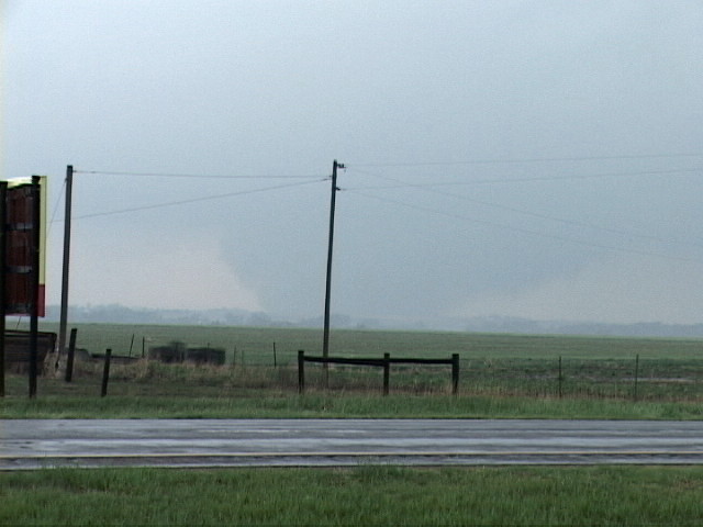
didn’t say anything. Suddenly, about 100 yards down the road, the trees started
shredding and a tornado formed and whizzed across the road at an angle, passing
about 50 yards from us!! I screamed for Matt to blast west and we hurried down
the road with Tom’s van following, but it was obvious that the tornado had
already crossed and we weren’t at risk, so we moved back up the road along with
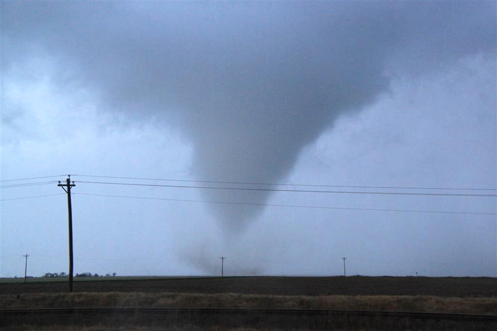
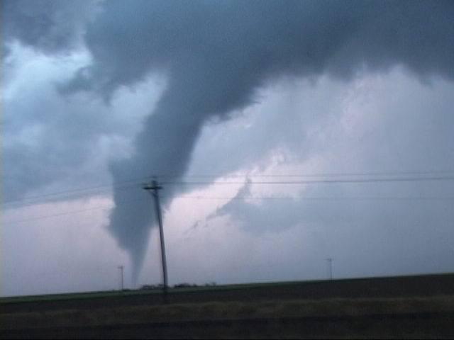
van 2, and to the north of us in the field just across the road, a big cone
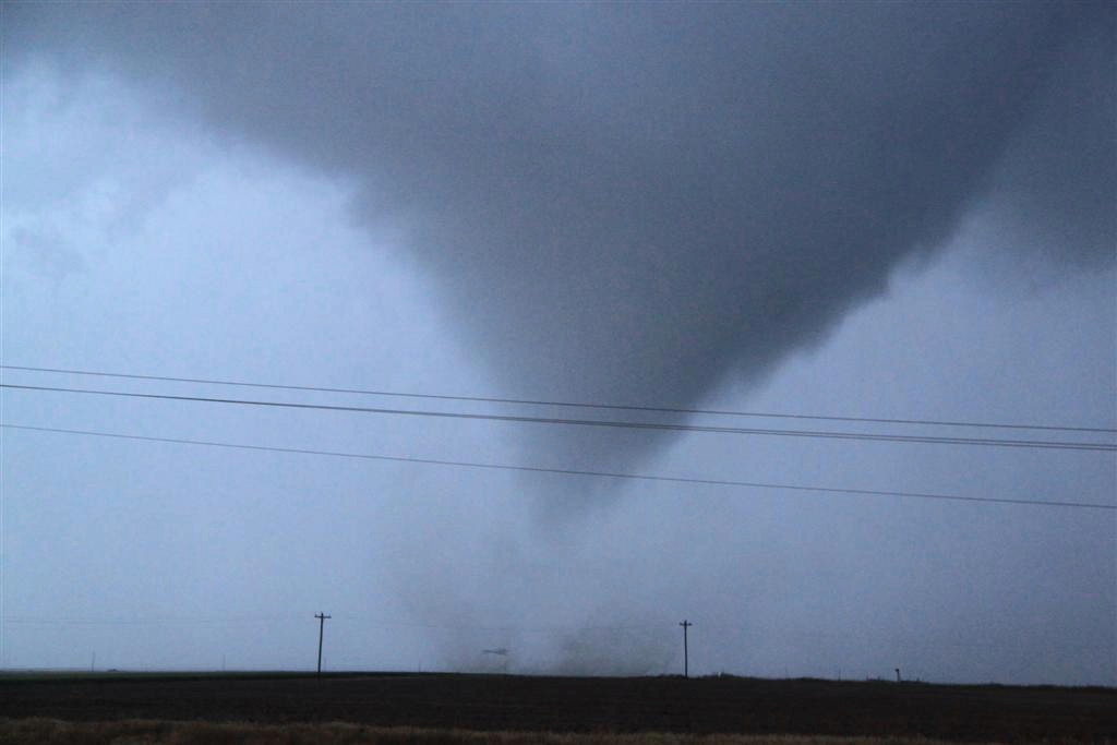
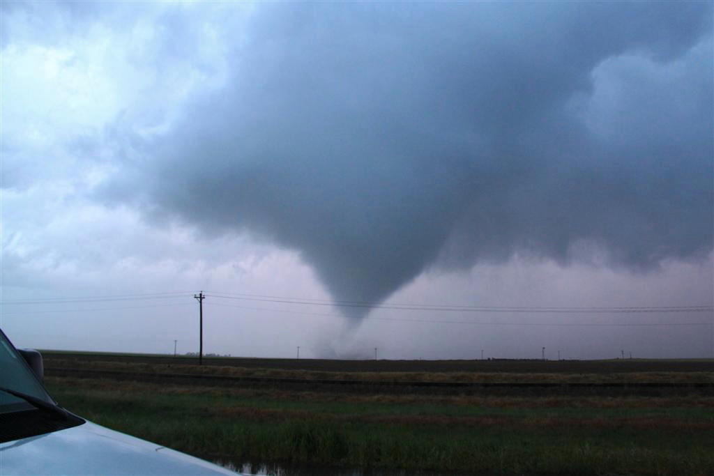
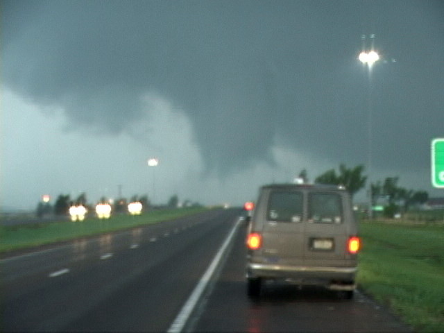
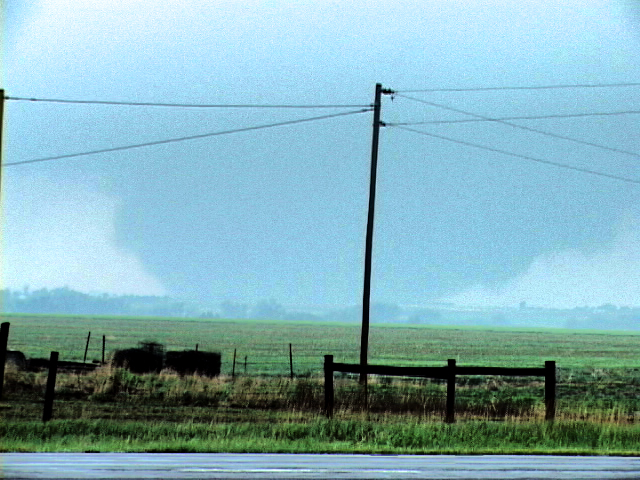
tornado had formed and was churning away with a big debris fan! I jumped out of
the van and started snapping stills and video as the tornado gracefully slid
along in the field for about 10 minutes, and then it finished with a spectacular
ropeout! And we got to see it all because we just happened to be sitting there
collecting hail!
Once the tornado finished, we were getting low on fuel, so we headed to
Springfield, CO to gas up and then went up to Lamar where we stopped for the
night.
What a crazy day!! I was more than satisfied with the structure of the LP and
classic supercells to call it a successful day, but instead we ended up getting
our second really close photogenic tornado of the trip!
It was a long driving day with a total of 731 miles traveled.
Click here to see the video of the Bartlett tornado.
Chase Route
SPC
Convective Outlook SPC Tornado Prob.
NOAA Storm Report
All pictures (C) Richard Hamel 2017.


