
SPC Convective Outlook SPC Tornado Prob. NOAA Storm Report
May 24th, 2009, Wheatland, WY Flooding Hail Storms
We
awoke in Denver, CO with a number of options: play in Wyoming, head up to
central Nebraska, or stay in Colorado. As of our group meeting Roger liked the
conditions up north, assuming the cloud cover that was up there at the time
cleared out to allow surface heating, so we proceeded up I-25 to Cheyenne, WY
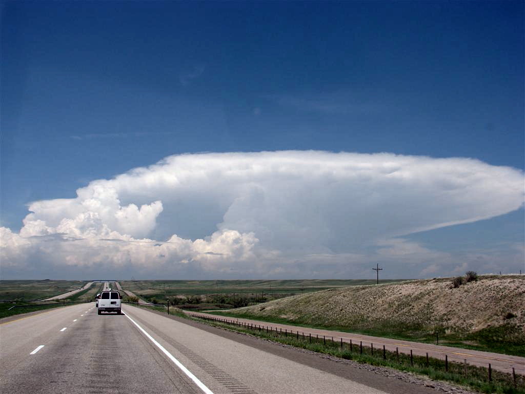
and then stopped to observe. It was a tough call as storms were firing down on
the DVCZ and also north of us up near Wheatland. Again drawn by the better
conditions up north we targeted a storm in that direction near Wheatland, WY
that was dumping copious amounts of hail as it came off the Laramie Range. After
stopping to take structure shots from a distance of about 20 miles neat
Chugwater, WY, the first updraft had started to fizzle but additional cells were
developing on it's flanking line so we targeted those cells and closed in for
the intercept. After watching the big rain and hail cores pass, along with some
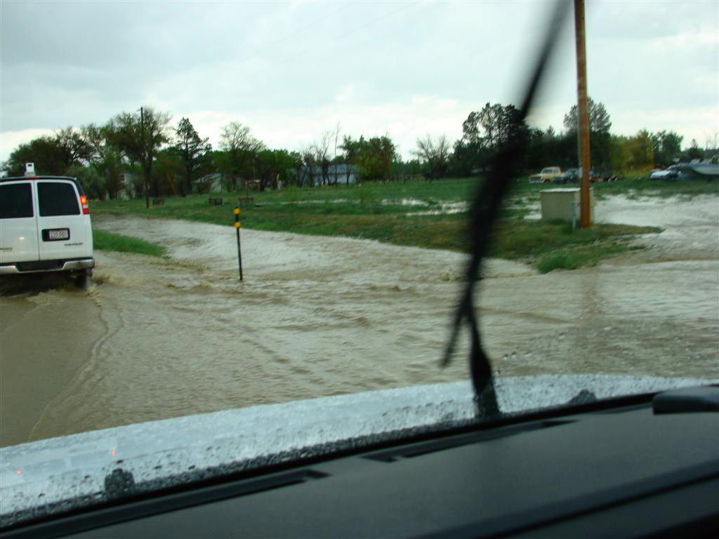
nice cloud to ground lightning, we went hail hunting and soon found ourselves in
flash flood conditions. GRLevel3 estimated that 3 1/2 inches of rain had fallen
at our location from this storm. We also drove through hail fields where hail
was stacked up 6 inches high at some points.
After deciding the roads were too flooded to continue poking around the back
roads for hail, we decided to call it quits on that storm and start heading
south since we had to be in
Pueblo
that evening. We kept an eye on the pop-up thunderstorms all around us, but
nothing too interesting happened and we eventually had dinner south of Denver on
our way to our hotel in Pueblo, expecting to head to Texas between Lubbock and
Amarillo the following day depending on how the morning model runs looked.
Total mileage for the day: 459 miles.
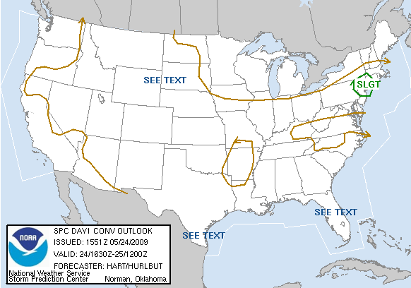
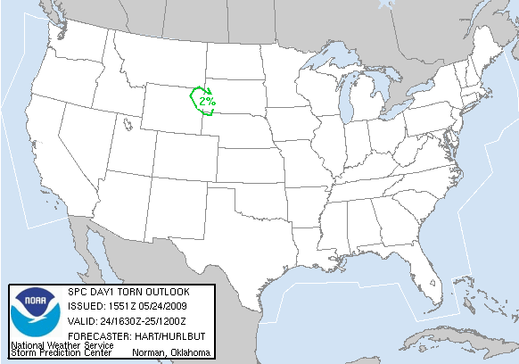
SPC
Convective Outlook SPC
Tornado Prob.
NOAA Storm Report
 |
 |
 |
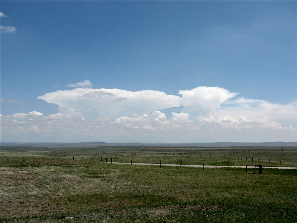 |
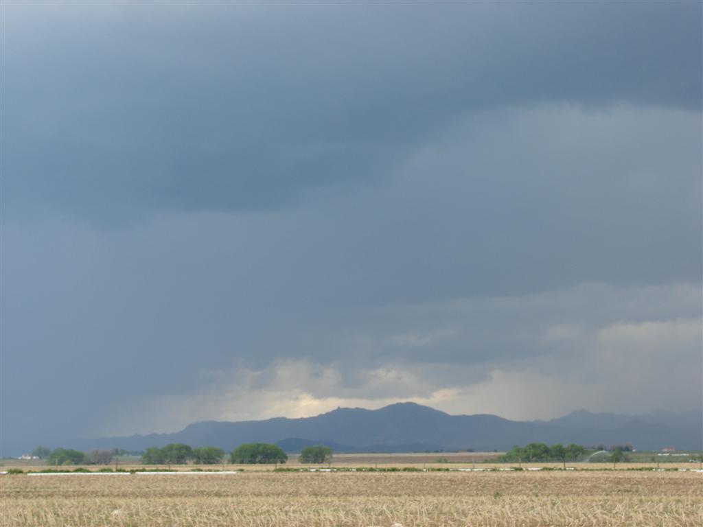
| On I-25 as we approach Chugwater, WY, nicely structured hail storm over Wheatland, WY. | Another look at the storm with well developed flanking line. | We stopped just north of Chugwater to take some photos of the storm's structure from afar. Notice that the anvil is already getting raggedy as the updraft weakens. | In the distance, additional storms over the Cheyenne Ridge. |
 |
 |
 |
 |
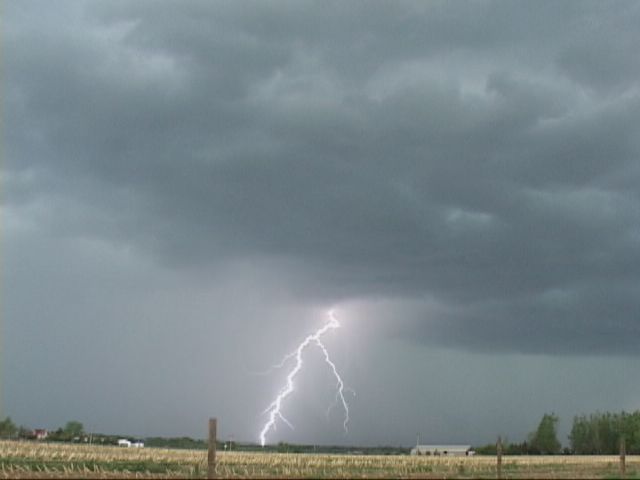
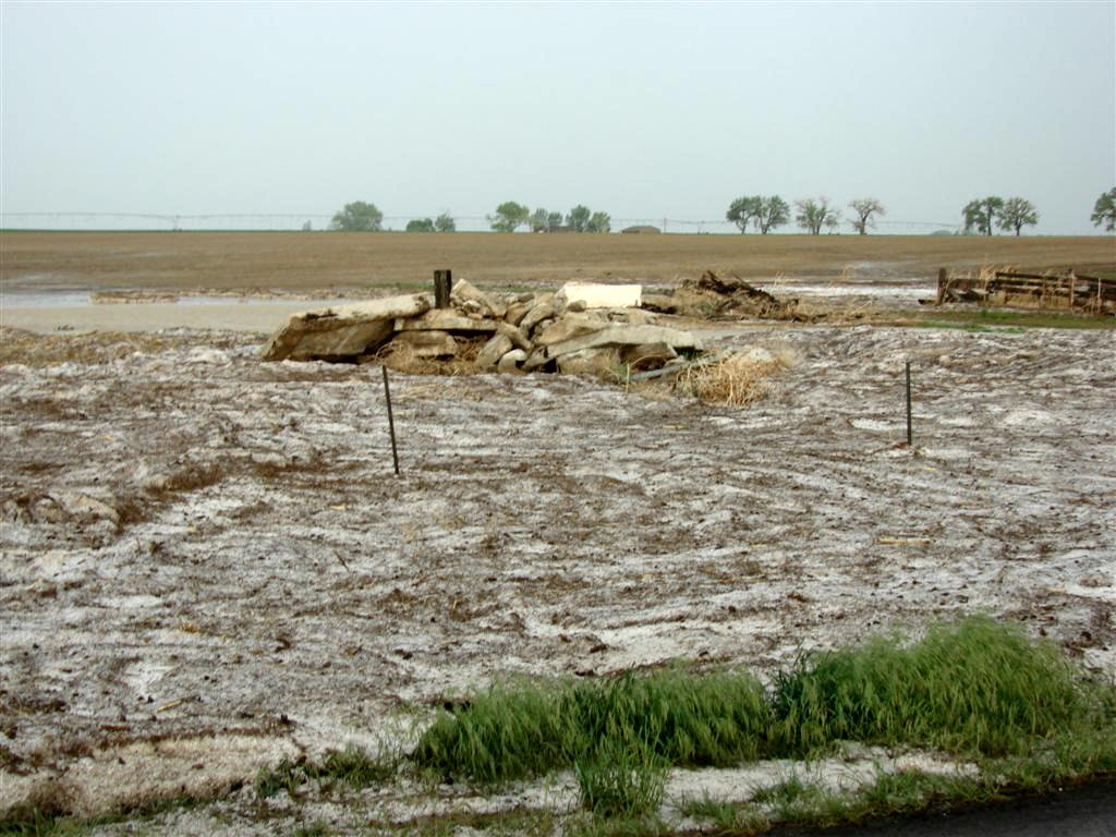
| Now in Wheatland, the first storm had passed through and died. We stopped to observe some intense rain and hail cores near the Laramie Mountains (in the background). | The storms were highly electrified. | We decided to go hail hunting to our north in Wheatland and found copious hail flows and flooding. | "Hailbergs" massed up several inches high. |
 |
 |
 |
|
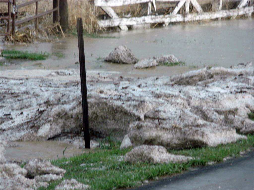
| Now past the fields of hail, we run into some severely flooded areas a few miles further north. | Major flash flooding! | With the water rising in the street an inch every couple of minutes, we decide we need to call off the chase and head for drier roads. |
All pictures (C) Richard Hamel 2017.