SPC Convective Outlook SPC Tornado Prob. NOAA Storm Report
May 22nd, 2015, Genoa, CO Structured Supercell
Starting in Lubbock, TX, the first order of the day was to decide between two targets: back down to Ft. Stockton, TX where there would be plenty of instability but a questionable wind profile, or up in Colorado on a warm front with a good amount of shear, but limited instability. By morning some of the models had enhanced the amount of CAPE that would be available for storms up north, so we chose the northern target and left Lubbock with a destination of Limon, Colorado. We made good time heading north, watching as storms started to fire along the warm front which was situated just north of I-70, and also in the mountains. By the time we reached Hugo (along with every other chaser who had selected the northern target that day) some individual cells along the front were looking more interesting, and we selected one just north of town to chase. Stopping north of town, the storm was off to the northeast and was of the low top variety, and produced 2-3 small wall clouds but none showed a great deal of rotation.
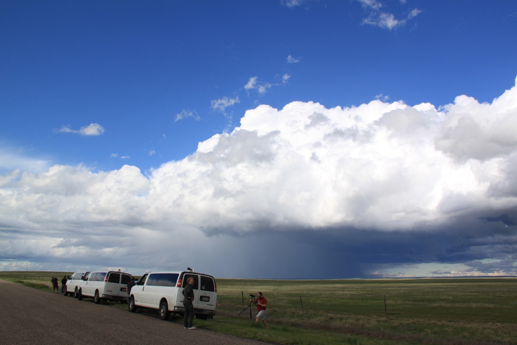
With that storm cycling down, we decided to move to get to a central location where we could react to whatever cell took over the show since there was also a mountain storm west of Pueblo that had potential but appeared to this point be anchored on the high terrain, and headed south and west on county road 2W, stopping a few miles south of Hugo to observe. The front was clearly visible in front of us with numerous small updrafts located just north of the front in the cold air. At one point, I think there were 4 wall clouds visible! None of them were rotating much if at all though, and with those storms north of the front, none of them were likely to. After about 30 minutes, a storm just north of us in Limon was looking more robust so we decided to go after it.
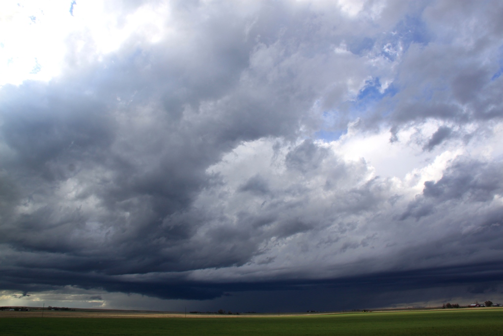
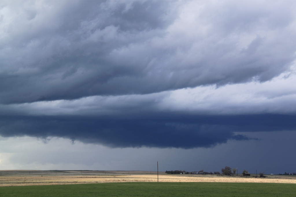
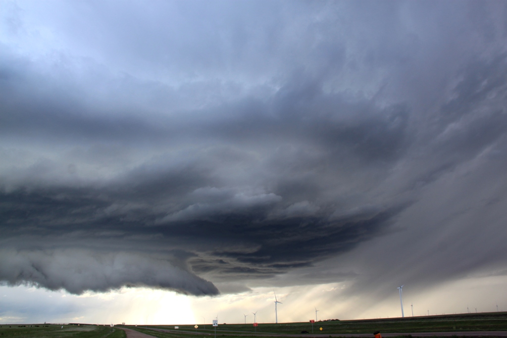
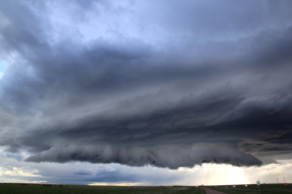
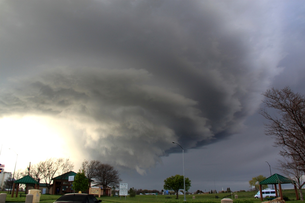
As we went through Limon, we caught the edge of the core and got some small hail, maybe with a few nickel sized stones, then headed east on I-70. We stopped in Genoa and looked back and much to our surprise the storm, which was north of the boundary and looked awful on radar, had terrific structure: A well-defined wall cloud with inflow tail, and laminar striations indicating rotation. It was also freezing cold! The weather station in the van indicated a temperature of 55 degrees and a dew point of 50 degrees and with the cold inflow winds it felt like it was in the 40’s! I was beginning to wonder if it could snow from a supercell! Certainly the coldest temperatures I think I’ve ever chased in. We continued down I-70 in front of the storm, stopping again in Bovina to watch the storm structure as it got better and better, taking on a mothership look. By the time we stopped at the rest area near Arriba, the Sun was popping through behind the storm and the view was breathtaking. Just beautiful structure, and amazing considering how unimpressive the storm looked on radar and in fact it was never severe warned.
Finally the storm looked like it was dying while a couple of cells along I-70 east of us were riding the frontal boundary and looked like they might be strengthening. We headed down the highway, running through a few small cores, but by the time we got to Stratton the storms were all dying down and with it getting dark, we turned around and called it a night. There was one more good looking storm down near Pueblo, but we couldn’t get to it before dark.
Talk about making something out of nothing! The models overestimated the amount of instability that would make it into Colorado and that was the failure mechanism that prevented a big day. Not one of these storms in Colorado was ever even severe but the structure of our little storm was a real treat.
Travel distance was 594 Miles.
SPC
Convective Outlook SPC
Tornado Prob.
NOAA Storm Report
 |
 |
 |
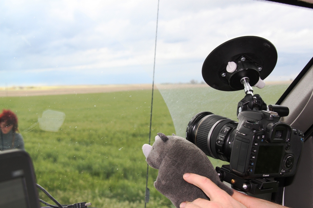 |
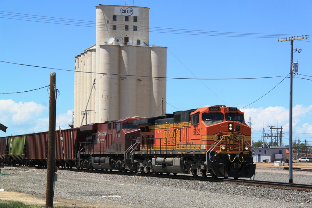
| The ubiquitous BNSF trains and grain elevators of the Plains. | We cruised all the way up to Hugo, CO with the front just to our north. First storm of the day produces a wall cloud just north of town. | Low topped storm north of town. | Ryan's storm rhino smells a storm! |
 |
 |
 |
 |
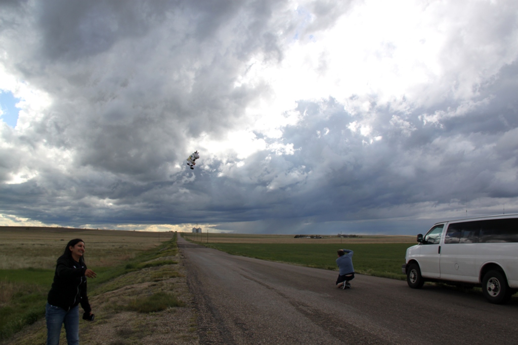
| Aman and the flying cow as we watch storms develop north and west along the front. | One of the storms along the front with a wall cloud. At one point there were 3 or 4 storms with wall clouds occurring at once, but with little rotation. | Storm along the frontal boundary just to our north. | Closer look at one of the wall clouds. |
|
|
|
 |
 |
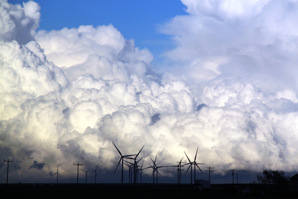
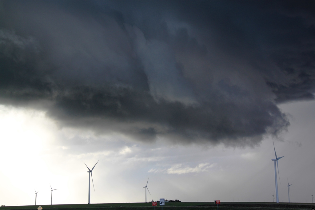
| Now near Genoa, CO, scud rising into the base of our target storm. | Mass convection behind a wind farm. | It was about 50 degrees out and this storm looked horrible on radar, but soon had amazing structure! | Great structure with striations indicating rotation. |
 |
 |
 |
 |
| Low hanging wall cloud on the northeast side of the storm. | What a view! | Vertical view showing the whole tight updraft. | The sunlight passing through the clear slot made for a spectacular view. |
 |
 |
 |
 |
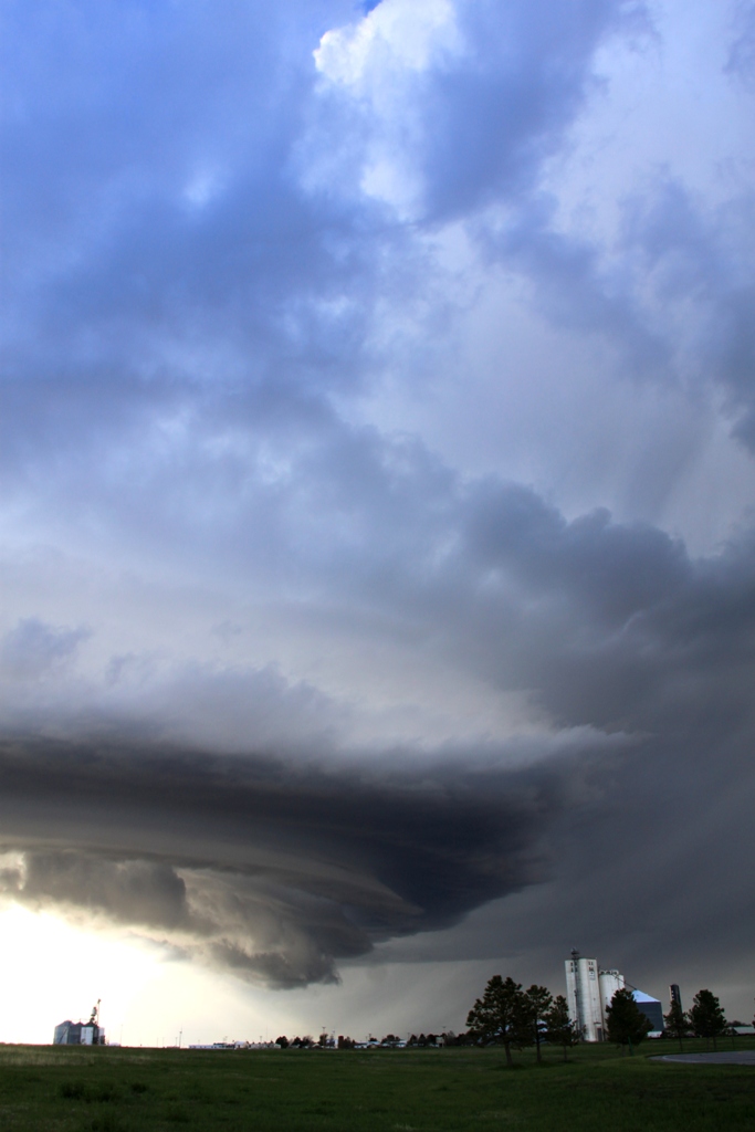
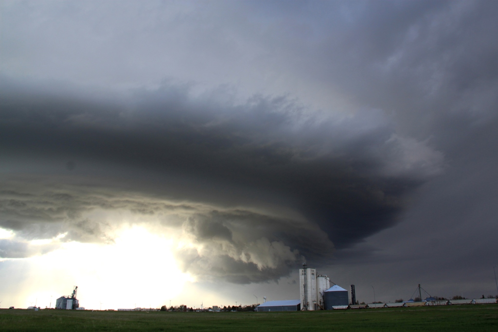
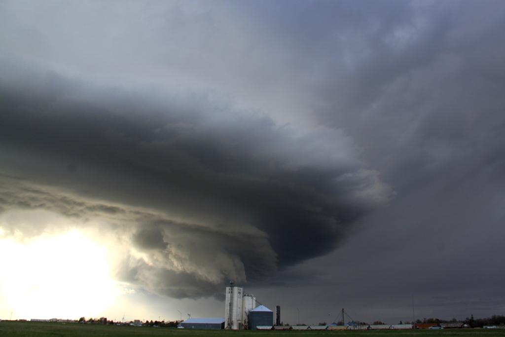
| Lowering passing over a grain elevator. | A couple more shots. | Despite the incredible structure, this storm never was never even severe warned! | Last one. |
All pictures (C) Richard Hamel 2017.