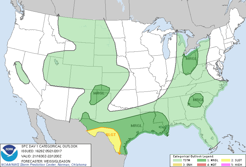
SPC Convective Outlook SPC Tornado Prob. NOAA Storm Report
May 21st, 2017, Laredo, TX Electrified Supercell
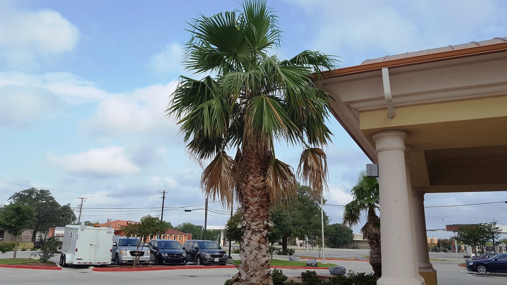
Palm trees and storms! Today was the farthest south I’ve
been in 17 years of chasing and so was a new experience for me. Starting in
George West, TX, today’s play was storms coming out of the mountains in Mexico
(we hoped), crossing into the states somewhere between Laredo and Eagle Pass,
TX. Model runs looked decent, so we blew off our initial thought of going up to
The Alamo in the morning and headed for Laredo instead.
We made Laredo by lunch time, and storms were already
well underway in the mountains on the Mexican side of the border, as evidenced
by the mammatus clouds drifting over our heads. We hung out at the mall for
about 2 hours as the storms bubbled up and down and started to make very slow
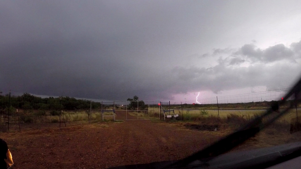
progress towards the US. By about 2:30 we’d progressed up Mines Rd. to Santa
Tomas and took up position in a dirt lot about half a mile from the border
crossing and were visited by the Border Patrol wondering what these 4 unmarked
vans were doing here. It was just one of four interactions with the Border
Patrol on the day.
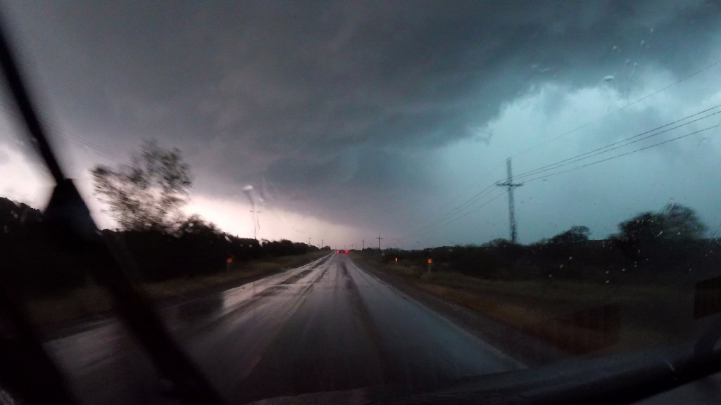
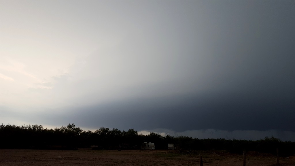
We waited about another hour before our storm finally
started coming across the river, a big HP moose with a greenish glow and
well-defined shelf cloud. Inflow was streaming in to a pinch point in the
updraft from two directions, but while a lowering formed under the updraft it
never appeared to be rotating much. We hung there as long as we could until the
hail got close, then repositioned south and east, taking Rt. 255 to La Tiendas
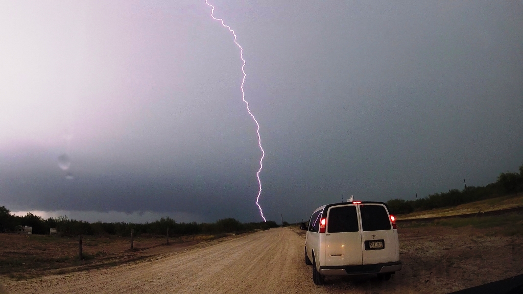
Rd., stopping at the junction for another look. About this time the lightning
really picked up, and being in a big lightning threat would be a theme for the
rest of the day. Being a bit farther away from the storm, we were able to take a
better look at the updraft and the big inflow band that had formed, with low
stratus clouds screaming towards the storm. The southern end of the
multi-cellular cluster seemed to be taking over, so we decided to head south.
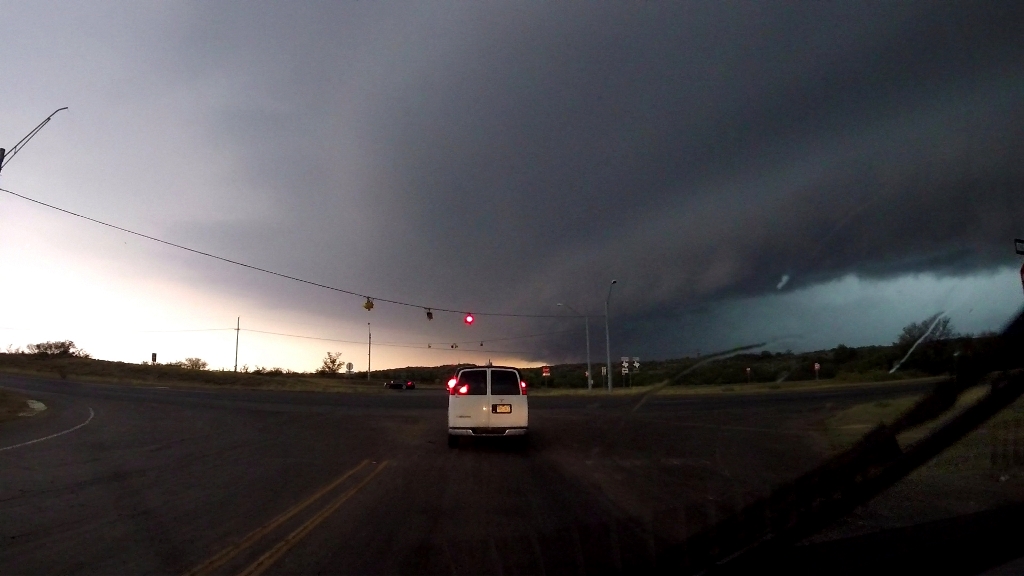
Getting around Laredo took a solid hour at the storm
started accelerating as it congealed into one monster high-precipitation
supercell. We were barely ahead of it as we cleared the city, with the big shelf
cloud indicating the leading edge of the wind and hail right over us and intense
cloud-to-ground lighting banging all around us. In fact, our attempts to stop
and film the “whale’s mouth” coming up behind us were thwarted twice when, right
as we stopped, CG’s crashed all around us, more than once only a couple hundred
yards from the vans! We proceeded east out of town on Rt. 359, watching more
CG’s hit out ahead of us, and drove way out in front, not stopping until we got
to Aguilares. One of the challenges chasing that far south is that you are in
the land of endless mesquite trees, so finding a good vantage was tough. We
found a lot next to some railroad tracks that was open and waited for the storm
to approach, but just as the structure was really becoming visible lightning
started crashing all around us again and we had to abandon ship and head further
east.
After a brief delay near Oilton going through a
secondary Border Patrol checkpoint, we continued east then doubled back,
stopping somewhere southeast of Bruni as the storm caught back up.
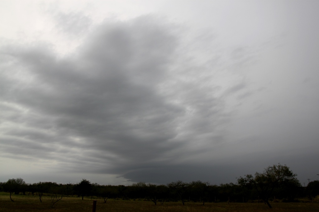
Finally, we headed north out of Bruni on FTM
2050 and got the payoff: a beautiful mothership updraft with striations showing
strong rotation only a few miles to our west. We hung out there and watched for
a solid 20 minutes (and I had a chat with the Corpus Christi NWS Office who
called looking for an on-the-ground report on how the storm looked), as it
approached. Despite the beautiful structure, it was clearly undercut by cold air
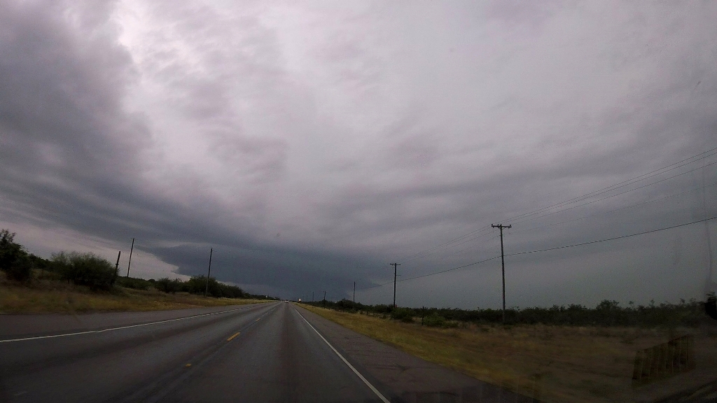
and struggling. Finally, the show was over and the storm fell apart in a matter
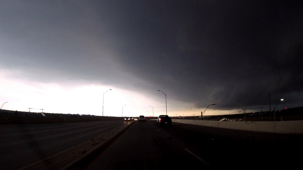
of about 15 minutes. We headed north to Freer after going through ANOTHER Border
Patrol checkpoint, and started the 300-mile, in rain cores all the way, trek
north to get ready for the next day, arriving at the hotel in Sonora at
midnight. A fun day in some unique chasing terrain.
Mileage for the day was 549.
SPC
Convective Outlook SPC
Tornado Prob.
NOAA Storm Report
 |
 |
 |
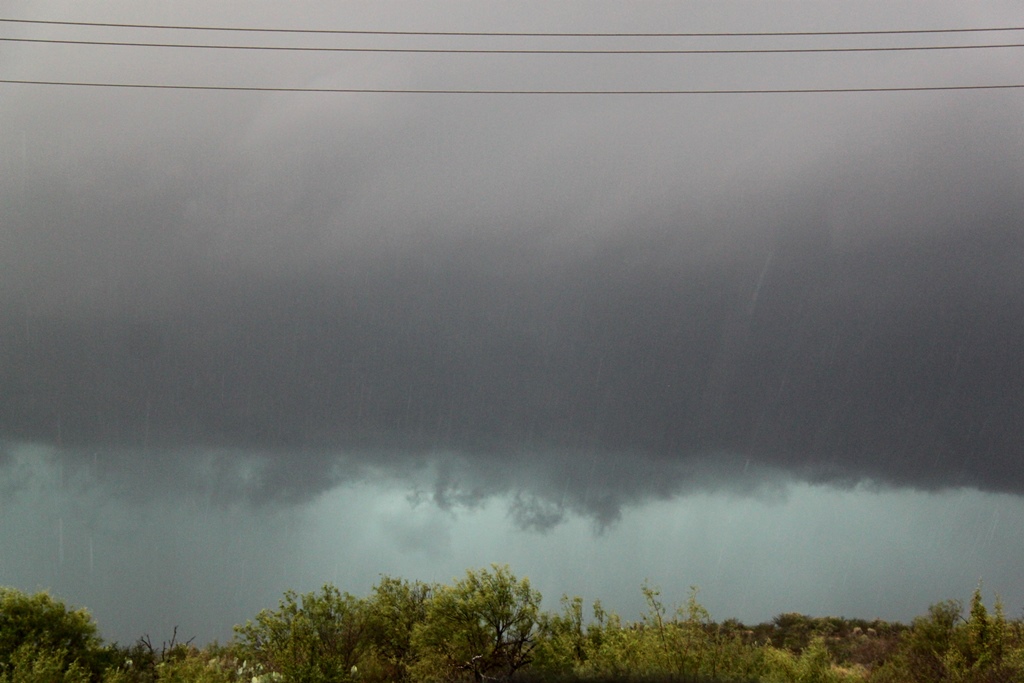 |
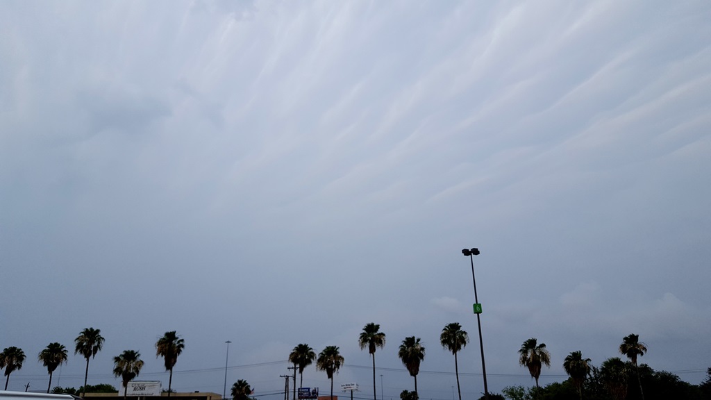
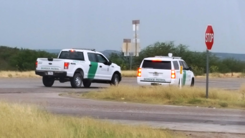
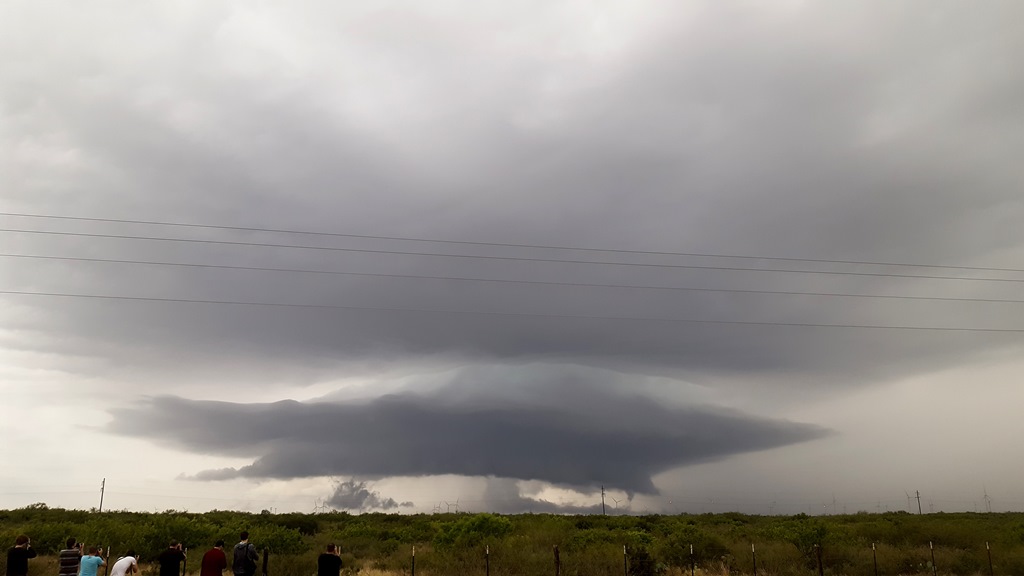
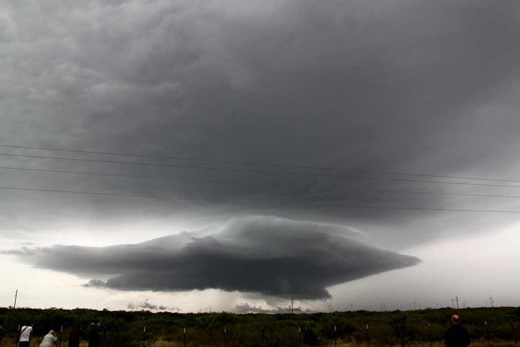
| Palms trees? There are no palms trees allowed in tornado chasing!! | Waiting for storms in Mexico to come across the river, we stop for lunch at the Laredo Mall. Palm trees and mammatus clouds. | We weren't the only ones waiting for something to come across the border... | Sitting in driving rain near Santo Tomas, the storms finally come off the mountains towards us. |
 |
 |
 |
 |
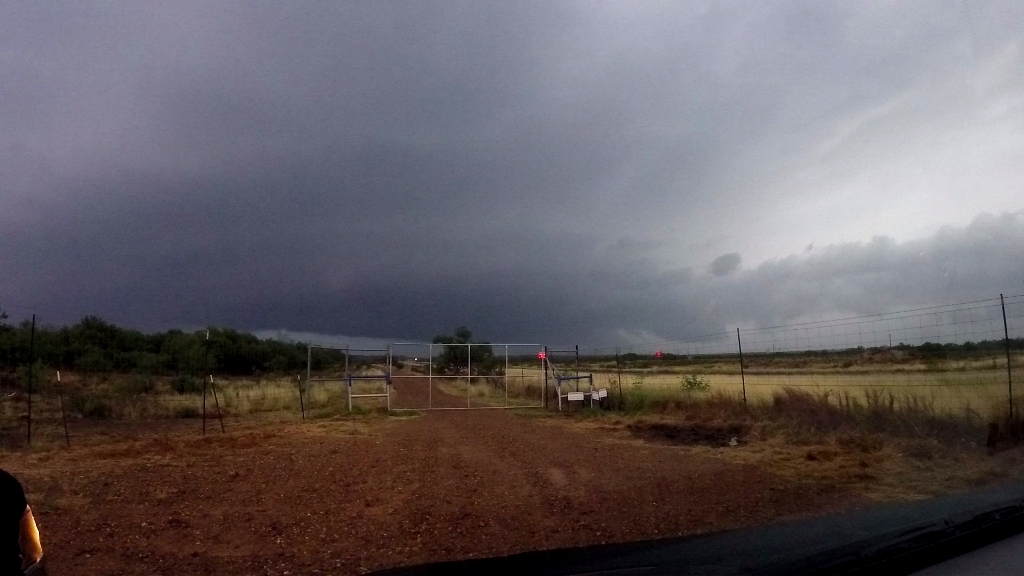
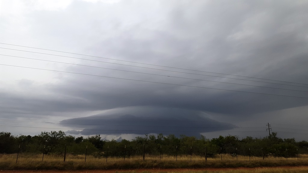
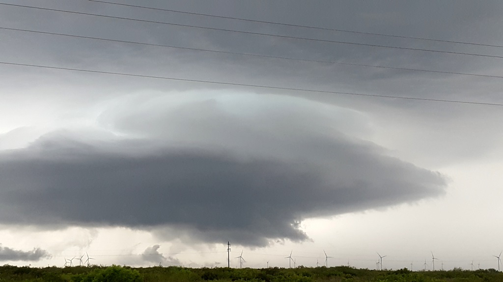
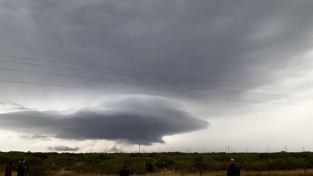
| A lowering in the murk just on the other side of the Rio Grande. | As the big HP storm came across the river, we re-positioned south and east and stopped again to watch the storm come to us. Note the big inflow band reaching out from the updraft. | The lightning ramped up significantly around this time and the storm continued to be highly electrified for the duration. | The southern-most cell in the storm was taking over the show so we decided to head south back towards Laredo, but first we had to beat this core to the city! |
 |
 |
 |
 |
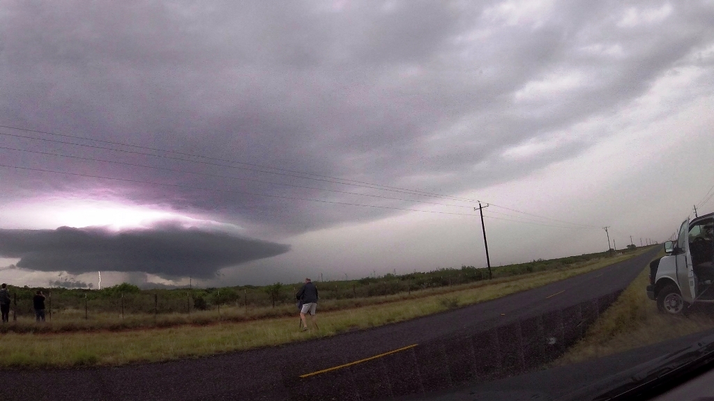
| We got around the first core, but here comes the big dawg! | We managed to get around the outskirts of Laredo and headed southeast towards Aguilares, staying just ahead of the storm, that was spitting lightning bolts all around us. | Now ahead of the storm, we stopped in Aguilares and waited for the storm to come to us. Soon we could make out some cloud features under the base. | The storm was still highly electrified and soon we were forced back into the vans and off to the east. |
 |
 |
 |
 |
| A bit later in the endless sea of mesquite trees near Bruni, the storm finally catches back up to us, is that a nicely structured updraft off in the distance? | North of Bruni, we headed towards the mothership updraft. | Awesome structure to our west! | Despite the neat structure, the storm was clearly struggling and ingesting cold air from the front flank core. About this time the NWS office from Corpus Christi called me for an opinion about extending the severe warning. I said "Nope". |
 |
 |
 |
 |
| It's dead Jim! Looks cool, but a lot of cold air clouds in there as the updraft dies. | Getting messier as the storm approaches us. | Despite the storm collapsing, it was still throwing cloud to ground bolts. |
All pictures (C) Richard Hamel 2019.