
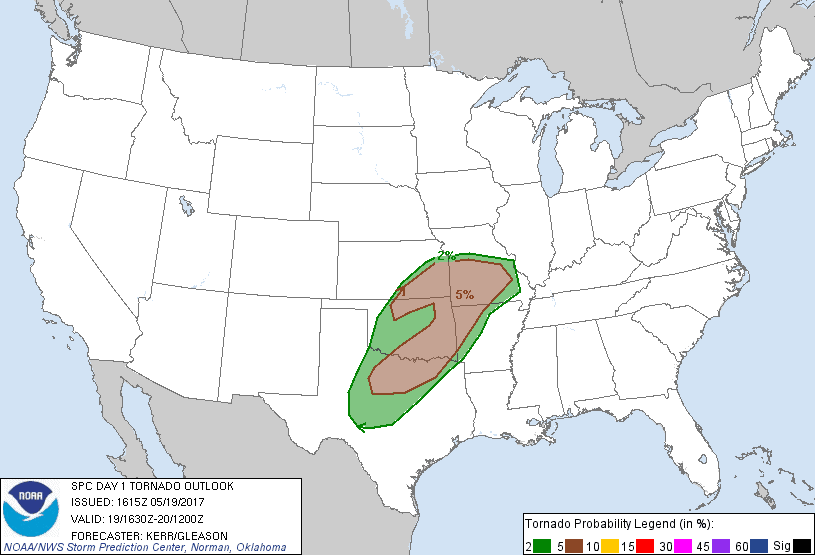
SPC Convective Outlook SPC Tornado Prob. NOAA Storm Report
May 19th, 2017, Central TX Supercells and Bangs, TX Tornado
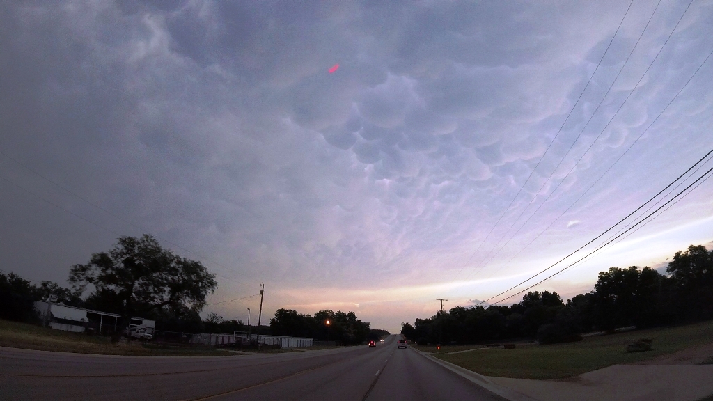
A long day of driving with a nice reward at the end. The
convection from yesterday had left a long line of storms extending the length of
the front, and our play was to get as far south as we could to get on the tail
end while some of those storms remained isolated. Models projected a couple of
big supercells down near Abilene, so that was our initial destination. We headed
out of OKC down I-44 towards Wichita Falls, TX and already there had been a
tornado warned storm that reportedly had produced a tornado far to the south. As
we got to Lawton, we faced a decision as to whether to blow the whole thing off
and head for Illinois for the next day, but decided against it and crossed into
Texas. After Wichita Falls we headed southwest to Seymour, skirting a storm
there, then turned south on Rt. 283 through Throckmorton and all the way down to
Baird on I-20, passing in and out of cores all the way. Once in Baird, our
target storm, tornado warned and already with one reported tornado, was just to
our southwest approaching Lawn, so we headed west off 283 on FTM 2926 for a
roller-coaster ride of up and down hills towards Oplin, then onto FTM 604 to
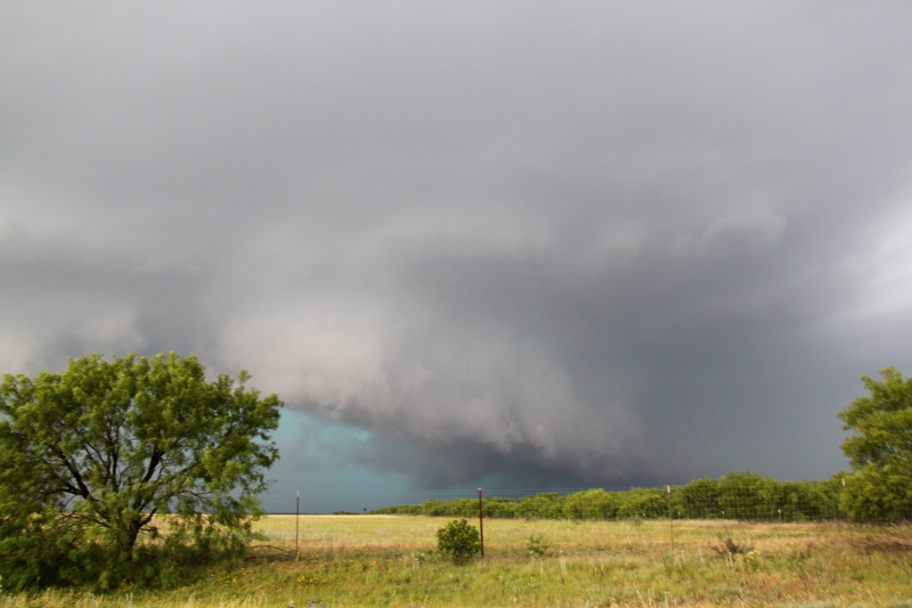
close on Lawn. Unfortunately, we realized that the rotation in this segment of
the storm was completely embedded in the core, and the big hail was going to
beat us to Lawn, so we retraced our steps out to 283 and headed about halfway to
Coleman then stopped to wait for another tornado warned segment to meet us.
Finally, as the storm approached you could begin to make out the features and it
was clear that it was a big HP, and while striated and rotating, it was nowhere
close to dropping a tornado.
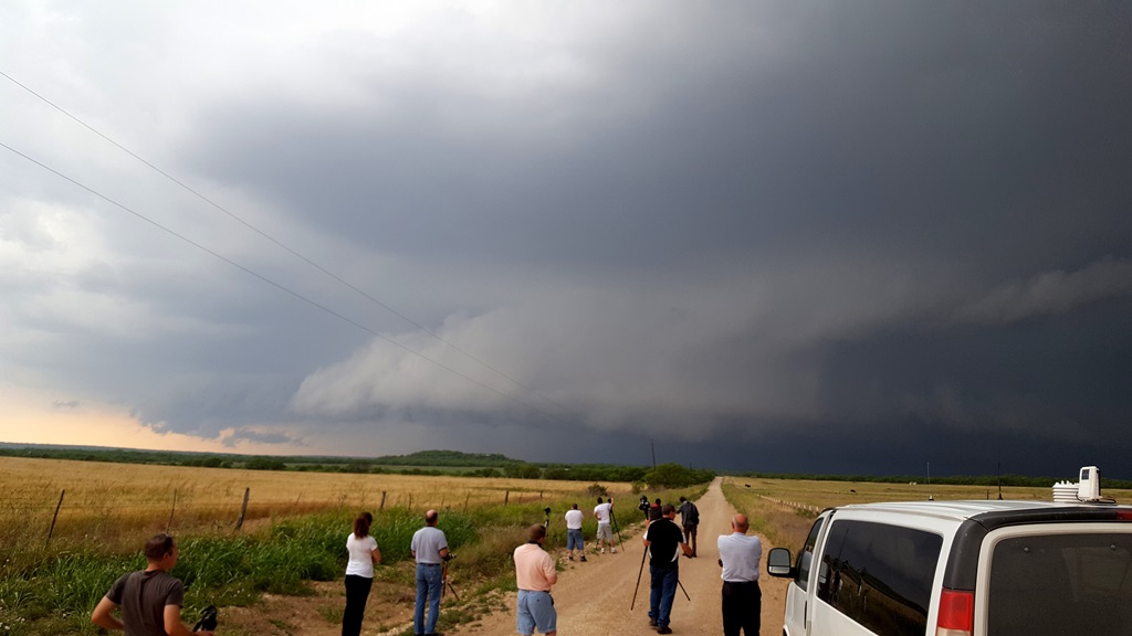
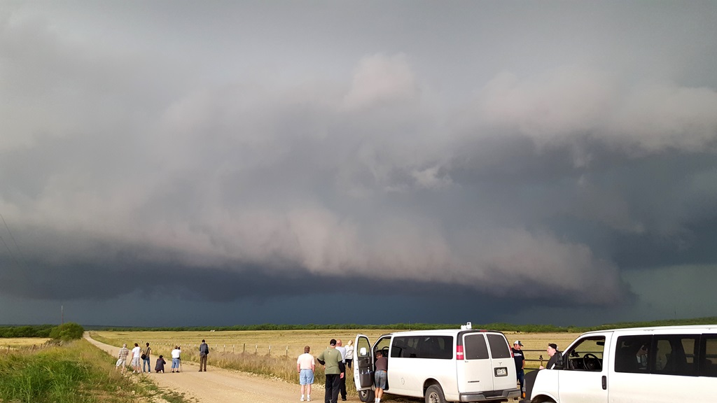
Meanwhile, the very southern edge of the line appeared to
be trying to break off and become isolated. It was clearly a supercell and had a
pronounced hook echo on radar. We headed south to intercept the storm that had
right-turned and was moving directly east. Right about this time, Verizon cell
service went out for the whole area and would remain out for the next several
hours so we were reliant on Mobile ThreatNet and visuals. We passed through
Coleman and then a little southwest before hopping onto FTM1026 towards
Gouldbusk, then turned west on FTM 317 and stopped to watch the storm come right
to us. Like all of the storms for the last two days, it was a big
high-precipitation supercell, so we had to wait for it to become more visible in
the murk, and soon a whitish wall cloud with an inflow band was visible straight
across the road ahead of us. The wall cloud wasn’t showing much sign of rotation
even though the upper levels were spinning hard, and soon the more interesting
features were the shelf cloud and the turquoise glow that again said “big hail”.
GRLevel3 was showing maxed out VIL’s and 3” hail, so we could not mess with the
core. We eventually had to leave our position and took FTM 1026 back to 283 and
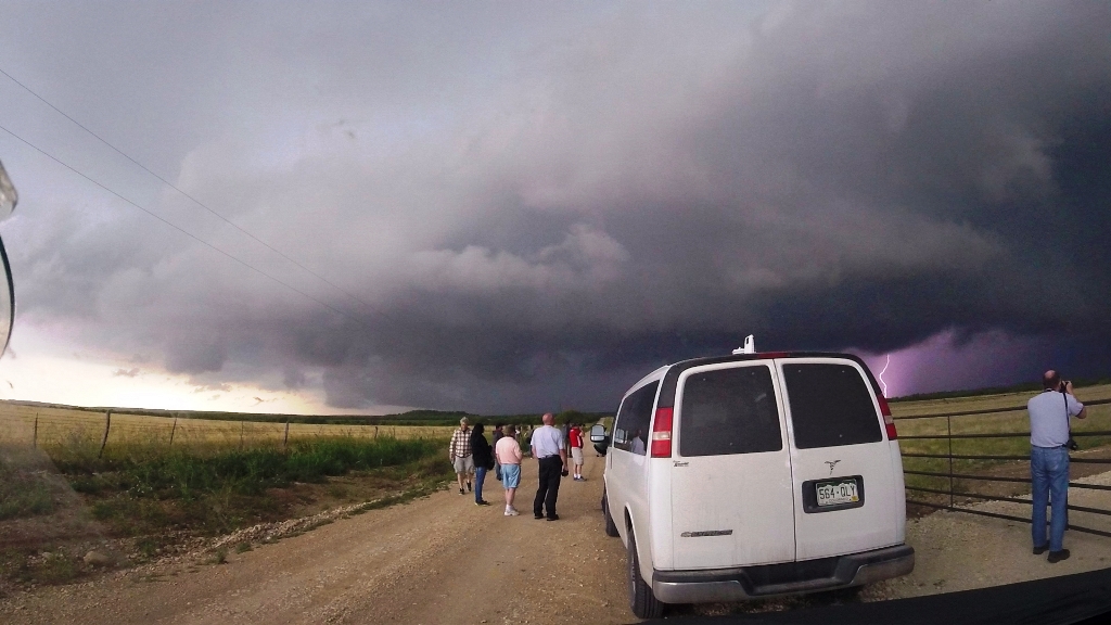
stopped again south of Santa Anna.
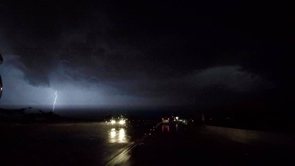
We watched again as the big HP moose came towards us
and the hail roar was constant and loud. We hung out as long as we could,
watching the brilliant colors of the hail core… once again almost too long as it
turned out as we had to race the core to Santa Anna and get east on Rt. 84
towards Brownwood to stay ahead of it. Eventually the storm was re-tornado
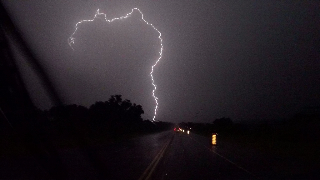
warned, and after passing through Brownwood into Early we circled back around
town to the south on FTM 2126, onto Rt. 377, and then FTM 1176 about 3 miles
southwest of town to watch the big HP coming at us as the tornado sirens in
Brownwood began sounding. The hail core was massive but there was also a
distinct lowering under the meso on the nose of the core towards
Bangs, and as we stretched our
vision trying to see if anything as going on under the lowering, a funnel seemed
to extend then FLASH! A power flash confirming a tornado! Several other spotters
who were closer also saw it. From our vantage, you could barely see it and it
probably only lasted a minute or two, but it was confirmed.
We watched for several more minutes until the core was
almost right on top of us then headed back east on Rt. 377 and through Brownwood
again, stopping once more to see the big core coming at us. As it got dark, we
broke off the chase and called it a night. After stopping in Stephenville for
dinner however, the storms had caught back up and we had to drive through heavy
cores all the way to the hotel, beating the storm into Weatherford by only a few
minutes. We scrambled to get the vans unloaded in the high winds, with cloud to
ground lightning banging closely all around us! Finally, everyone had their keys
and we dumped our stuff in the rooms and then watched the lightning show for the
next half-hour or so before it passed. A fun, LONG chase day in the end!
Miles for the day were 562.
SPC
Convective Outlook SPC
Tornado Prob.
NOAA Storm Report
 |
 |
 |
 |
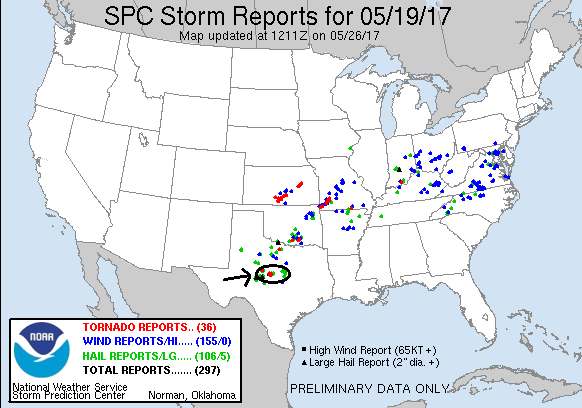
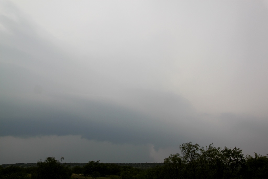
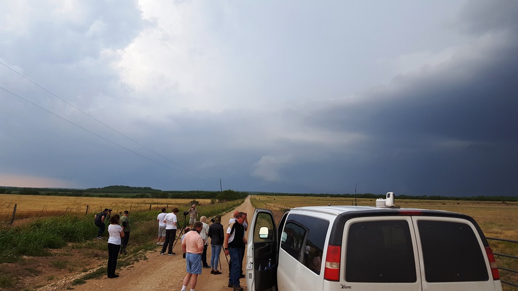
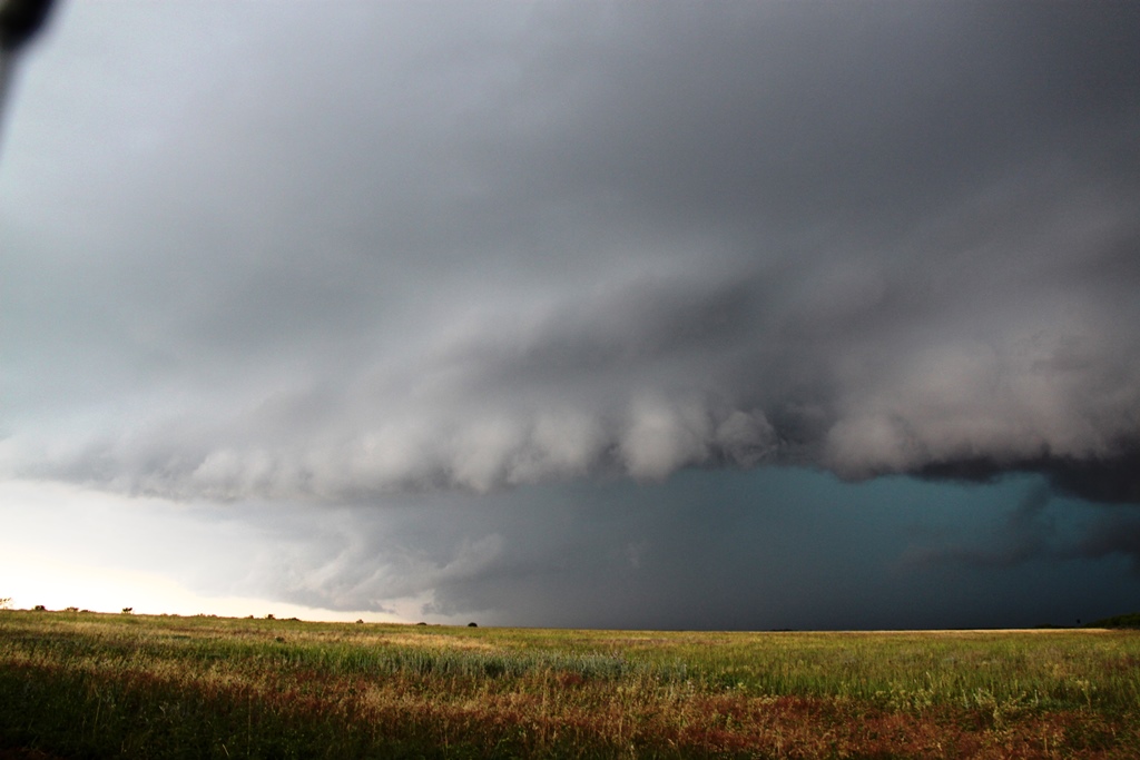
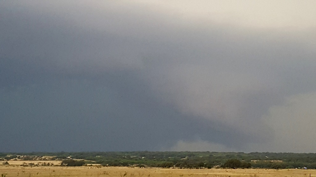
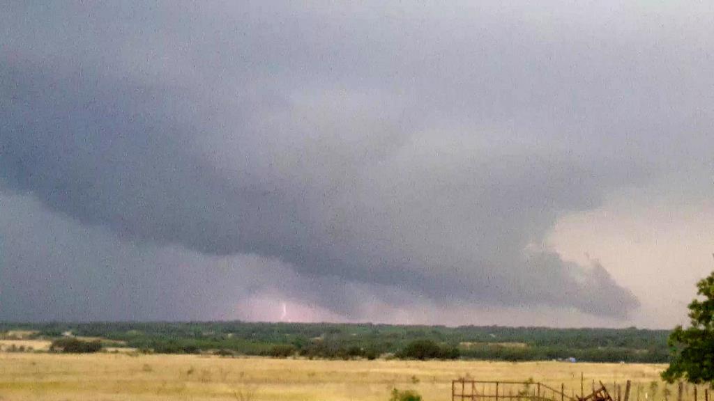
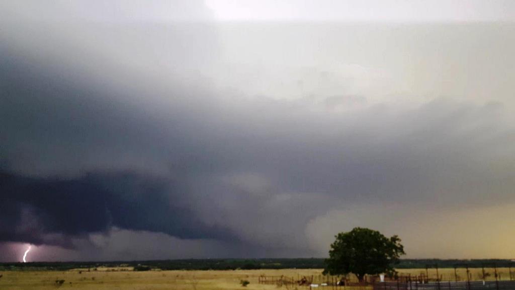
| The prior day's storms had left a long line of convection in progress, and our goal was to get as far south as we could to get into better air. We intercepted this tornado warned storm, which had already produced one tornado, north of Coleman, TX. Through the murk a distinct lowering hangs from the base. | The storm was highly electrified but didn't show much sign of rotation as it neared. | The line propagated farther and farther south, but a single more isolated storm became tail-end charlie and we headed even further south to intercept, stopping west of Gouldbusk, TX as the storm came towards us. | Features appear in the base of the updraft as the storm gets close. |
 |
 |
 |
 |
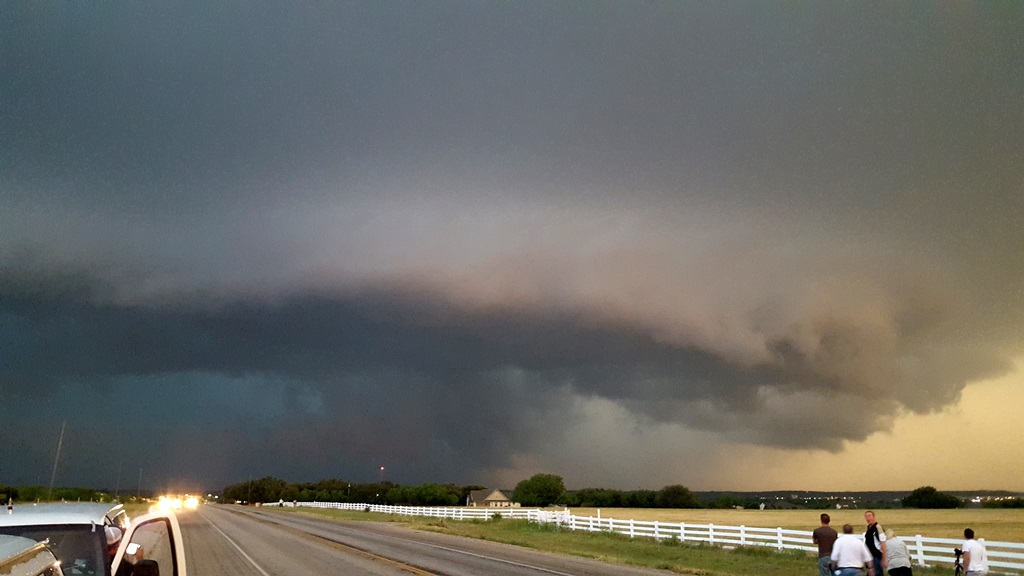
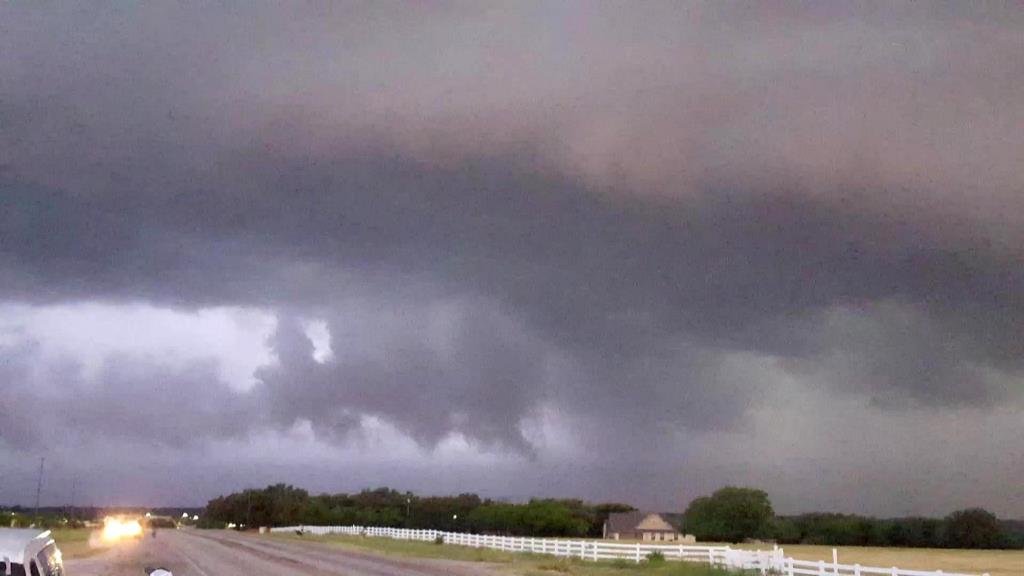
| Clear signs of rotation under the updraft base. | Unfortunately the wall cloud was very disorganized as the storm neared. | Shelf cloud approached and soon we were in danger of getting run over by the hail core | Running north towards Santa Anna as the big High-Precipitation moose with turquoise hail glow comes towards us. |
 |
 |
 |
 |
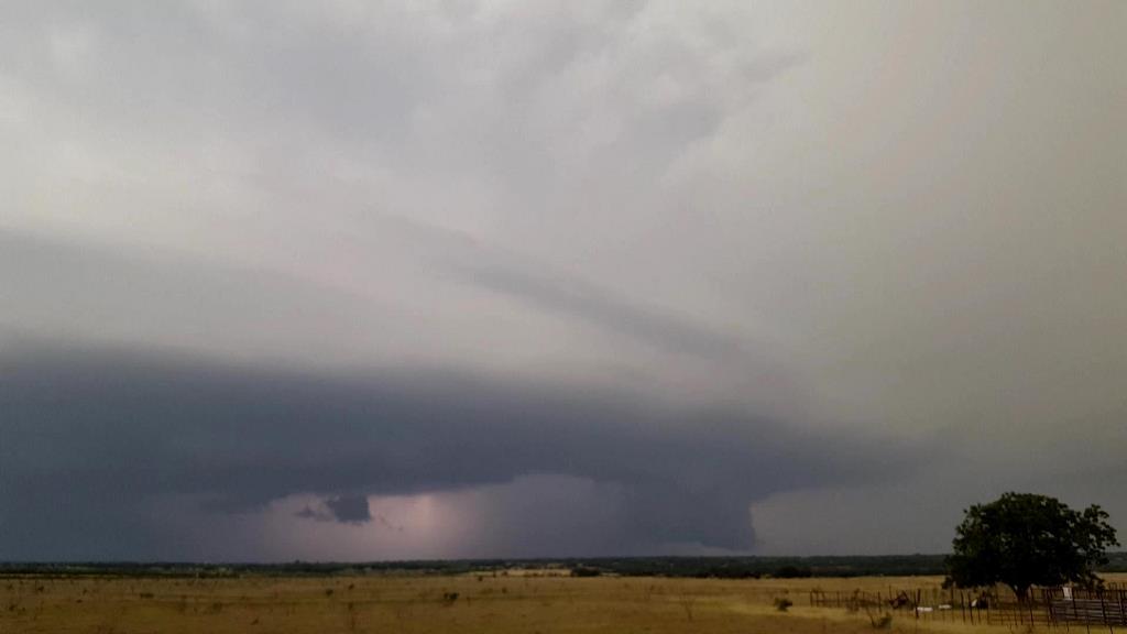
| Stopped just south of Santa Anna, we almost lingered too long and barely beat the storm there to get east. | Now southwest of Brownwood looking towards Bangs, a lowering lurks in the murk to our northwest. | Lightning illuminates a blocky wall cloud. | Closer look at the wall cloud, again illuminated by lightning. |
 |
 |
 |
 |
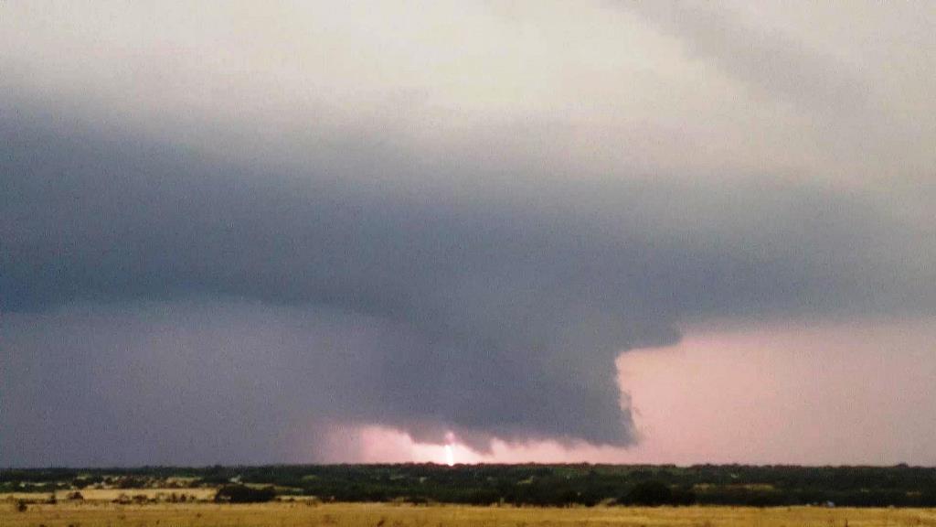
| Right around this time we thought we saw a funnel, followed by a power flash confirming another tornado. We could barely see it from our vantage but it was confirmed by spotters. | As it started to get dark, the storm continued to get more and more electrified. | As the core almost gets to us, the tornado sirens start to sound in Brownwood. Time to get moving! | Lightning illuminates some of the cloud features as we bug out. |
 |
 |
 |
|
| Back ahead of the storm after passing through Brownwood, mammatus hanging from the front of the anvil. | Over dinner the storms caught back up to us, resulting in an intense lightning show on the way to the hotel. | Nice cloud to ground strike! |
All pictures (C) Richard Hamel 2019.