


SPC Convective Outlook SPC Tornado Prob. NOAA Storm Report
May 18th, 2017, Western Oklahoma Supercells
A High-Risk of severe weather, or, in storm chasing
parlance, a high risk of a bust! We started the day in OKC, and with potential
targets ranging from northwest Oklahoma to southwest Oklahoma, we started west
on I-40. Though our initial choice of targets was in the Seiling area, we wanted
to keep the southern option open and decided to head to Watonga and stop there
and wait. As we reached Greenfield though, we decided to turn around and head
back to I-40 as the model runs were progressively making the southern target
look more appealing. We stopped in Hinton for lunch and to wait and see which
target area would present the first opportunity. The way the models were
developing it looked like early storms would fire in the Altus area and
eventually line out, but then a secondary group of isolated supercells would
fire along the OK/TX border and provide additional opportunities to chase.
After a wait of an hour or two, storms began to start
popping not only up on the warm front, but also down the dry line. The one that
immediately caught out attention was developing near Duke, OK and quickly had
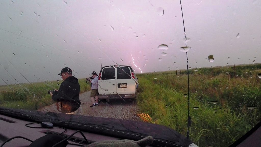
maxed-out VIL’s and cloud tops approaching 50,000 feet. We decided to go for it
and blasted west on I-40 with the intent to meet the storm around Hobart. By the
time we made it to Clinton and turned south on 183, the storm was tornado warned
and soon produced two tornadoes well before we were able to get there. Once
arriving in Hobart we headed west on Rt. 9 planning to go to Lone Wolf, but it
became clear that we would not beat the hail there and instead dropped south on
2180 Rd. out of town to try and get around the core.
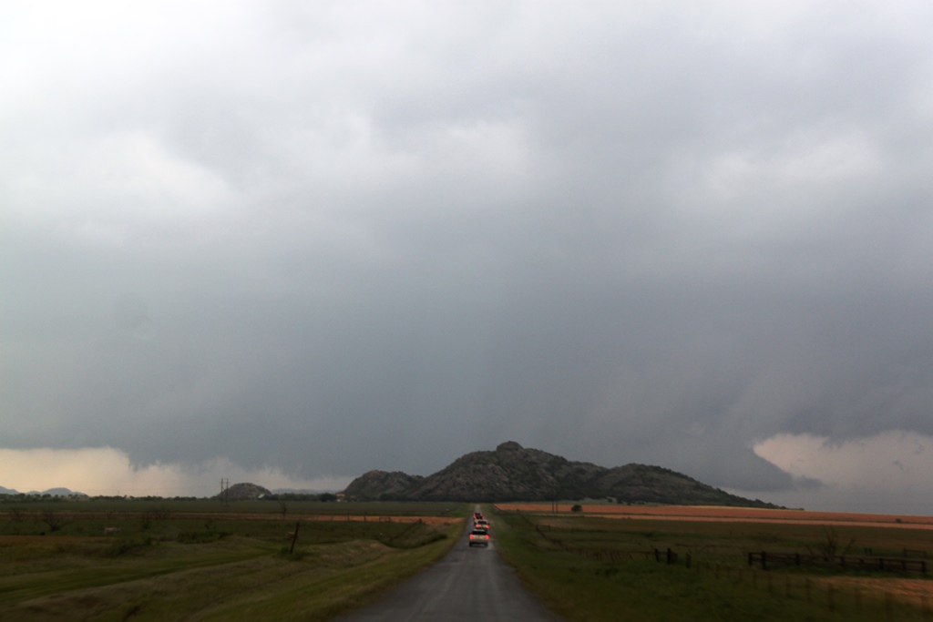
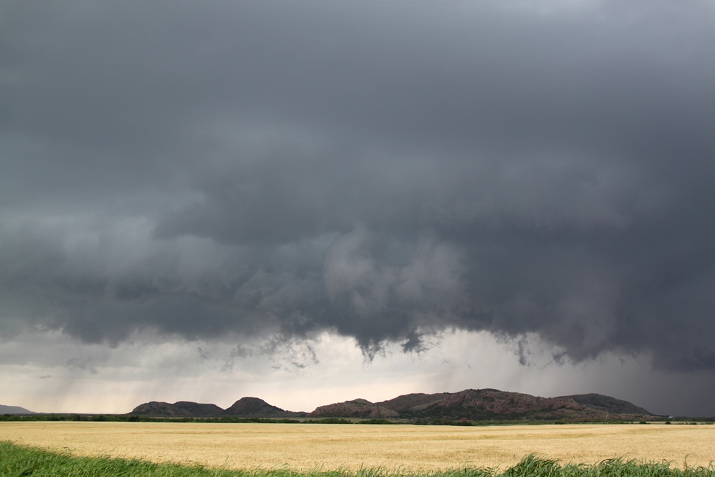
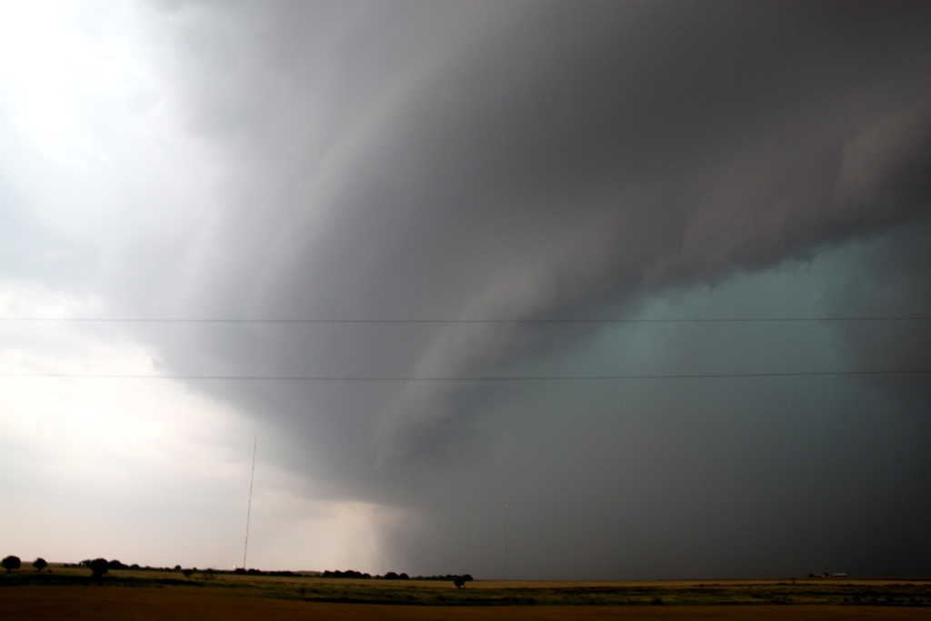
After some navigational fun, the wall cloud came into
view, hanging low over the small mountains in that region of Oklahoma. We turned
west to approach the storm and get around the hills and were treated to a neat
view with the spinning wall cloud just over some low mountains. Soon the storm
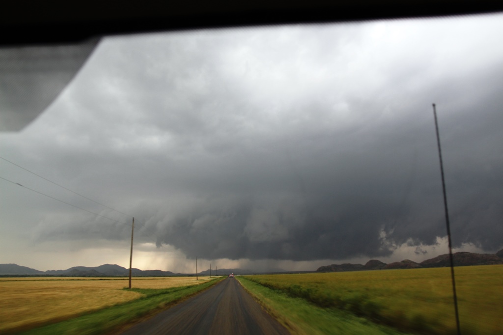
started wrapping up and generated a big funnel that made it about halfway to the
ground, but then got disorganized and dissipated. We followed the storm north
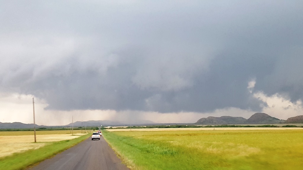
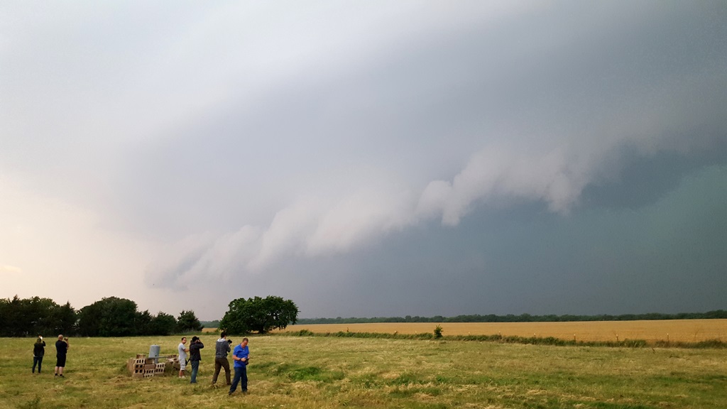
for a bit but then our attention was drawn to the tail-end storm near Vernon, TX
that looked like it could take over the show, with tops near 60,000 ft., and a
scorpion tail hook echo on radar. The storm in front of us looked raggedy and
disorganized, so we ultimately violated one of the rules of storm chasing: Stay
with your storm! The storm ended up producing another tornado about an hour
later, though it was rain-wrapped.
We started blasting south and were in a hurry as we had
to beat the new target storm to Oklaunion, TX or be cut off on the north side of
the Red River. We got back to Rt. 183 in Roosevelt and rushed south, but by the
time we made it to Frederick, it was clear we weren’t going to beat the hail
core to the river crossing, so after a brief stop in Davidson we headed east to
parallel the river on the Oklahoma side. Luckily, the storm wasn’t right-turning
as hard as it had been and did indeed come across the river. We sat in
Grandfield and waited for the storm to come to us. As the storm neared, it was
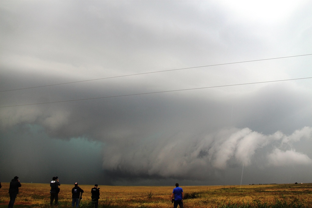
showing signs of becoming a high-precipitation (HP) supercell, with that
turquoise glow that says “big hail”. We adjusted just to the west of town then
south on a gravel road and waited as the storm closed to where we could start to
see details of the structure. That was a consistent theme of the day: lots of
rain and cloud debris made for a gloomy, wet chase day. Finally, we saw the wall
cloud area, low to the ground and developing a big inflow band stretching off to
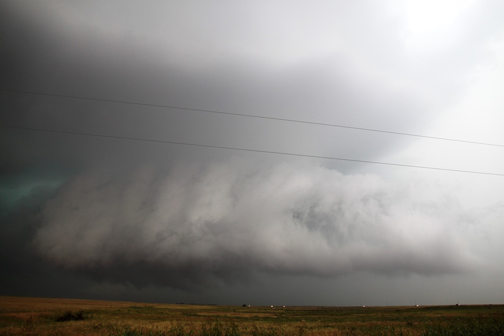
the northeast. We stayed and watched as long as we could as the hook wrapped up
and it became more and more difficult to see the wall cloud through the rain and
hail. In fact, we almost stayed too long as we suddenly had to beat-feet east to
stay ahead of the monster core with 3” hail!
We raced east out of Grandfield on Rt. 70, then turned
north at Randlett on Rt. 277 through Cookietown, then east towards Walters,
staying with the rotating area of the storm. The rotation indicated on radar was
very strong, but totally embedded in the hail core so we couldn’t see it. Wind
and hail damage reports started popping up on Spotter Net as the big HP started
gusting out. He headed east out of Walters and stopped on Rt. 53 in Corum, now
that we were out of the rain, and waited for the storm to come to us again. Now,
a little farther ahead of the storm, we could see the structure better: a
striated updraft showing strong rotation, the green hail look, and a
shark-toothed shelf cloud as the outflow rushed out ahead of the storm. We stuck
around for as long as we could (again, almost too long!) and had to blast east
as the core got to us. Around this time there was a report of 104 MPH winds in
Walters, suggesting there may have been a brief tornado in there but again, we’d
never have seen it. We charged east to Comanche then south to Addington. But at
this point the storm was completely wrapped up, and with several other cells
training along with it, it was quickly becoming a flash-flood machine. We
decided to call it a day.
Turning west at Waurika, we cut through the weaker cores
to the south of the main one, struggling through driving rain and a little bit
of small hail until we hit the Interstate just west of Randlett, completing a
big circle. As we headed north and stopped in Lawton for dinner, we were treated
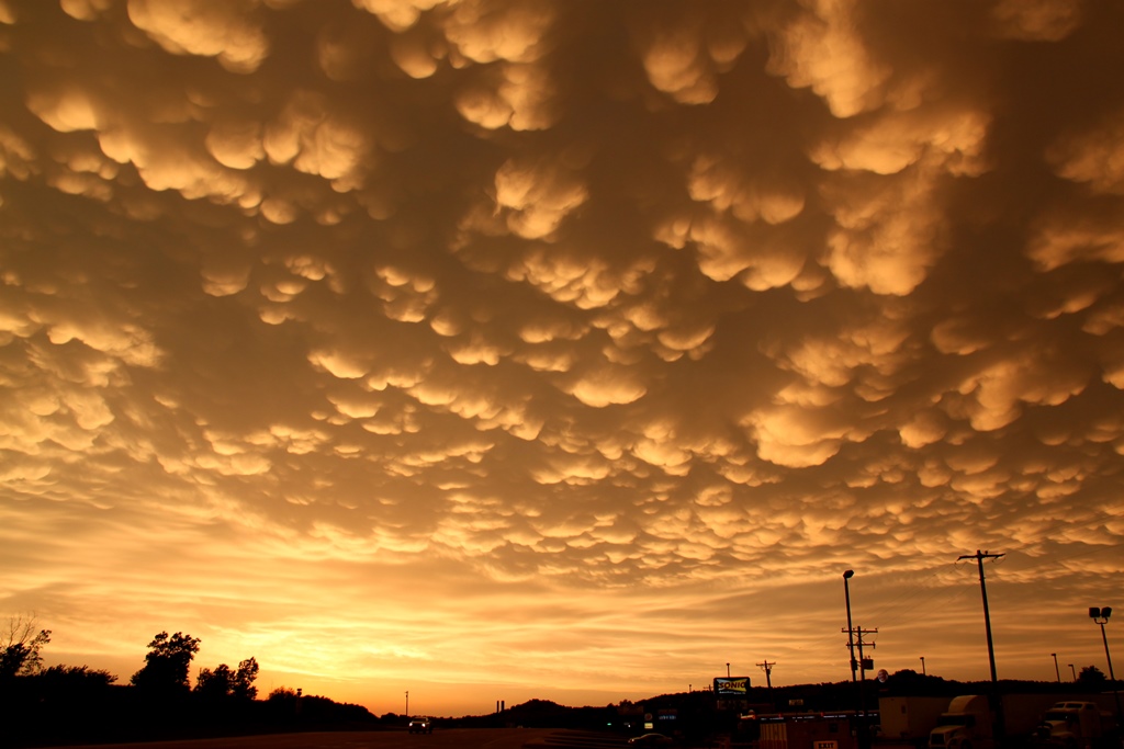
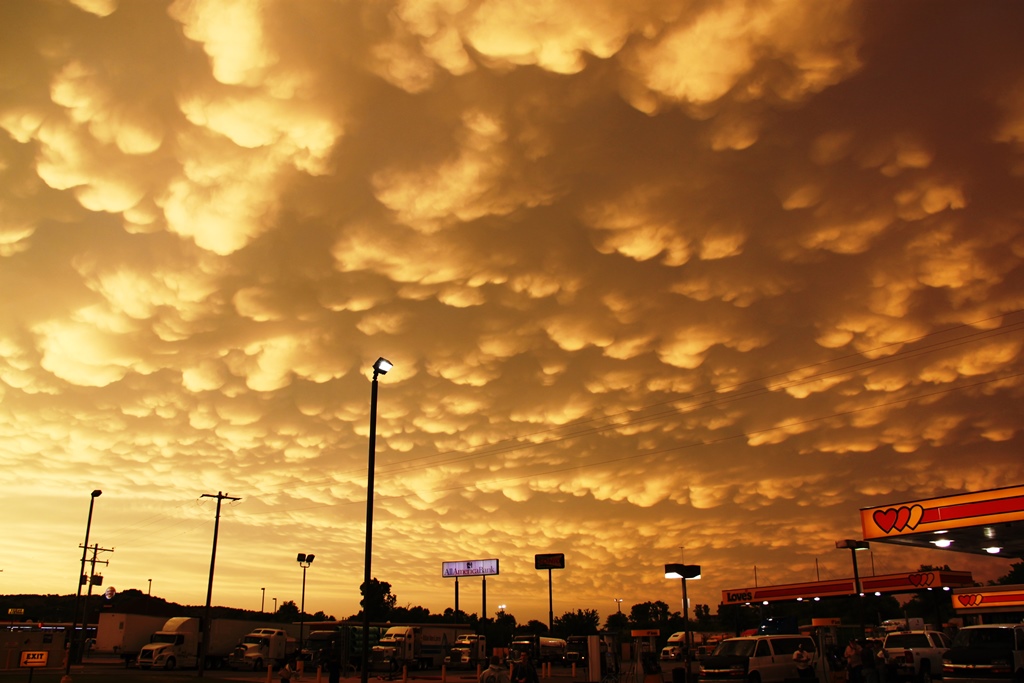
to a nice mammatus display with the setting Sun glowing orange off the clouds,
and some great cloud to cloud lightning which persisted all the way to Oklahoma
City.
All in all, another High-Risk bust. Giving up on our
initial northern target was the fatal flaw, though given the way the models were
trending hard to the south it made complete sense. Leaving the first storm
“violated the rules” but ultimately the only difference staying with that storm
would have made would maybe have been a brief glimpse at rain-wrapped tornado.
Miles for the day were 489.
SPC
Convective Outlook SPC
Tornado Prob.
NOAA Storm Report
 |
 |
 |
 |
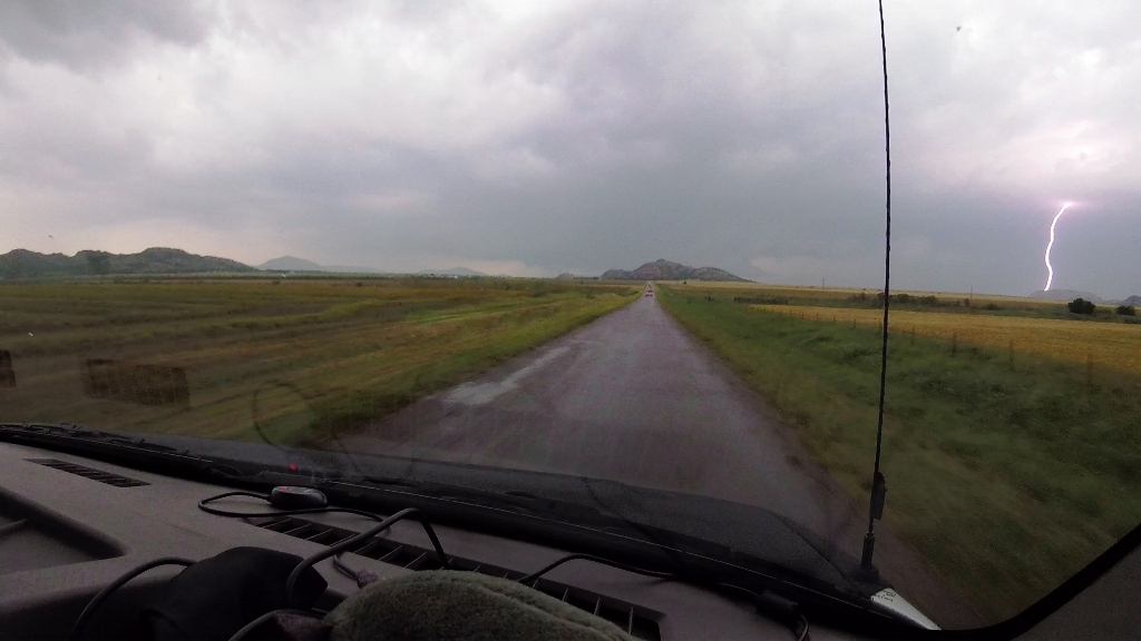
| A high-risk day in West-Central Oklahoma, we intercepted our first target storm in the small mountains southwest of Hobart, OK. CG strike as we charge towards the storm. | Ground scraping wall cloud hiding behind the small mountains. | Finally around the mountain we get a better view. Solid block wall cloud. | Closing in, but rain is falling out of the updraft. |
 |
 |
 |
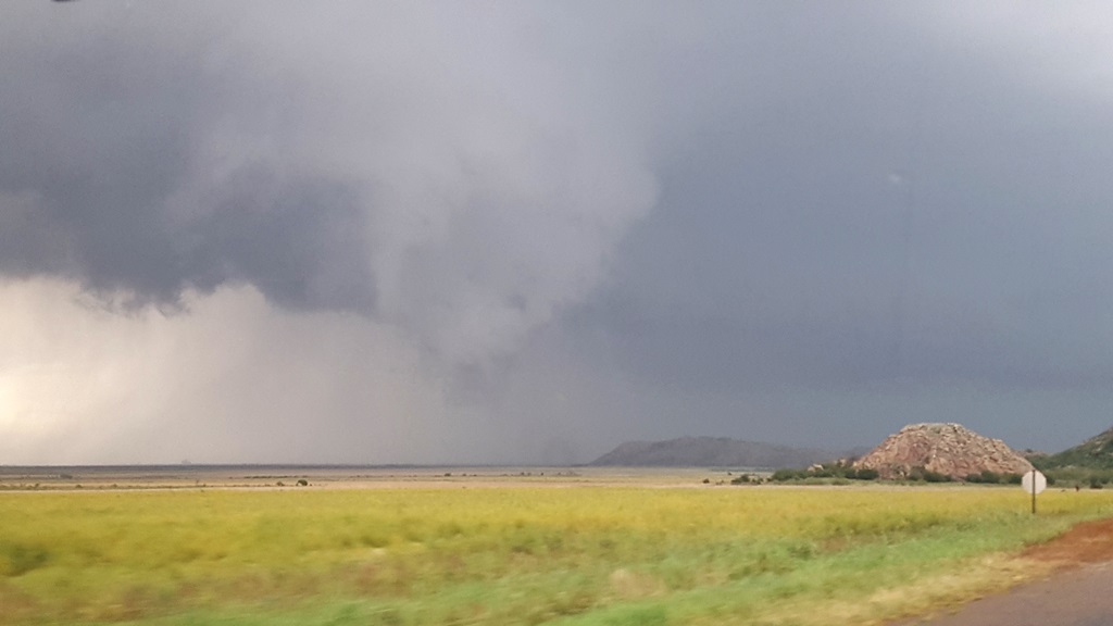 |
| The wall cloud quickly lost its organization and fell apart. | Cycling back up just to our north. Possible funnel right in front of us. | Big lowering develops. It looked like it had a chance! | The lowering drifts off to the north. Unfortunately it lost focus and we had to wait for the storm to cycle again. |
 |
 |
 |
 |
| The wall cloud cycles yet again but the storm is drifting off to the north. | Closer view of yet another big block wall cloud. | One more stop before we blew the storm off and headed south for another storm that caught our eye. Once again, after we left the storm, it produced another tornado! | We raced south and intercepted our next storm, a big HP Supercell, west of Grandfield, OK. |
 |
 |
 |
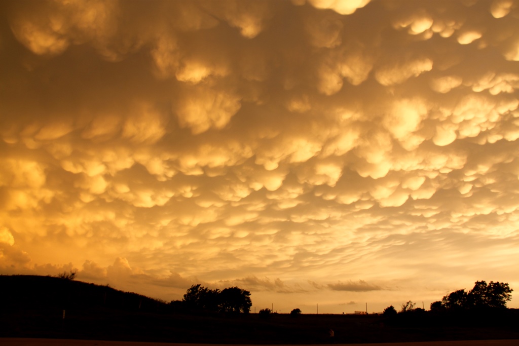 |
| Getting out ahead of the storm, we headed east, eventually stopping near Corum and picking a good spot to stop and let it come to us. | Zap! | End of the evening mammatus clouds near Lawton on the way back up to OKC. | A few more views... |
 |
 |
 |
|
All pictures (C) Richard Hamel 2019.