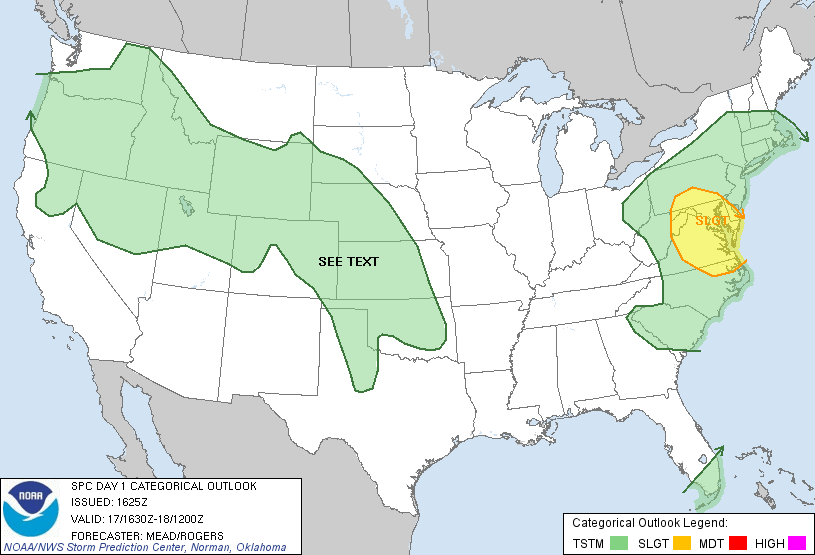
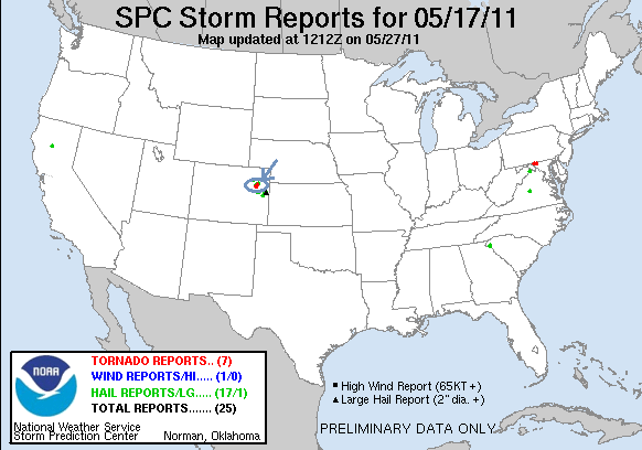

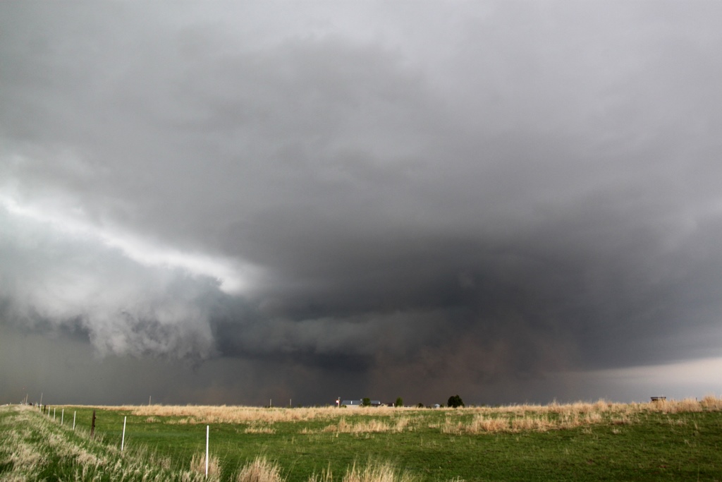
SPC Convective Outlook SPC Tornado Prob. NOAA Storm Report McCook Tornado Damage Path and Analysis
May 17th, 2019, McCook, NE Tornadic Supercell
A great chase day rewarded by 2 tornadoes (some saw 3)
and some adrenaline pumping close encounters! We started the day in North Platte
with a general target northeast of the triple point near McCook, NE, with the
intent to also keep an eye on storms forming further west along the Nebraska /
Colorado border, or potentially needing to drop even further south into Kansas.
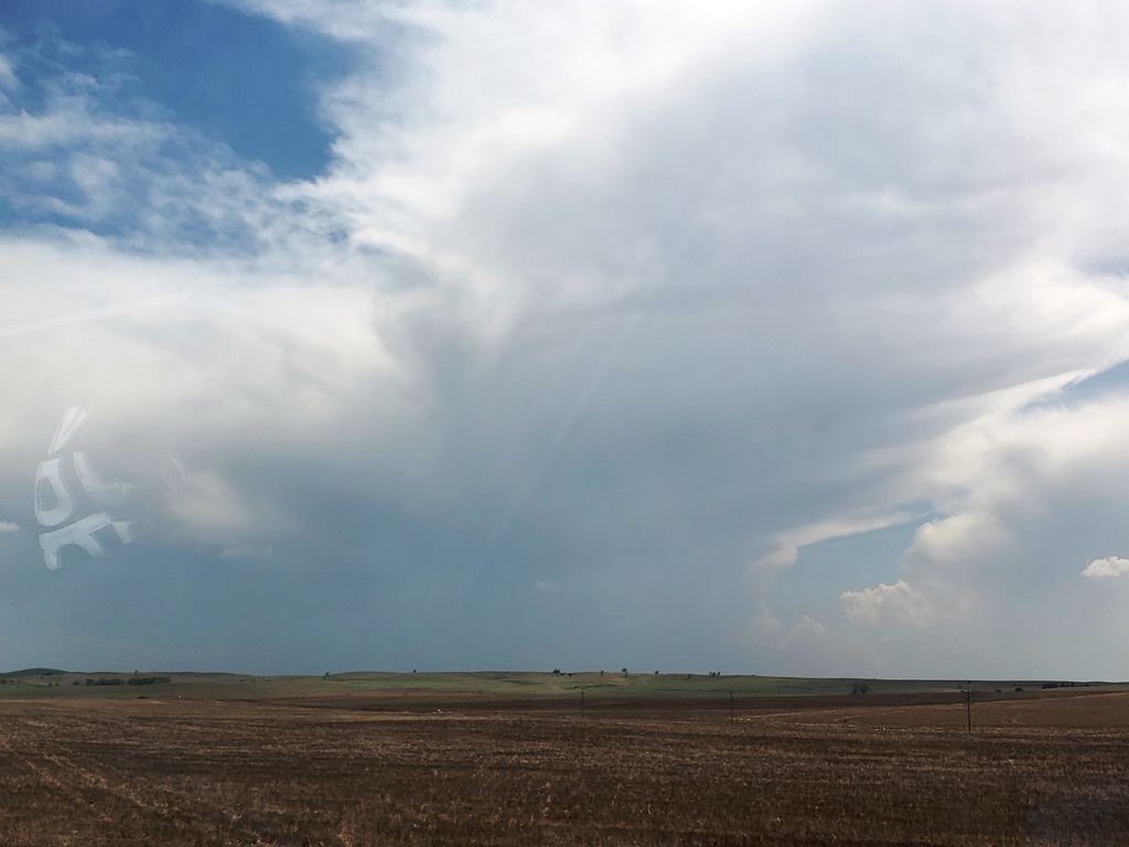
We initially headed south on Rt. 83 down to McCook, but as storms were already
firing west of us, we almost immediately turned around and headed back up to
Wellfleet, west on Rt. 20 to Wallace, and then south on Rt. 25. We then stopped
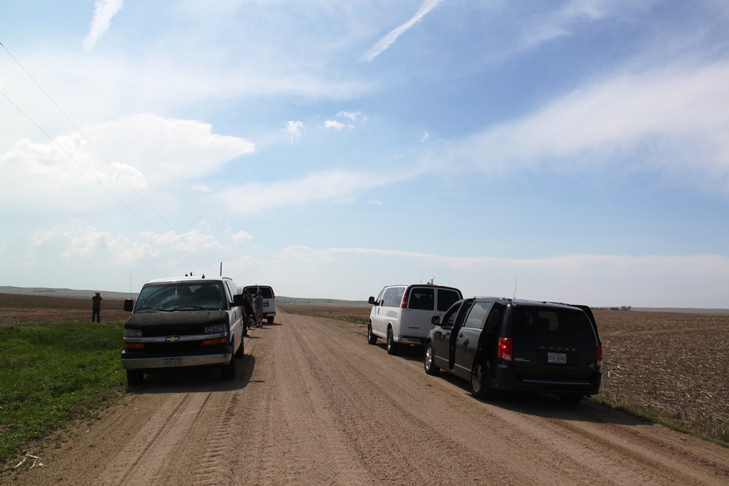
about 10 miles south of Wallace to consider our options: there were robust
storms to the west coming off the Cheyenne Ridge, but we were concerned they
would be high based. Meanwhile to our south there was a storm coming up from
Goodland, KS struggling in bad air, but quickly moving into a far better
environment. We ultimately decided to target that storm and headed south.
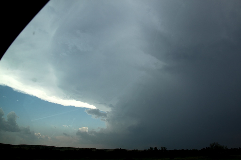
We proceeded down through Hayes Center, then east on Rt.
6 and south at Culbertson onto Rt. 17. As we closed on the Kansas border, the
rock-hard eastern wall of the updraft of our rapidly intensifying storm became
visible and we knew we’d made the correct choice of storms. We ended up stopping
about 2.5 miles from the Kansas border just north of Rt. 704 and could see scud
rising into the base of our storm, but as yet it was still fairly disorganized.
We stayed with the storm moving back up Rt. 17 and turning off on Rt. 710 to
stop and observe again. At this point the storm had a much more defined wall
cloud and produced two decent funnels and showed intensifying rotation as the
storm got close to us. The storm began to get the look that it could tornado at
any time, but soon we were forced to move or risk being cut off by the hail core
packing 2-3” hail, so we scooted north to stay ahead. We headed back up 17 and
then east on Rt. 713 which unfortunately was dirt, watching behind us as the
wall cloud showed more and more rotation. With the storm moving quickly
northeast, we blasted east on the dirt road and then north on road 384 and
thankfully back onto the pavement into McCook.
As we got to McCook, the tornado sirens were blaring and
we decided to head north for a mile or two on Rt. 83 out of town to get a look
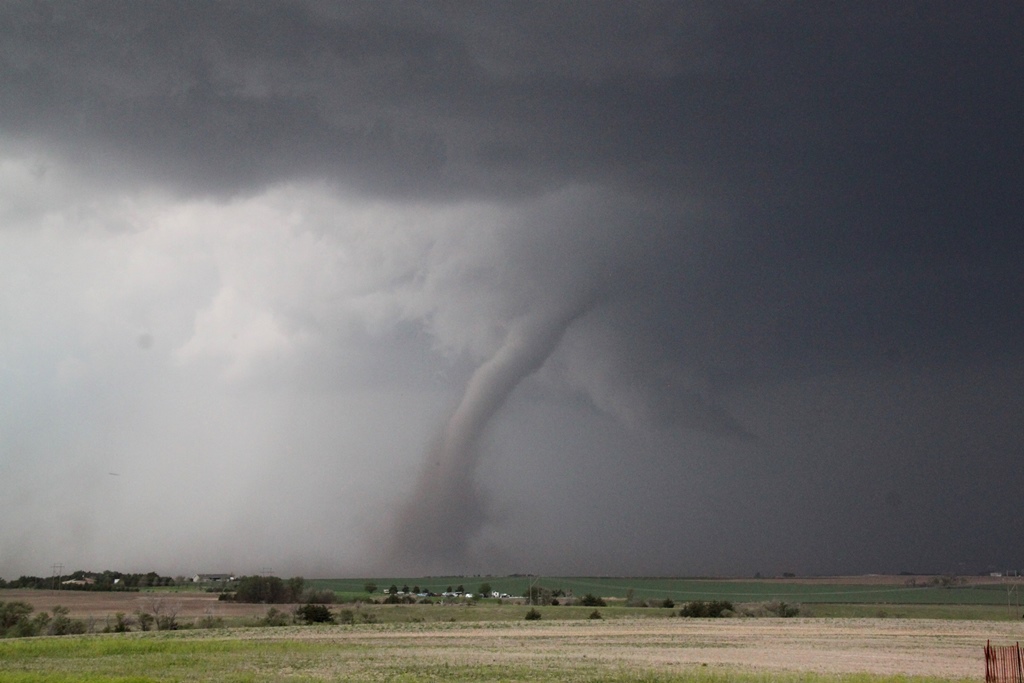
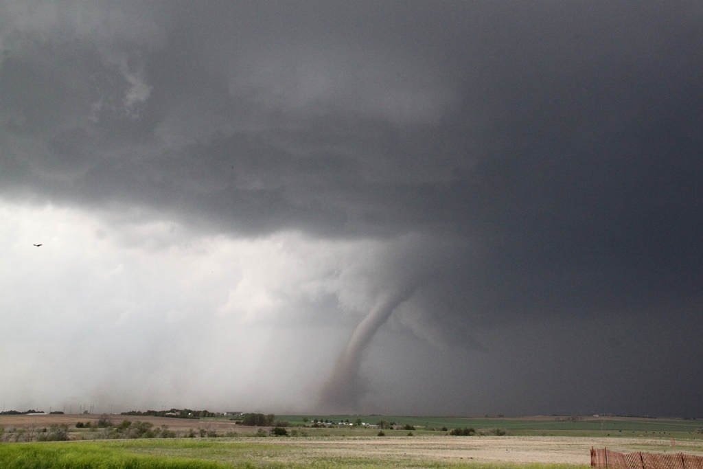
before heading east. As soon as we turned north, we spotted a large dirt plume,
RFD, and then north of that another… with a large funnel extending downward.
Tornado! We quickly turned into a nice, empty parking lot near Heritage Hills
Golf Course with a clear view to the west and observed the large tilted “Wizard
of Oz” tornado churning up dirt about 3 miles west of town. The big white
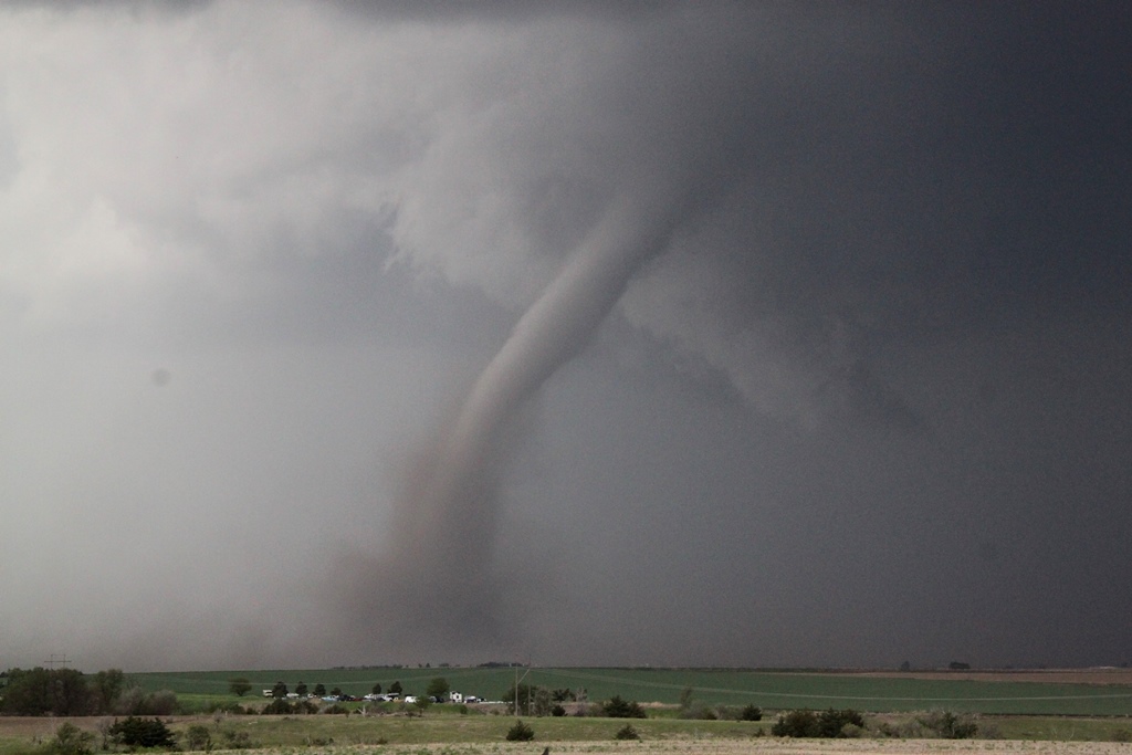
tornado moved northward with a large, dirty debris fan for several minutes, then
roped out with a large kink and elongated funnel that stayed in one spot
churning as the funnel stretched more and more northward before finally
dissipating. We knew the storm was not done yet but now had some catching up to
do so we beat feet east!
We now had considerable maneuvering to do in the very
poor road network of southwest Nebraska and it would be nearly an hour before we
were back in position. We blasted east on Rt. 6 almost all the way to Cambridge,
temporarily losing our view of the wall cloud, then turned north on the paved
Rt. 73A. We eventually intersected with Rt. 18 to head east…. Only to find that
it was not paved!! This slowed our progress dramatically. We slugged our way
east about 3.5 miles before turning north onto another dirt road heading towards
Eustis. Around this time as we were about 5.5 miles SW of town, we were seeing
more tornado reports and heard word of a dusty cone tornado in progress. Our
view to the west, when we could see going up and down through little ravines,
was of the old meso deteriorating and the new one with a large amount of dirt
flying but no clear view of the tornado if it was still there (some guests said
they could see it, and later I did see a picture one had taken that made it
pretty clear. I did not). Continuing onwards, we descended into a gully, only to
hear of another tornado in progress! We quickly turned up a side road and saw an
elephant trunk tornado in the distance in the process of roping out for tornado
#2 of the day! It only persisted for a minute or two then we were back to our
trek in the dirt.
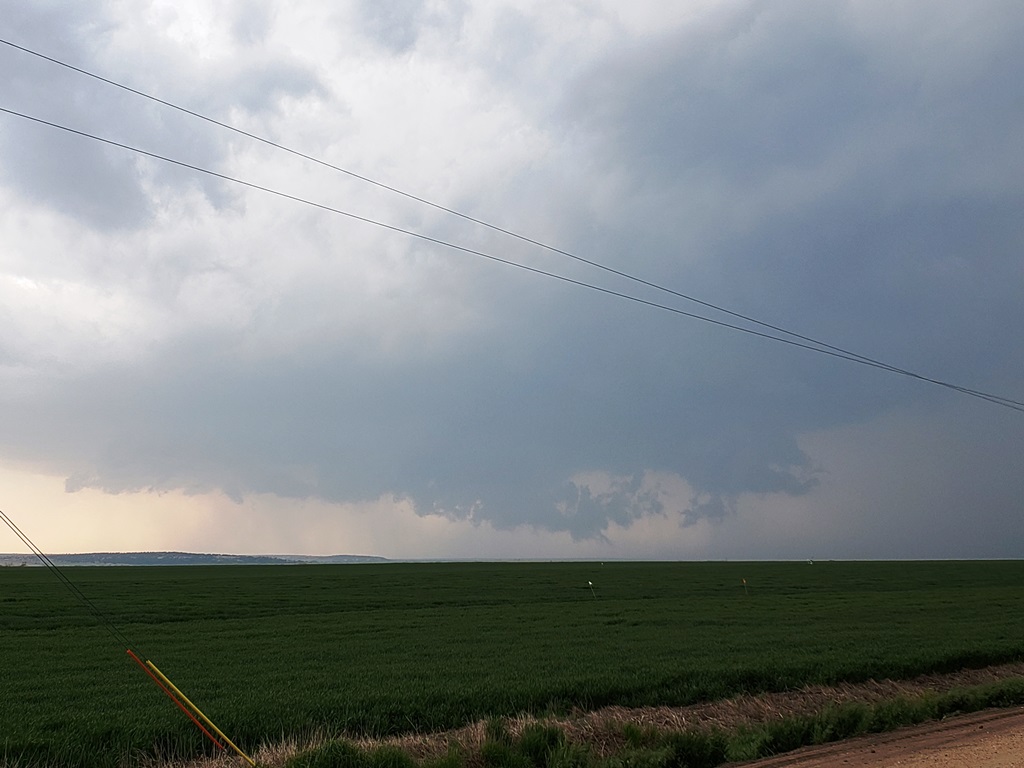
We finally made it to Eustis and back on pavement and
quickly blasted west right towards the meso and met it just as it crossed Rt. 23
near Farnam. The wall cloud was spinning like crazy and it appeared that the
storm might drop a tornado right in front of it but it never quite focused. We
waited until the meso started to fade from view and then blasted east again to
keep up. Later, there were several tornado reports from Farnam as the storm must
have tornadoed right after it got out of our sight.
We passed through Eustis again and north on Rt. 21 with
the wall cloud just to our west churning away. About 15 minutes past as we
blasted up towards Cozad, racing the hook echo to town to prevent getting cut
off. As we closed on the Interstate and a safe path east, the mesocyclone was
quickly closing on our position and soon was almost right over us. In fact, from
van 2 I was yelling over the radio that a satellite area of rotation appeared to
literally be right over the lead van. The storm just beat us to the highway and
soon we were punching the hook from the south with a big block wall cloud just
to our northwest and crazy rising motion all around out. As we got to I-80 and
started heading east, we were blasted by strong RFD winds that threatened to
blow the van right off the left side of the highway with the wall cloud churning
seemingly right outside the driver’s side window!
After that adrenaline moment, we headed east down I-80
(and later, there were more tornado reports in Cozad where we’d just had the
close encounter) and got off again at road 428, blasting north right back at the
mesocyclone we’d just left. We caught up again about 5 miles north of the
highway and were once again in the bear’s cage right under the meso, with a huge
plume of RFD dirt rising almost surreally to our east, and the wall cloud
immediately to our northwest. Suddenly a huge gustnado blew up right to the left
of the vans, immediately causing several guests to scream “Tornado!!” I could
see the rotating plume of dirt, but not the cloud base, so I could not confirm
myself but others could see that there was no connection to cloud base nor was
there a funnel, so it was confirmed as a gustnado, not tornado. Still, some
anxious, exciting moments! Ultimately, after heading east on road 761 to
continue stair-stepping, we stopped the chase about 10 miles from the highway as
the mesocyclone was getting away from us and there was no way to keep up with
the road network north of the highway. Passing through Lexington back onto the
highway, we were less than an hour from our hotel in Kearney and got there early
enough to celebrate with a good meal and a beer at Old Chicago.
A really fun chase day! Two tornadoes, maybe 3, and a
couple of very up-close moments under the mesocyclone. A pretty solid chase
considering the road network. With better roads, I’m certain we could have
gotten 4 or 5 tornadoes from the storm.
Miles for the day were 389.2
SPC
Convective Outlook SPC
Tornado Prob.
NOAA Storm Report
McCook Tornado Damage Path and Analysis
 |
 |
 |
 |
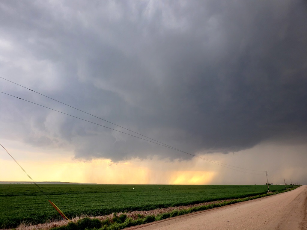
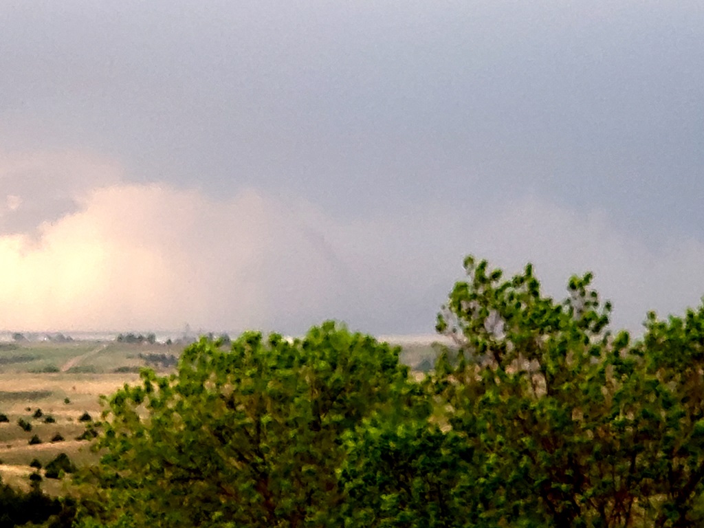
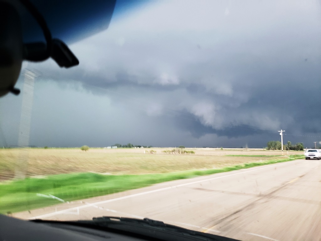
| Finally the day we'd been waiting for! Enhanced risk along the southwestern Nebraska border. Here, we're stopped south of Culbertson waiting for the dominant storm to develop. | The anvil of our target storm streaming in from south of the Kansas border. | Maneuvering to the south and east to meet the storm and get around the front flank core. | Now around the precipitation with a clear view of the updraft and low-hanging wall cloud. |
 |
 |
 |
 |
| As the wall cloud closed to our position, it showed clear signs of rotation but was still a bit disorganized. | More solid wall cloud showing distinct rotation. | Funnel cloud! | The funnel dissipated but the wall cloud was wrapping up significantly as it closed on our position. |
 |
 |
 |
 |
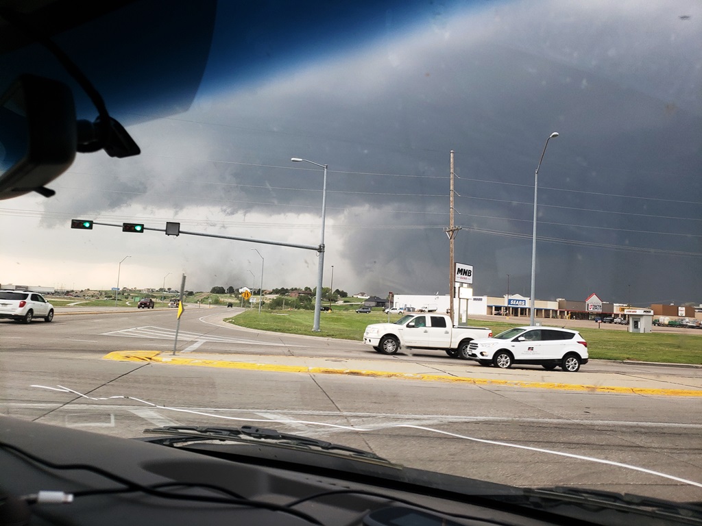
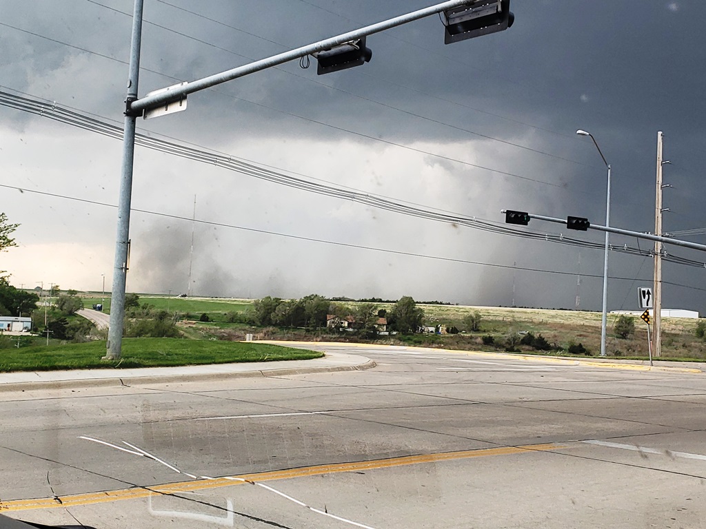
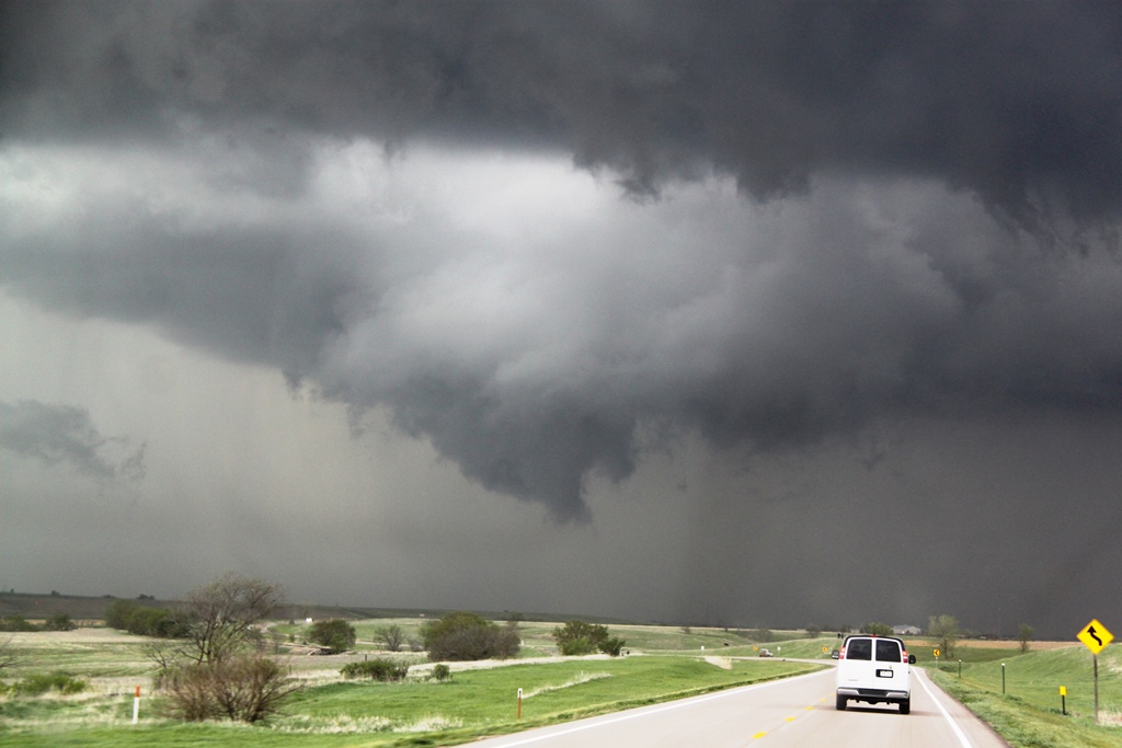
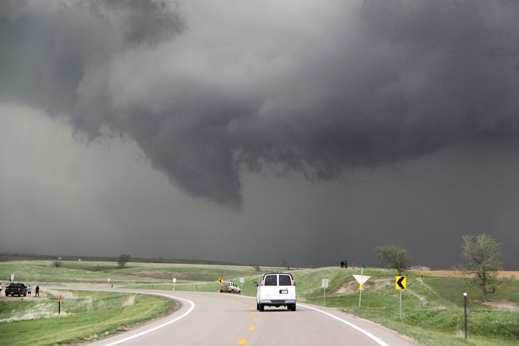
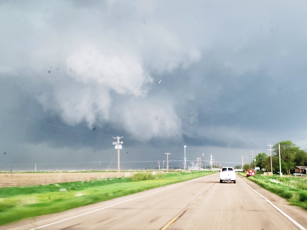
| We raced the storm to McCook. Here RFD is wrapping about the mesocyclone to our west. | Turning north to parallel the storm. | Tornado to our northwest! | The funnel becomes more visible as we close in. |
 |
 |
 |
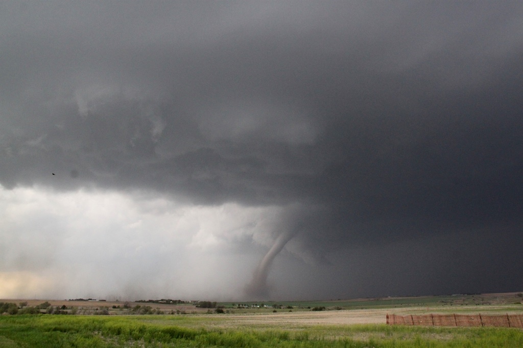 |
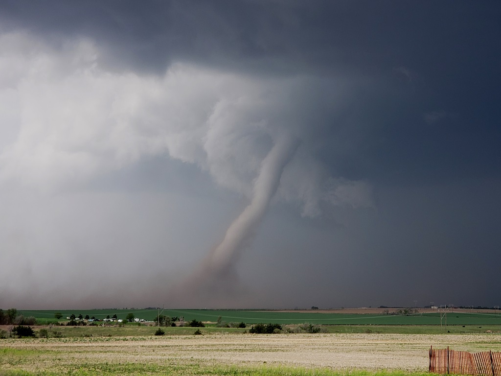
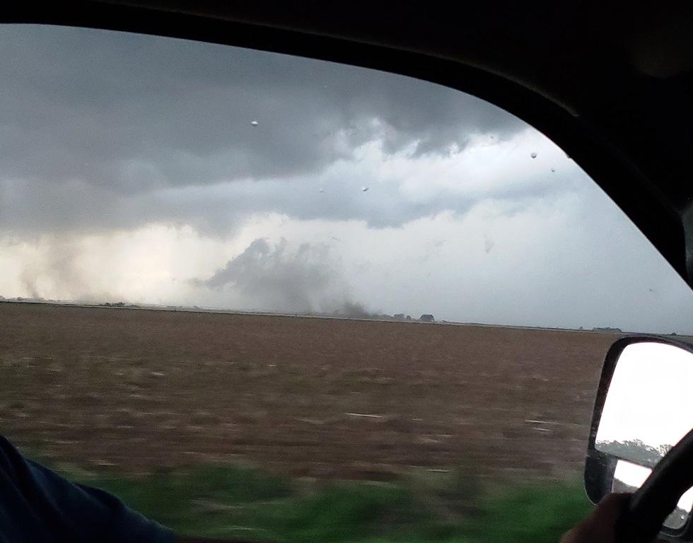
| Tornado with debris field about 3 miles west of town. | We ended up finding a parking lot with a great view of the tornado to our west. Several more views in the next few shots. | Wider view. | |
 |
 |
 |
 |
| Tornado roping out. | |||
 |
 |
 |
 |
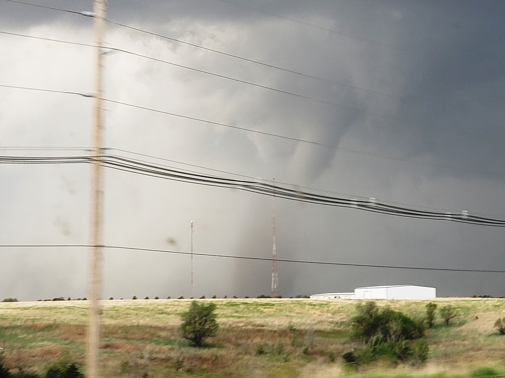
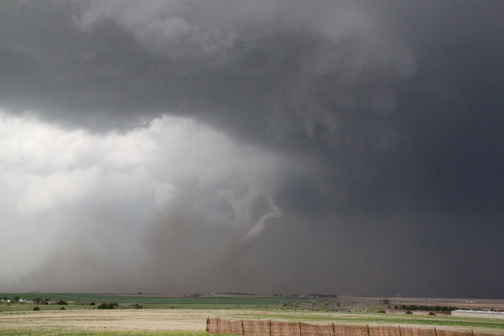
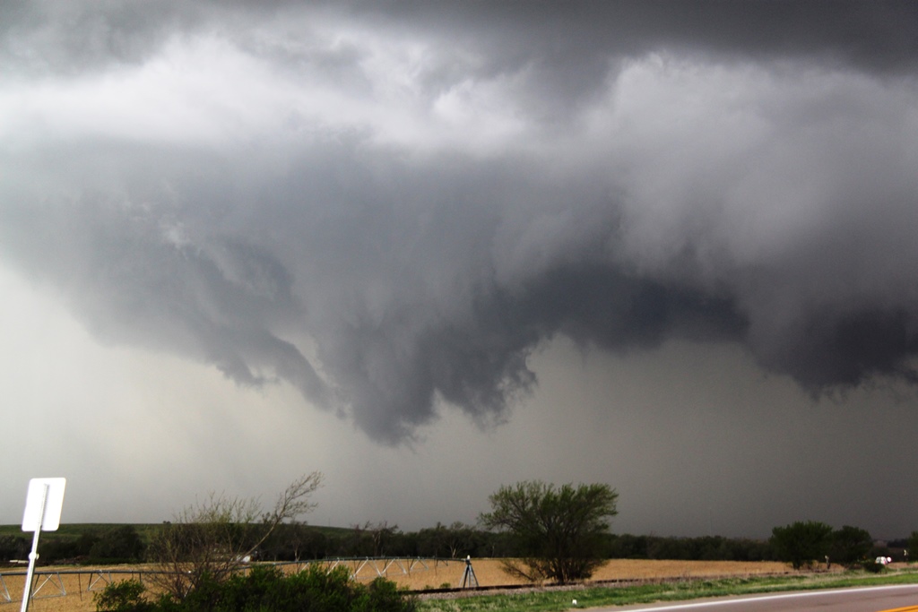
| Last gasp as debris flies everywhere. | Now blasting north near Cambridge, NE, wall cloud under a new mesocyclone. There may have been a tornado in progress on the occluding meso to the northwest (right of the picture) at this time. | Ground dragging wall cloud off to our west as we struggle along the unpaved roads. | We heard reports of a tornado to our west as we struggled through a valley. As we emerged we were able to see a tornado roping out to our west. |
 |
 |
 |
 |
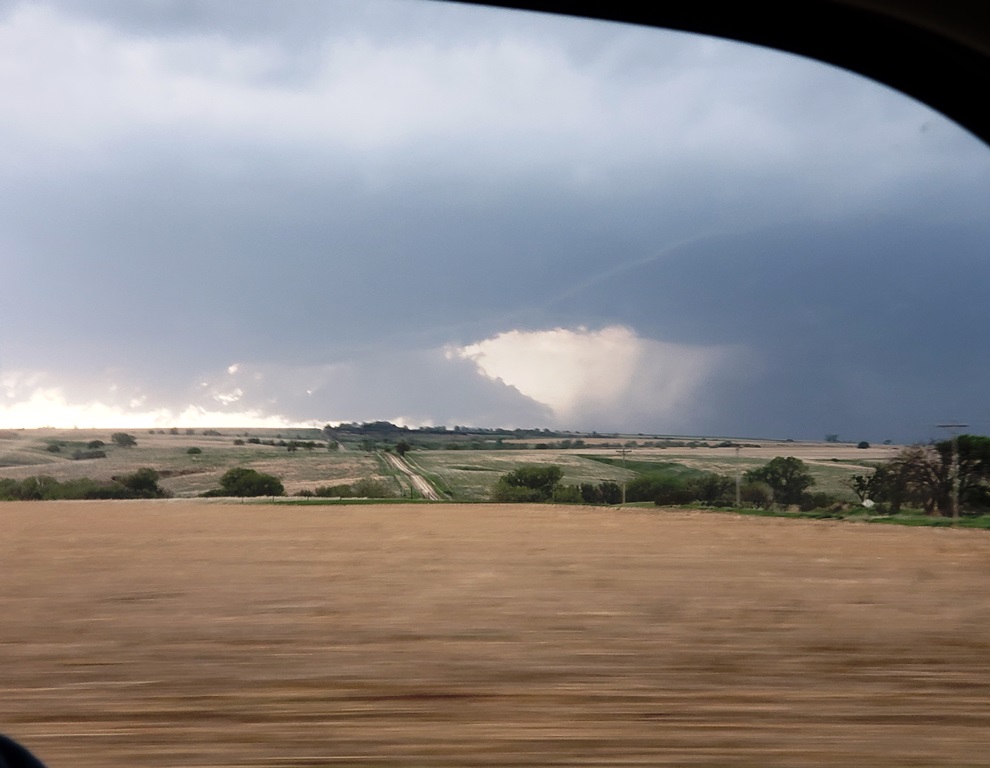
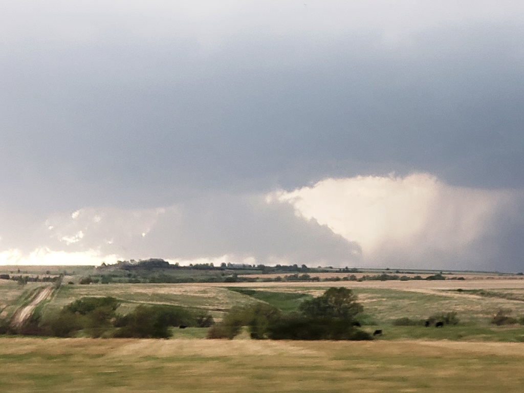
| Contrast enhanced view. This was likely the Farnam tornado that a lot of people captured on video. | West of Eustis we close in on a rapidly spinning wall cloud crossing the road right in front of us. | Funnel crosses the road in front of us but never touched down. | After a bend in the road we pull right up along side the wall cloud. |
 |
 |
 |
 |
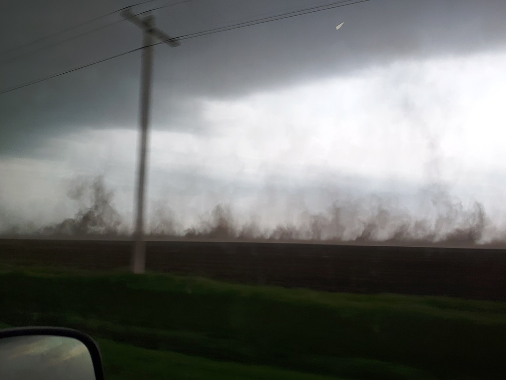
| Cut off by the wall cloud, we raced back to Eustis and north, trying to beat the wall cloud to Cozad. Lots of debris falling here, we may have missed another tornado. | Wall cloud as we race north on Rt. 21 to catch it. | It was going to be close! | After crossing right under the meso as we reached I-80, we blasted north in the Bear's Cage with wild motion to our west and RFD blasting to the east. |
 |
|||
| Crazy rising motion to our east as the RFD plows the dirt upwards. |
All pictures (C) Richard Hamel 2020.