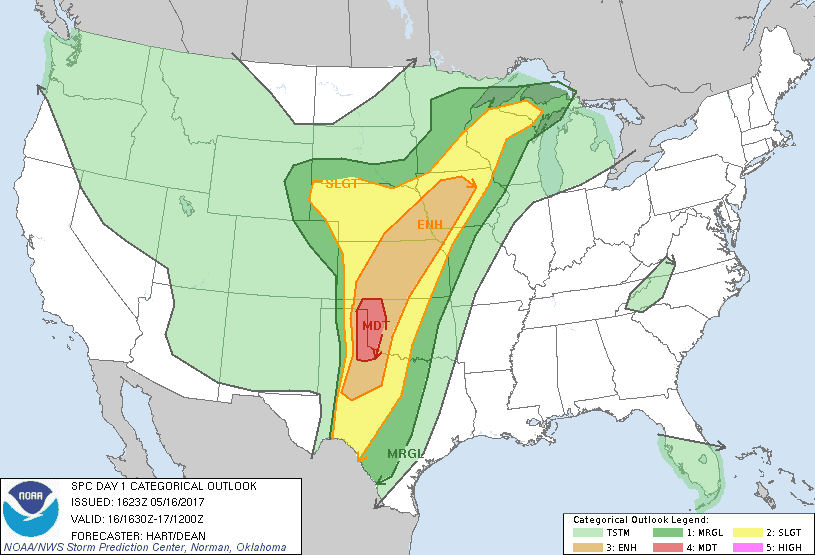
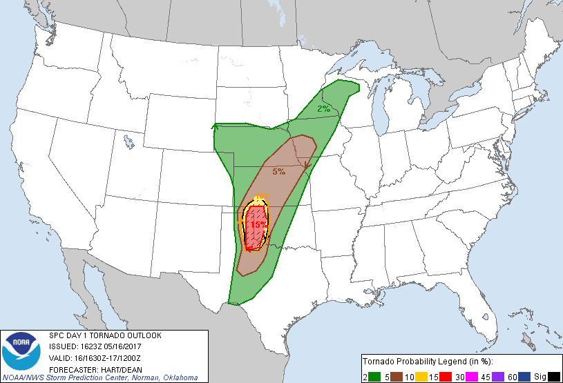
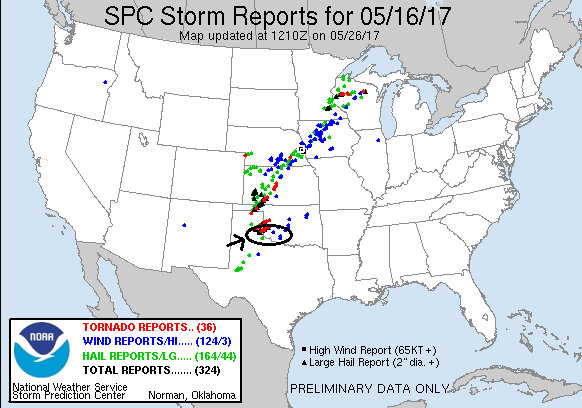
SPC Convective Outlook SPC Tornado Prob. NOAA Storm Report
May 16th, 2017, McLean, TX Tornadic Supercell
A fun, but challenging chase day! The setup was similar
to the previous day except the dry line was sharper and better defined, and the
moisture was better as well. There again were two distinct targets, though
unlike the previous day it seemed clear that both might verify. The first target
was along the frontal boundary in the northeast TX panhandle / eastern OK
panhandle, and the second along the dry line down towards Childress. Storms were
going to be moving fast from the southwest to northeast, and with large lapse
rates big hail was definitely going to be in play. Although we generally liked
the southern target better, traveling from OKC we didn’t need to decide and,
like half the chasers in Oklahoma it seemed, we headed to Shamrock, TX to get
into position where we could easily go north, west, or south as needed.
After lunch and a bit of a wait as storms bubbled up
along on dry line and had already fired way up near the Oklahoma panhandle, we
headed west on I-40 as a string of storms was coming up from the south. We met
the first storm of interest around Alanreed, stopping on the service road just
south of the highway and watching as a raggedy wall cloud zoomed across the
highway and headed north. We were more interested in the next storm in line, so
we headed south out of Alanreed on FTM 291, only to discover that the pavement
ended a few miles south and the road was already muddy! We turned around and
headed back north and then east on the highway again to get back in front of the
storm, which had a second hook echo somewhat to the south of the original one.
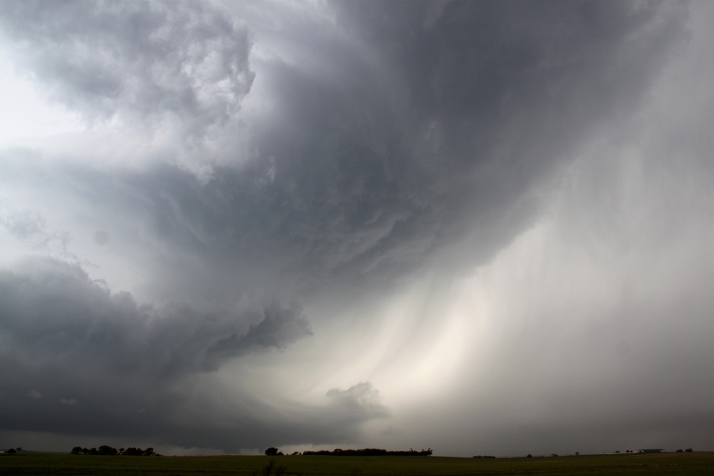
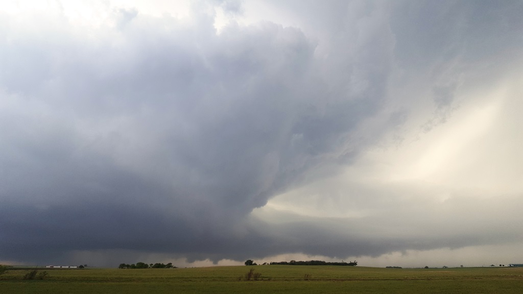
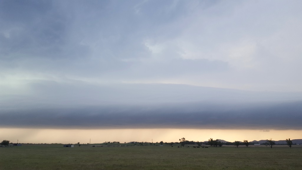
We made it to McLean then dropped a couple of miles south of town on Rt. 273 and
watched as the storm came up from the southwest with a very long, broad base and
a rotating wall cloud. We sat just on the edge of the front flank core as
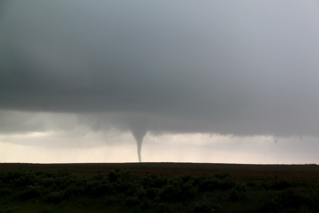
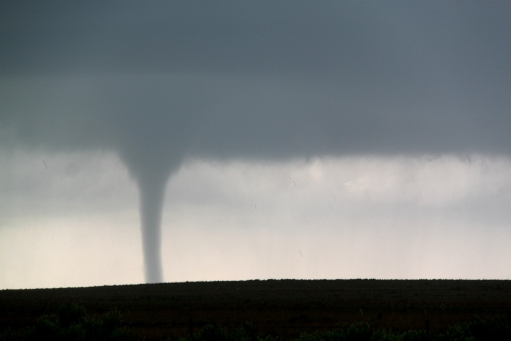
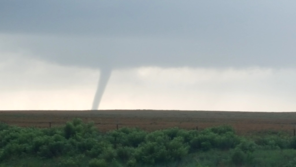
quarter to golf ball hail landed around us and suddenly a very stout funnel
formed, not under the wall cloud, but in a separate area of the mesocyclone
somewhat to its south heading almost directly at us, and soon, tornado!! It
developed initially as a tall elephant trunk but soon morphed into a thick
stovepipe heading generally in our direction.
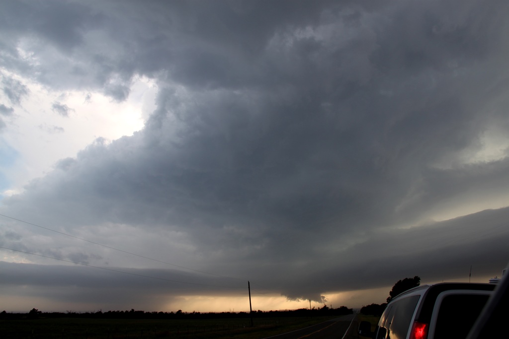
As the tornado closed on us we needed to get north and
east to stay with the storm, but now had a problem: the hail core was about to
pass over I-40 and we needed to get to the highway then east to stay with what
we thought could be a long track tornado (in fact it only lasted a few minutes).
Thinking the hail wouldn’t be much larger than golf balls, we blasted north
under copious amounts of hail and started heading east on I-40, and it looked
like we’d make it out as the hail began to let up significantly until WHAM!! on
the roof of the van, and then again, and again, and again, until the front
windshields of all three vans were smashed by baseball to even softball (based
on the size of one of the craters) sized hail!
Once clear, we quickly stopped to assess the damage but
then we were right back off again, heading for a storm we’d been keeping an eye
on for a while that had formed down near Turkey and was moving up from the
southwest, already tornado warned. We zoomed east on I-40 back into Oklahoma and
continued all the way to Sayre, stopping for a quick fuel up then heading south
on Rt. 283 to get past the front-flank core and into position to see the
updraft. As we headed south we received a report of a tornado in progress,
though given the number of chasers who were there and the dearth of reports or
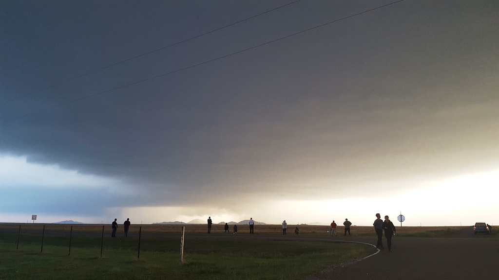
pictures, that report may have been false. We found a good vantage near the
entrance to Sayre Municipal Airport and parked there and waited for the updraft
to come to us. As the cloud debris around us cleared out we were treated to a
fantastic view of the storm’s rock-hard spiraling updraft up to 50,000 feet with
two large inflow bands streaming into the base from the northeast and southeast.
Hail was visibly pouring out of the vault region to our west, but as the
mesocyclone got close enough to see, it was clear the storm was not producing a
tornado, and didn’t look like it was imminently going to. Soon it was time to
move but it was too late to go back north as the hail core was crossing the road
up there already, and with our windshields compromised we couldn’t risk more big
hail. We proceeded south on Rt. 283 to the junction of Rt. 34, but again, the
fast-moving storm had already reached that road so we headed east on E1350.
Now we were debating: continue to try to get back to the
northern storm, which was moving quickly away from us but now had a reported
rain-wrapped tornado in it, or another storm coming up from Childress, TX to our
southwest that was an easy intercept and also in better air. Ultimately, we
decided the southern storm made more sense, and dropped south on Rt. 6 to
intercept. Sadly, the northern storm ended up hitting Elk City, OK pretty hard
and caused 2 fatalities.
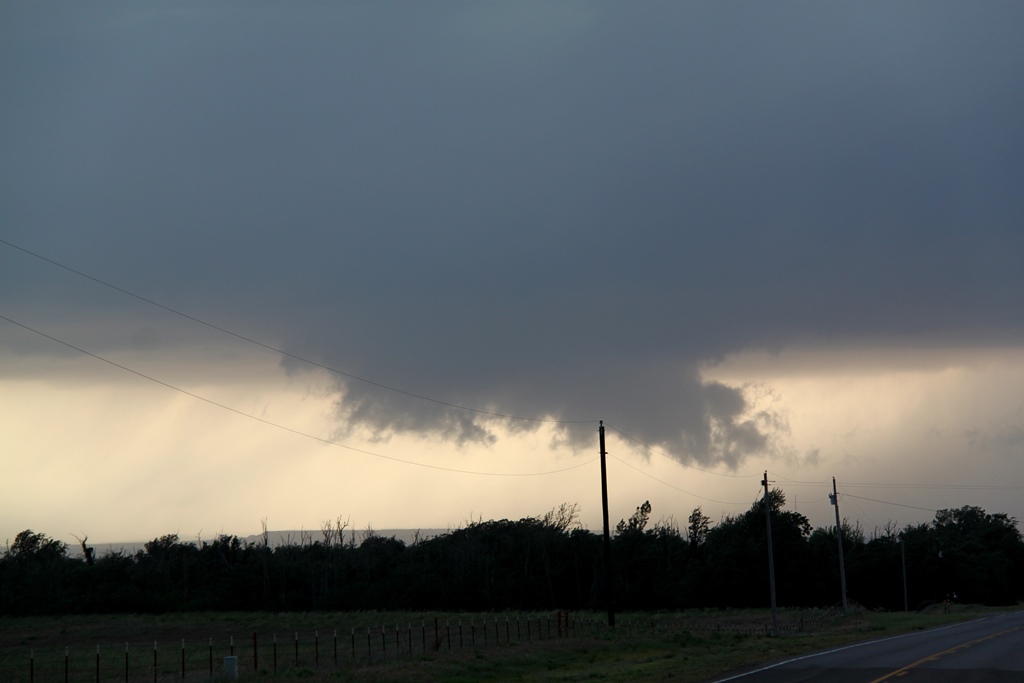
Heading south, we passed through Granite under light
anvil rain as we repeated the process of getting around the front flank core of
a storm. As the Sun was starting to set, the sky had started to take on that
orange-yellow glow to the clouds and rain, making for an eerie view. Arriving in
Blair, we skirted east towards Warren and stopped to watch the oncoming storm
which, despite a nice radar presentation, high VIL and tops approaching 50,000
feet, did not look very promising. One feature it did have was impressive was a
massive inflow band coming in from the east, with the low-level inflow jet under
it sucking dirt off the field into the storm. The inflow band was sucking in
colder than expected air though, and was even raining out. This may have been
the factor that kept the storm from really going off as the expected warm inflow
really wasn’t there. We went back and forth on Rt. 19 around Warren for a while,
then partially gave up and worked our way north and east toward Roosevelt. We
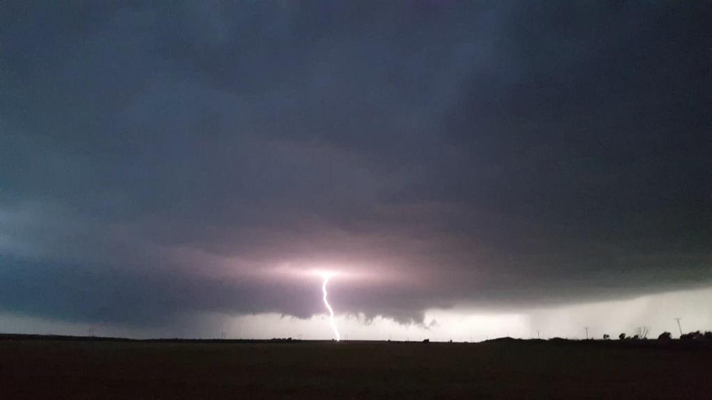
stopped a couple of times along the way and as it got dark the storm became
highly electrified, with smooth cloud-to-ground bolts hitting all around us west
of Gotebo.
Eventually we called it a night and zigzagged north and
mostly east to avoid the hail core from the storm all the way back to the hotel.
The night wasn’t quite over yet as the guides and a couple of the guests watched
as a severe squall line came through OKC, taking out the power for a couple of
hours.
All and all a pretty cool chase day! We got a tornado,
got smashed by big hail, and chased 4 strong storms.
Mileage for the day was 502 miles.
SPC
Convective Outlook SPC
Tornado Prob.
NOAA Storm Report
 |
 |
 |
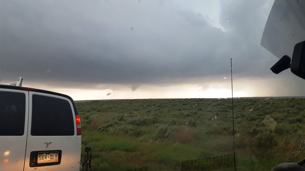 |
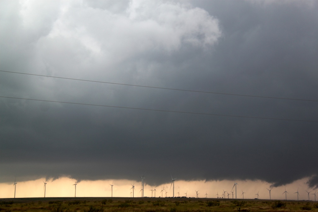
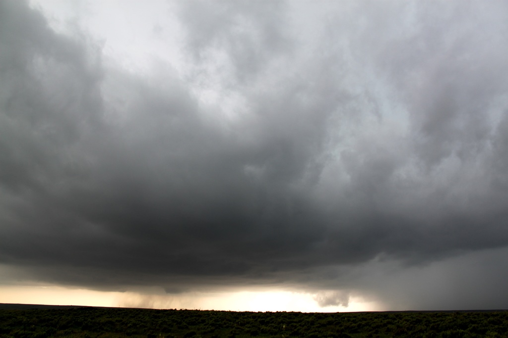
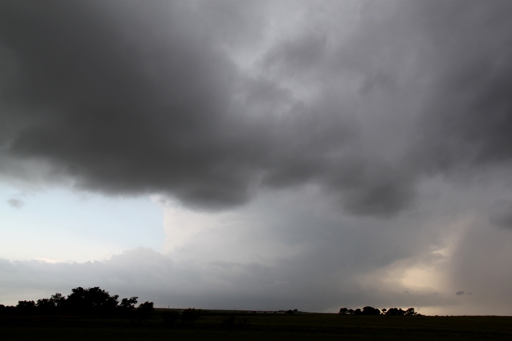
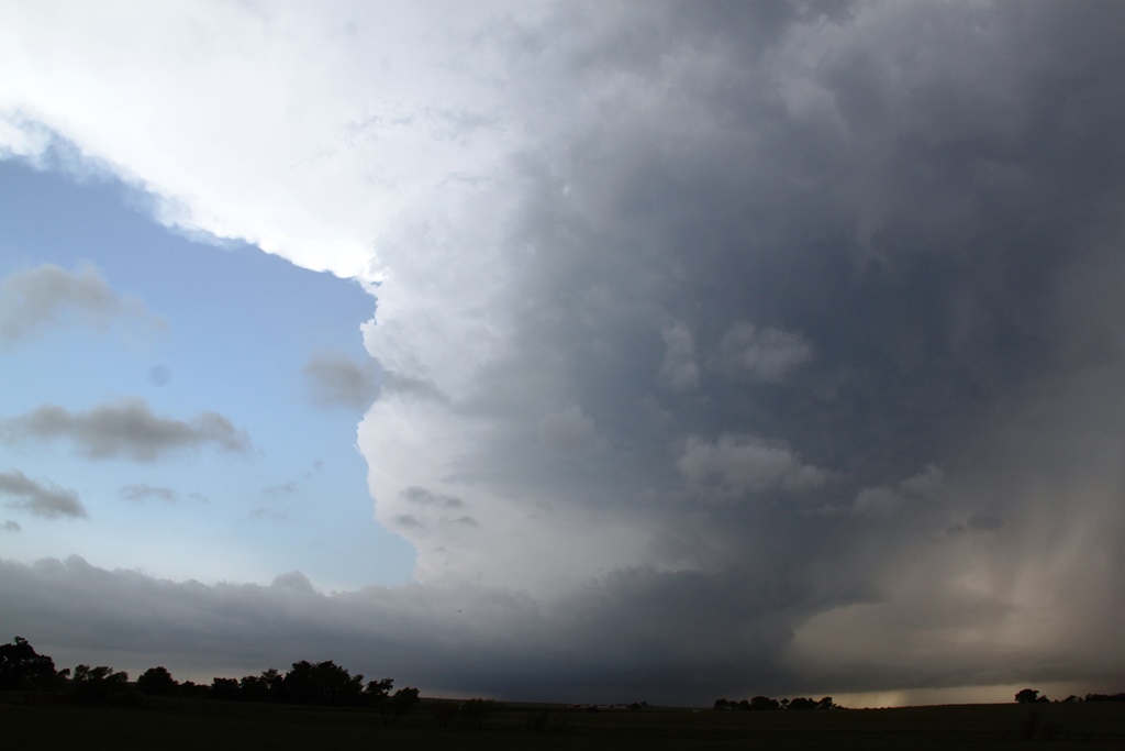
| Choosing the southernmost of two potential targets, we intercept the first storm of the day along I-40 near Alanreed. | Nice inflow band on the Alanreed storm, which raced away to the northeast and later dropped at least one tornado on the TX/OK border. | Now South of McLean, TX on Rte. 73, the broad base of our new target storm with a lowering developing under the updraft. | Funnel cloud developing to our west! |
 |
 |
 |
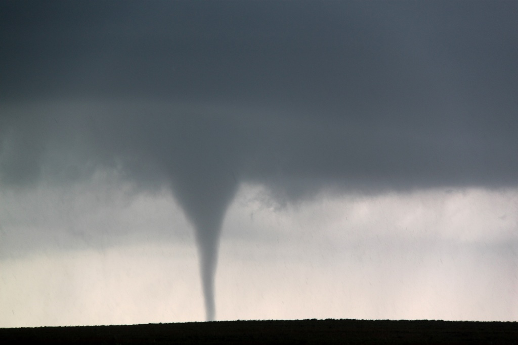 |
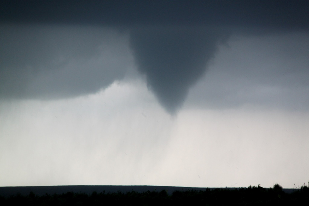
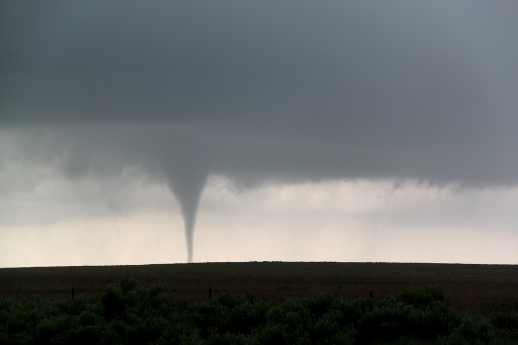
| Closer view of the stout funnel. | No real wall cloud here, the funnel developed right from the updraft base. | Tornado! Nice stovepipe southwest of McLean, TX. | Closer view. |
 |
 |
 |
 |
| Broader view. Again, not much of a wall cloud. | The tornado gets bigger as it starts to get close to us. About this time we decided we needed to get north and east to stay with the storm. | Starting to head north in a race to beat the hail core to the highway. | Didn't make it! All three vans had their windshields wrecked. Van 3 with numerous hits from baseball hail. |
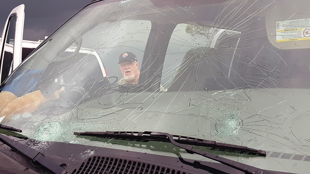 |
 |
 |
 |
| The lead van hit with baseball hail and one big softball sized stone. | Boom! The glass isn't just broken, it's pulverized. | Hail smashed your windshields? No problem, we continued to chase for another 300 miles. Waiting for the next storm to approach near Sayre, OK Municipal Airport. | Classic supercell structure! |
 |
 |
 |
 |
| A look at the long inflow band with the precipitation core to the north. | Prime Time guests enjoying the show. | The storm is close enough to see structure under the updraft. No tornado yet! | Looking pretty HP with a big front flank precipitation core. |
 |
 |
 |
 |
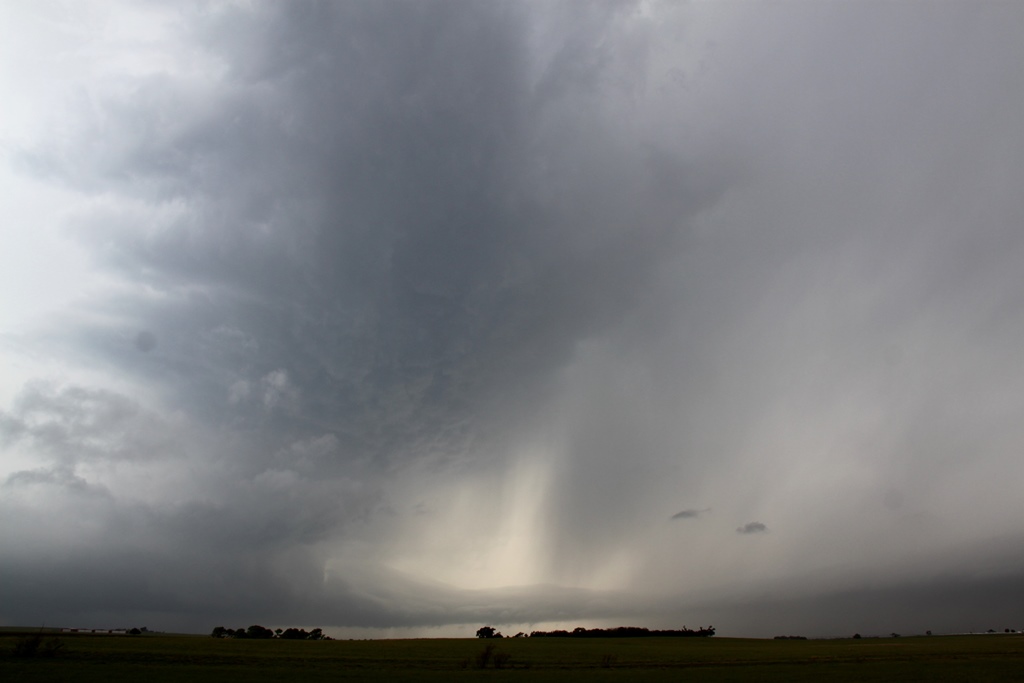
| The rain clears for a moment, revealing the beaver tail and the disorganized lowerings under the base. We lingered a bit too long and got cutoff by the hail core and had to let it go. This storm produced a damaging tornado near Elk City, OK. | We dropped south to Blair and then a bit east. Our new target looked great on radar but not great visually. Here, scud is rising into the updraft. | Closer view of the disorganized wall cloud. | Massive inflow tail near Roosevelt, OK. |
 |
 |
 |
 |
| Cold air clouds hanging off the inflow band with mountains in the distance. | Under the inflow band stretching off into the updraft. | The storm was highly electrified as dark fell. Here a bolt hits off to our north. | This was my view for over 300 miles of driving! |
All pictures (C) Richard Hamel 2019.