
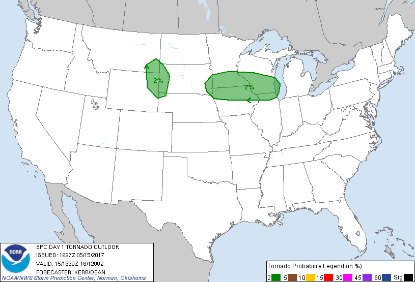

SPC Convective Outlook SPC Tornado Prob. NOAA Storm Report
May 15th, 2017, Borger, TX Supercell
Arrival day chasing!
I arrived at Will Rogers airport in OKC at Noon, and by 1 PM I had the keys to
Van 2 and we were off to the Texas Panhandle with whatever guests were on hand.
Our targets were split between storms projected to form along a shallow dry line
west of Amarillo and a confluence zone north of Amarillo. Storm motion was going
to be north-northeast and the storms would be moving pretty fast. We headed to
Amarillo to see which solution would win out. The failure mechanism was that dew
points were about 10 degrees lower than optimal, meaning that the storms would
be very high based and thus limit the tornado potential. Hail and strong winds
were the goal for the day.
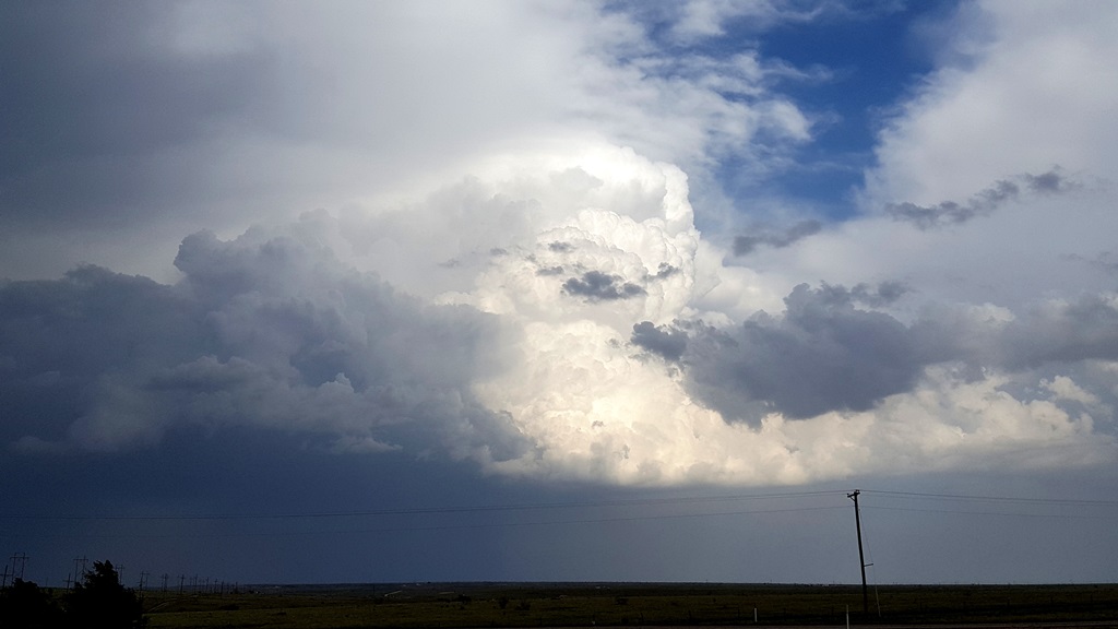
Once in Amarillo, we stopped just northeast of town to wait a bit as towers
bubbled up and down the line to our west. The northern option was looking better
even though the dew points up there were only in the high 40’s, compared to low
60’s to the southwest. Nonetheless, things soon popped and we were quickly
surrounded by pulsing severe storms. We decided to chase one to our north and
headed up Rt. 87 towards Dumas after the best-looking storm at the time, also
watching another to our southwest, and an isolated storm to our south east near
Claude that looked like it might take over. We eventually decided that we’d
never catch the northern storm, which was pulsing down regardless, and gave our
attention to the storm that was now right to our west with a big visible hail
core just west of the road. We turned around and tried to drop ourselves right
in front of the core, but it missed us slightly and we were only pinged by
nickel to quarter sized hail, though it was rock hard.
Ultimately, we shifted targets to the storm coming up from the south which we
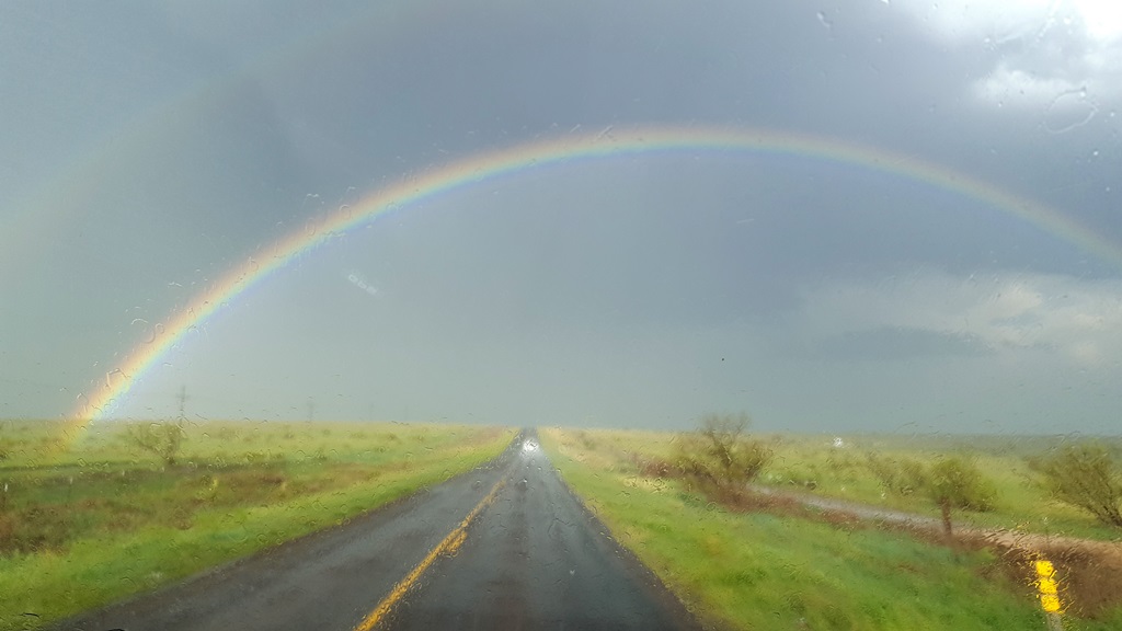
now almost east of us. We flew north, and then east on FTM 1913 out of
Masterson/Four Way. About halfway to Lake Meredith, driving towards a brilliant
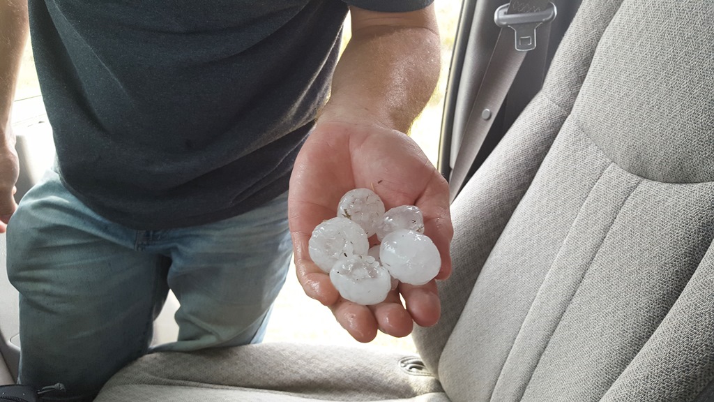
rainbow, we plowed into the southern flank of the hail core, which now had maxed
out VIL’s, and were pummeled by golf ball hail right at the edge. Not wanting to
blow out the windshields before the tour even started, we let the big core cross
the road right in front of us.
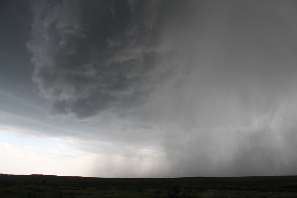
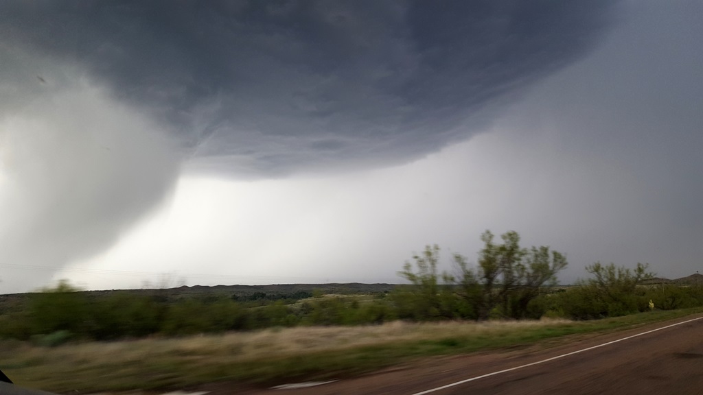
Meanwhile the storm developed a big hook echo almost right over us and in fact
we effectively “hook punched” the storm, with violent rotation just south of the
road with hail falling in a merry-go-round just a couple of hundred yards south
of us coming straight at us, and the main core just to our northeast. We charged
in between them and other than a few big stones that you could track
individually as they fell out of the sky, we skirted east just before the
southern hail core crossed the road behind us.
We were still in a hurry, however as the one road available to us turned
northeast and we paralleled the big core, containing reported tennis ball and
baseball sized hail (we heard of a few chasers losing their windshields) which
was travelling about 50 mph just about ½ a mile west of us and closing along the
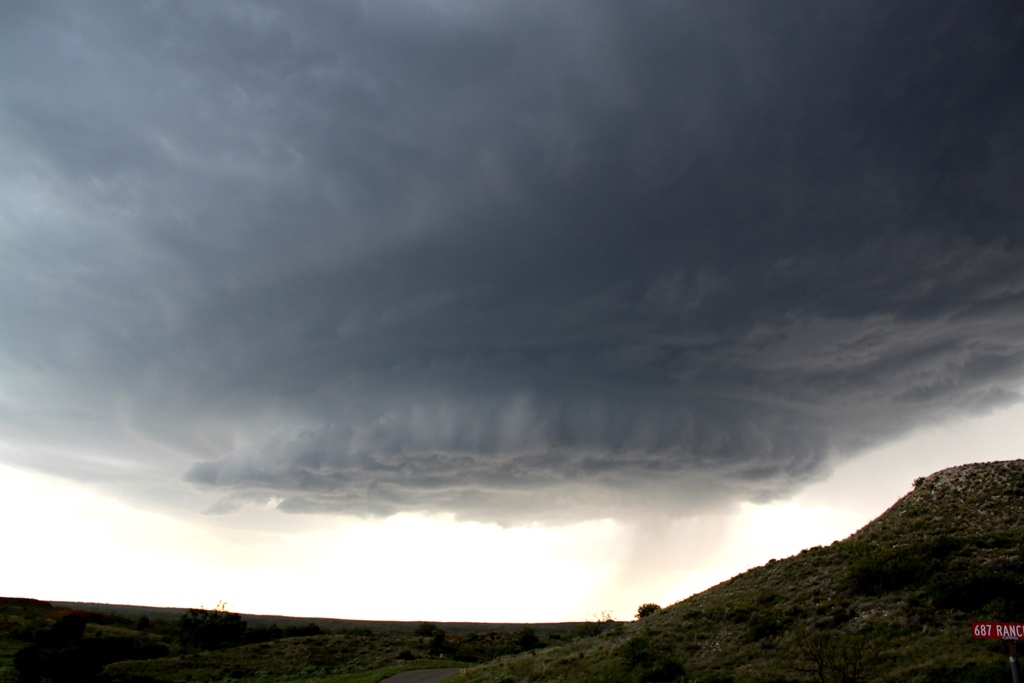
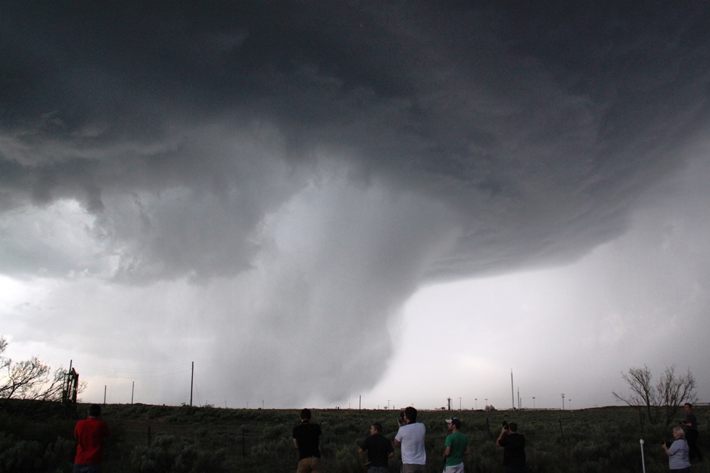
same path. The structure was fantastic, with big striations and a nice wall
cloud spinning like a top, albeit a mile off the ground, and hail pouring out of
the precipitation core. Another storm just north of us in the meantime was
dropping numerous repeating cloud-to-ground lightning bolts not far ahead.
In an attempt to beat the storm to Stinnett and buy ourselves some room to the
east, we turned on to FTM 3995 through Sanford, and eventually FTM 687 as we
headed for town, weaving through valleys and cool terrain all the while,
stopping every so often to take some great structure shots. It soon became clear
we wouldn’t be able to keep up with the storm for long, and since we were
already looking at a 4-hour drive back to the hotel, we decided to peel off and
head south for I-40, calling it a day. A fun warmup chase day and some great
storm structure and big hail!
A long drive on pre-tour day, 612 miles.
SPC
Convective Outlook SPC
Tornado Prob.
NOAA Storm Report
 |
 |
 |
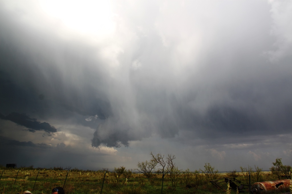 |
| Within an hour of landing, we're in the vans and heading for the Texas Panhandle. Soon we were targeting a storm near Masterson, TX. | Brilliant Rainbow about 1/2 way to Lake Meredith on FM1913. | First hail of the tour as we plowed into the edge of the hail core with ping pong ball sized stones. | Rapidly rotating wall cloud racing us east with hail falling in between in and us. |
 |
 |
 |
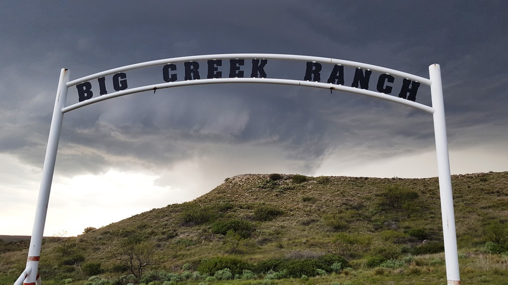 |
| Closer view as we punch the hook echo. The hail was spiraling around under the rotating clouds and coming towards us while the main hail core was just to our northeast. | We let the hail core pass in front of us, then circled around to get out in front of the storm, blasting up dirt from the rear flank downdraft. | Now east of the nicely structured, spiraling updraft. Hail still falling out of the front. part of the storm. | Welcome to the Big Creek Ranch! |
 |
 |
||
| Racing the hail core towards Stinnett, TX. | Stopping to get some shots of the hail core as it blew past us. Eventually we gave up and headed back to OKC after a fun warmup day of chasing. |
All pictures (C) Richard Hamel 2019.