
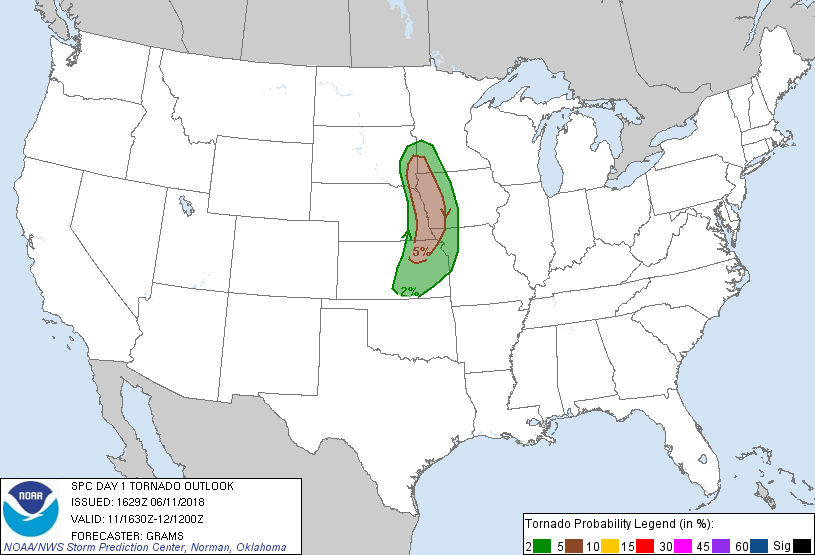
SPC Convective Outlook SPC Tornado Prob. NOAA Storm Report
June 11th, 2018 Fremont, Nebraska Supercell
A long day of driving and chasing. We started the day in
Pierre, SD with the plan to play cells firing along the north or south edge of a
bubble high projected to form in the wake of the MCS that had formed off the
previous day’s convection, somewhere in southeastern Nebraska or southwest Iowa.
The day would be somewhat of a repeat of the previous day: Lots of moisture and
CAPE but not much wind support at the 500 MB level. The key would again be to
get on storms as early as possible to hope they could do something in the window
where they were isolated before merging into a large squall line. We headed out
and made it to Sioux City, IA for lunch, and then were delayed a bit by a
mechanical issue with one of the vans.
Once the technical difficulties were resolved, we headed
south on I-29, but towers were already forming to our west and southwest so we
got off the highway in Missouri Valley, IA and took Rt. 30 west across the
Nebraska state line into Blair. By the time we got into town, there were already
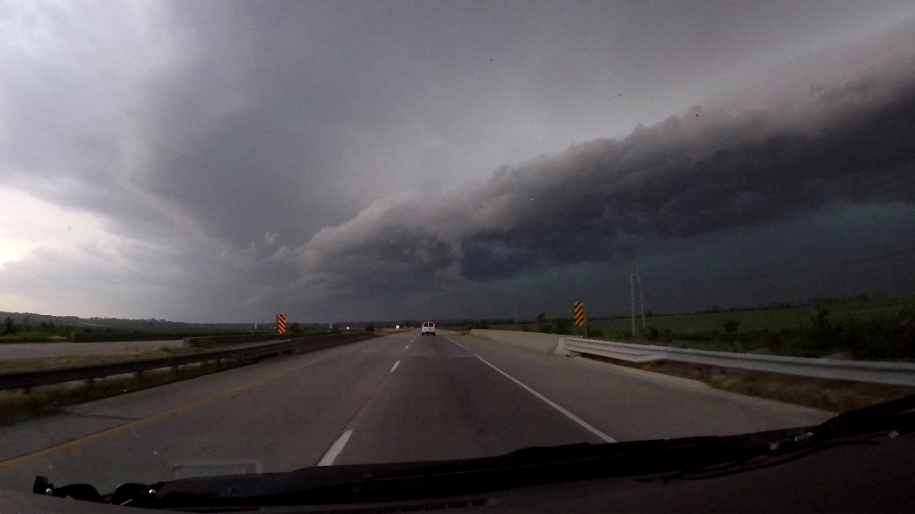
3 storms to our west, and another to the southwest, west of Omaha. We targeted
the southernmost of the 3 to our west which already had a broad, rain-free base,
and turned north at Nickerson and northwest on Rt. 275 towards Hooper, stopping
short of town to observe, parked in the rain as a precipitation core from
another cell passed over us. The storm had a distinct lowering, with scud rising
into the updraft, but the storm cycled down as it was interfered with from a
cell that had blown up on the flanking line farther south. This one was the real
deal, and we charged back south on Rt. 275, getting off in Fremont as the storm
generated a well organized and rotating wall cloud. We watched as the
fantastically structured storm tried to wrap up and got very close to producing,
but then lost its organization and the wall cloud deteriorated. There was a
spotter report from near our location of a confirmed touchdown, but we did not
see even a funnel from our vantage point so we couldn’t confirm.
Our storm was never able to cycle as it was now being
seeded with rain-cooled air from the southernmost storm down near Greenwood, NE
which was not only tornado warned but had produced a confirmed tornado. With our
storm merging with others near it and lining out, we decided to try and get to
the southern storm, but the problem was we had to not only close the distance,
we had to maneuver all the around it, which would take time. We headed southeast
on 275 to Rt. 6, utilizing some local knowledge from one of our guests who lived
in the area, and crossed into Iowa and back onto I-29 south, skirting the
northern side of our new storm’s precipitation core.
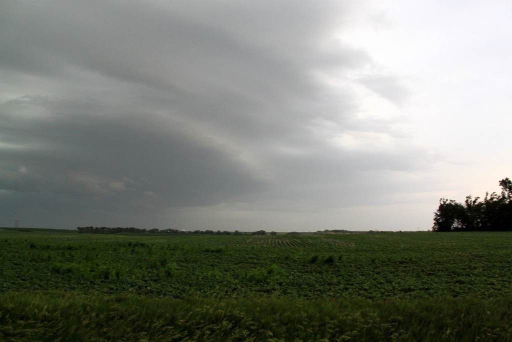
As we headed south, our new target looked to be lining
out as well, and we considered blowing it off and targeting a cluster of cells
that were still away from the line near Oakland, IA, but then thought better of
it and continued after our southern storm after the tornado warning was renewed.
We got off I-29 at Pacific Junction and headed for the crossing over the
Missouri River at Plattsmouth, but then realized that by the time we got south
on the west side of the river, we’d be cut off by the tornadic rotation and
stuck on that side, while the storm crossed over the river and went east. So, we
turned around and headed south to Nebraska City, NE about 20 miles south.
Proceeding down the highway we could eventually see lowerings at 2 different
sections of the line that were tornado warned but didn’t see anything to
indicate a tornado was in progress.
Once we got to Nebraska City, the whole system had become
a huge line, and after heading west out of town briefly we decided to divert to
the tail end cell, which was taking over as the dominant part of the line. We
turned around and went back south on Rt. 75 to Auburn, briefly committing west
before again changing our minds, as now the line was surging east and was almost
on us with baseball sized hail. We continued down towards Dawson then turned
west on Rt. 4 to Humboldt, where were pulled off and observed as the shelf cloud
came towards us. We watched as a portion of the line near us that was tornado
warned spun hard, but again, no tornado. Soon, the first raindrops started to
fall around us and the gust front hit, throwing flying dirt in the air all
around us so we bolted south to get out of the way.
We dropped down to Rt. 8 and back east to Rt. 75 again,
stopping along the way a couple of times to take some photos, but eventually
called it a day and headed to the hotel in Topeka, KS about an hour ahead of the
line and hunkered down as it passed over us.
A long driving day of 665 miles.
SPC
Convective Outlook SPC
Tornado Prob.
NOAA Storm Report
 |
 |
 |
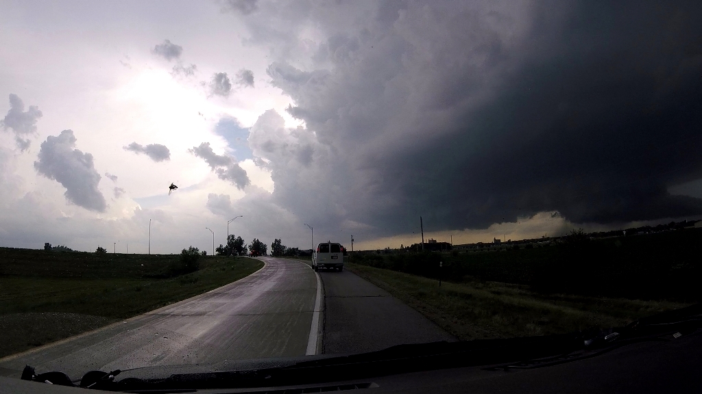 |
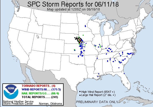
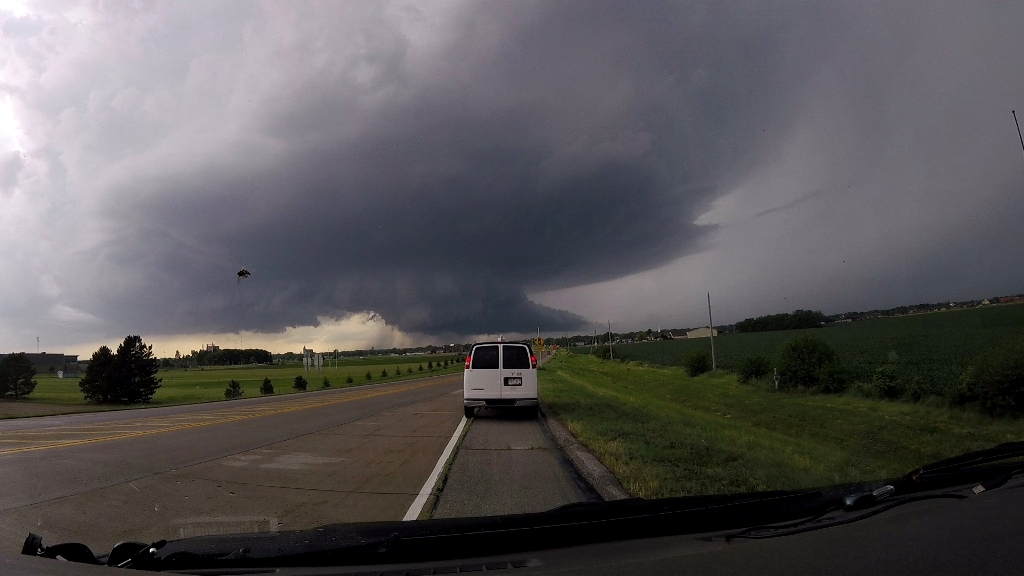
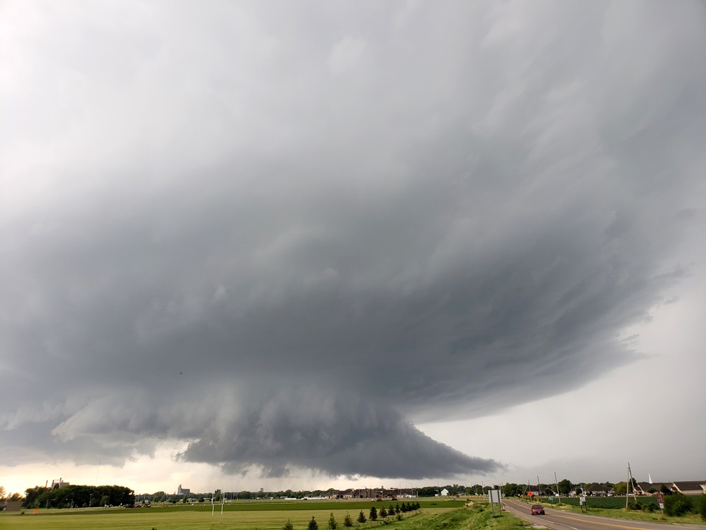
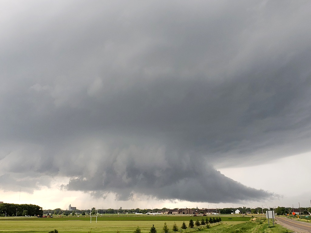
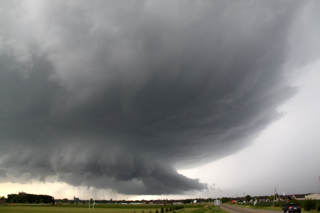
| The plan was to play the north or south end of a bubble high project to form along the Nebraska / Iowa border behind the MCS that was left over from the previous day's storms. Here, we're closing on the first target of the day near Nickerson, NE. | We headed northwest out of Nickerson and stopped short of Hooper to observe the base of our target storm while we sat under the front flank of another cell in the rain. | Lots of scud getting pulled into the updraft, but it was being interfered with by another storm to the south. We changed our attention to that one and headed for Fremont. | Blasting towards Fremont with a developing wall cloud to our southwest. |
 |
 |
 |
 |
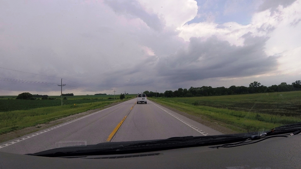
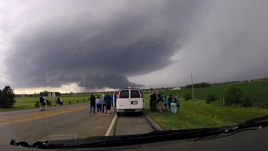
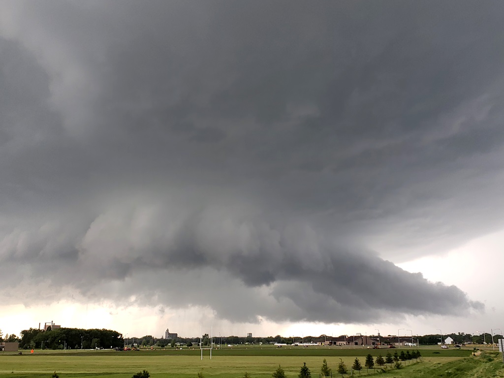
| Off the exit with a rapidly rotating wall cloud right in front of us! | The guests quickly dump out of the van to watch and take photos. | It looked like it was going to drop a tornado, but soon the wall cloud lost focus. | Great structure, but the storm was going to have to cycle to have another chance at a tornado. |
 |
 |
 |
 |
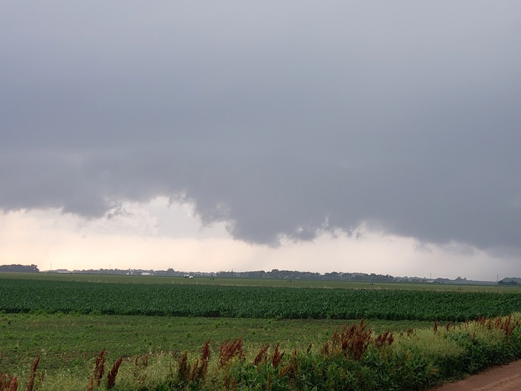
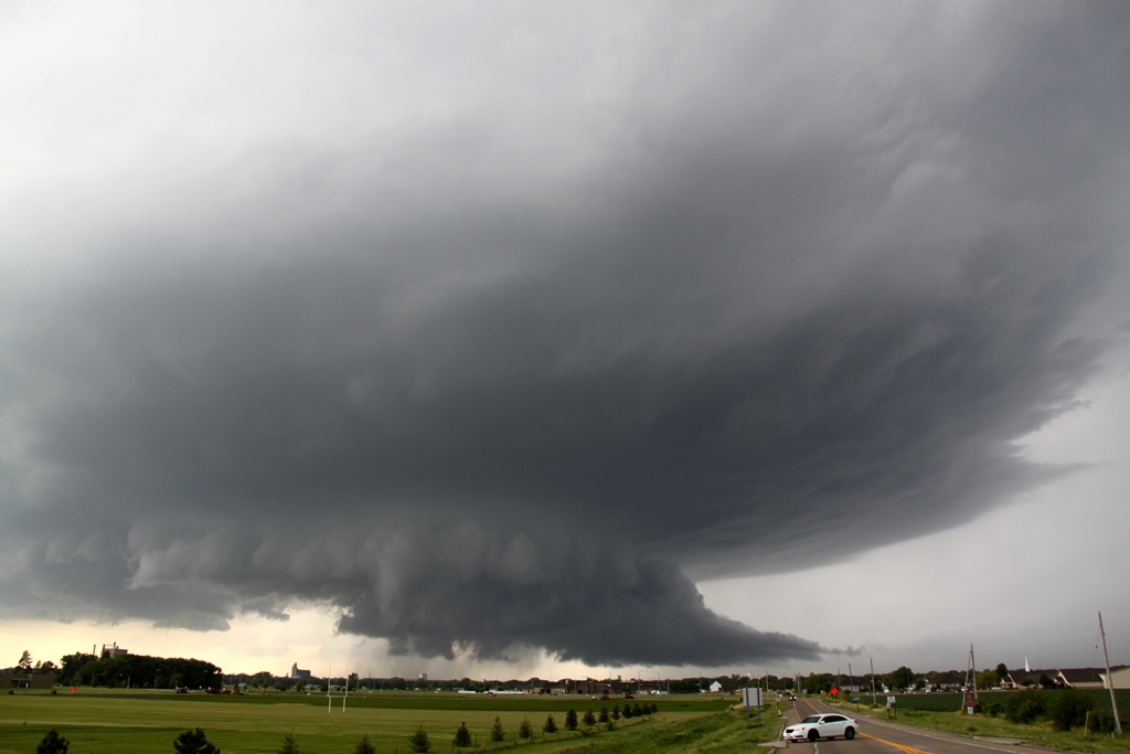
| Closer view | Starting to look more shelf-y. | Now it was this storm's turn to be interfered with another from the south. We started eyeing tornado warned storms southwest of Omaha. | We hacked our way through the Omaha commute traffic in pouring rain as we punched through the front flank core of our target storm. Now on the Iowa side of the state line, we charged south to try and get out in front of tornado warned segments of the line. |
 |
 |
 |
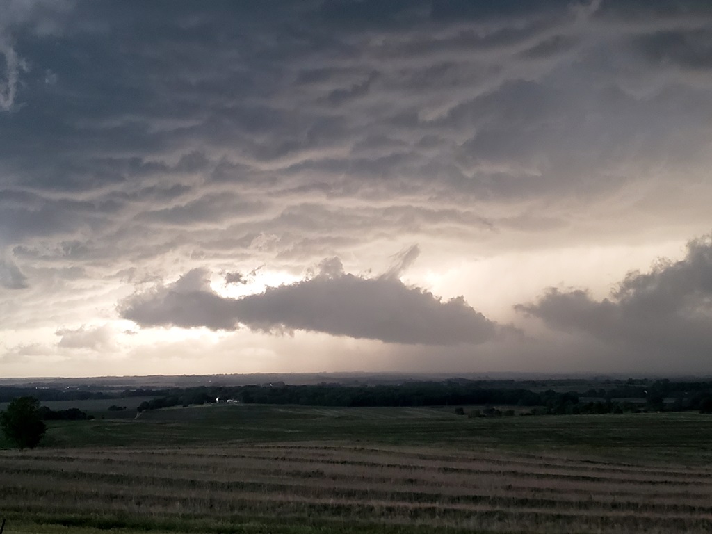 |
| We dropped well south and crossed back into Nebraska but at this point it was one big line of storms. We stopped near Humboldt and observed lots of roiling and rotation in the tornado-warned segment in front of us, but again, no tornado. | Another stop, another tornado warned segment in the distance. | One more stop along the Nebraska / Kansas border as the line surged south, with a lot of scud and other cold air clouds below. We decided we'd had enough and headed for the hotel in Topeka, KS. | Closeup under the shelf. |
All pictures (C) Richard Hamel 2019.