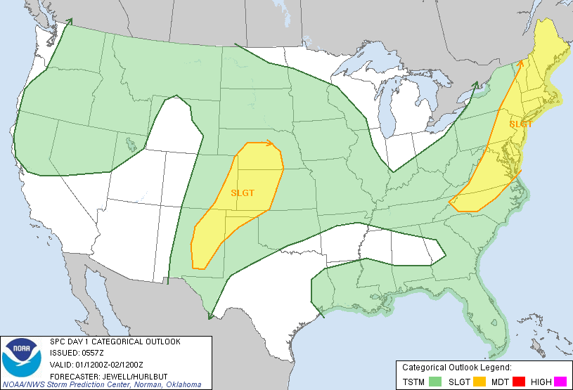
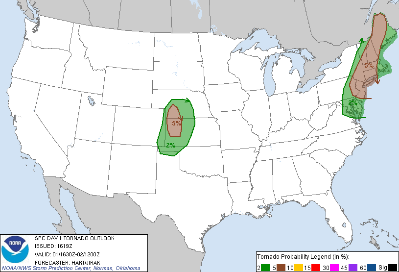
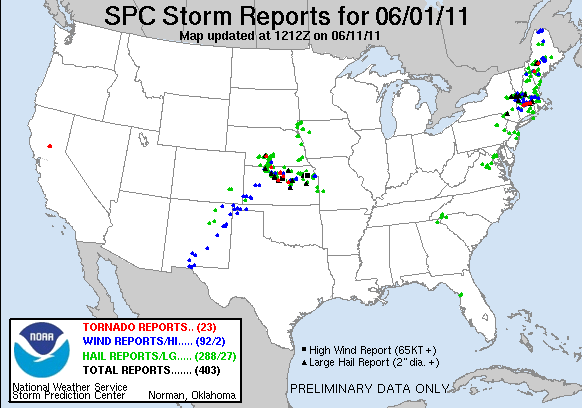
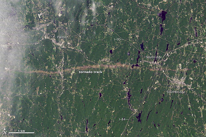
SPC Convective Outlook SPC Tornado Prob. NOAA Storm Report Satellite Photo of the Damage Path
June 1st, 2011, Springfield, MA Tornado
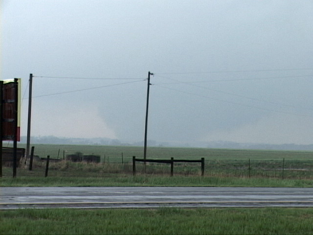
On June 1st, just my second day back to work after returning from my annual storm chasing trip to the Central Plains, Massachusetts suffered it's most significant tornado in over 50 years. Three tornadoes occurred along a line from Springfield to Sturbridge, MA. The largest of these tornadoes was a long-track EF-3 with a damage path extending 39 miles. Being that I had just returned to work, I could not take the day off to chase, but it was obvious by 10 o'clock that morning that if the cap broke that afternoon, there were going to be very severe and possibly tornadic thunderstorms. I did leave work early with the intent of chasing, and was amazed to hear reports of a tornado on the ground as I drove from work to home in order to get my chasing gear. By the time I got out on the road, the commute traffic had become too heavy to make an intercept possible, and when the tornado warning was extended to include my county, I decide it was best that I pick up my daughters from their day care and make sure we all stayed safe. Luckily the storms weakened significantly before they got to us, though later that night a squall line passed through with some of the most stunning lightning I've in a New England storm.
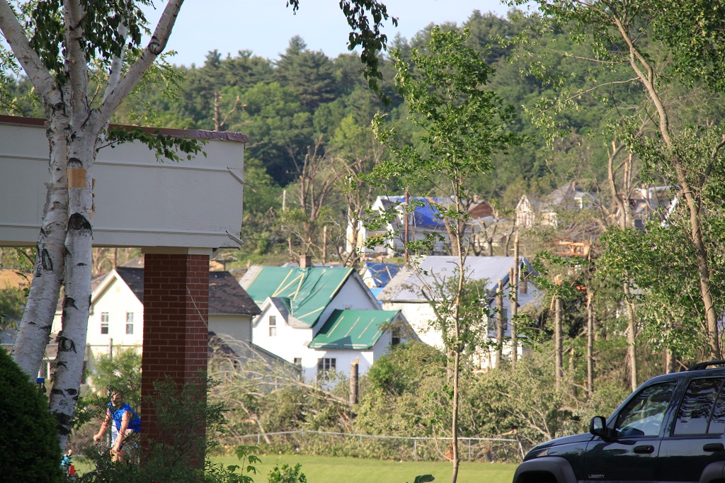
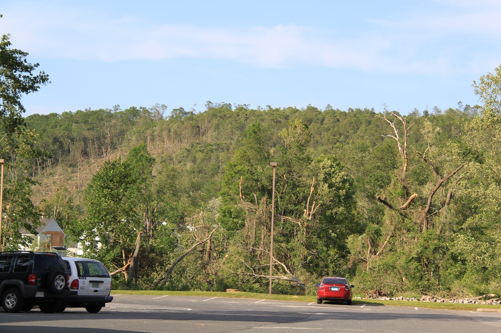
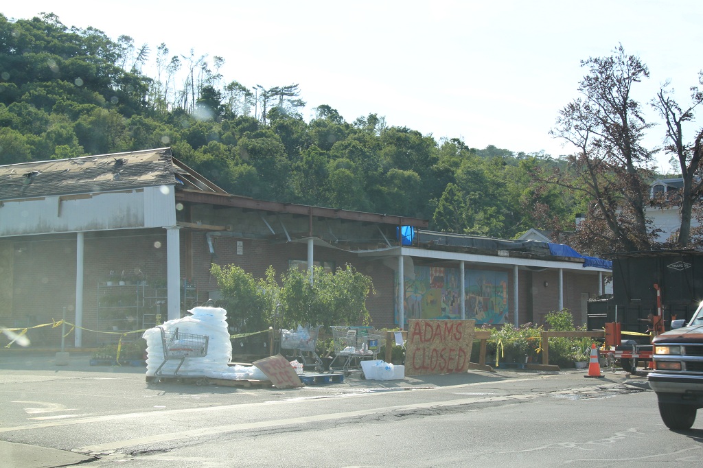
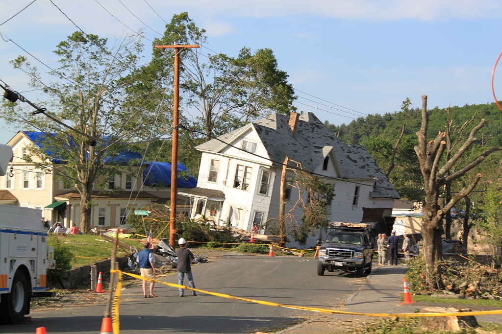
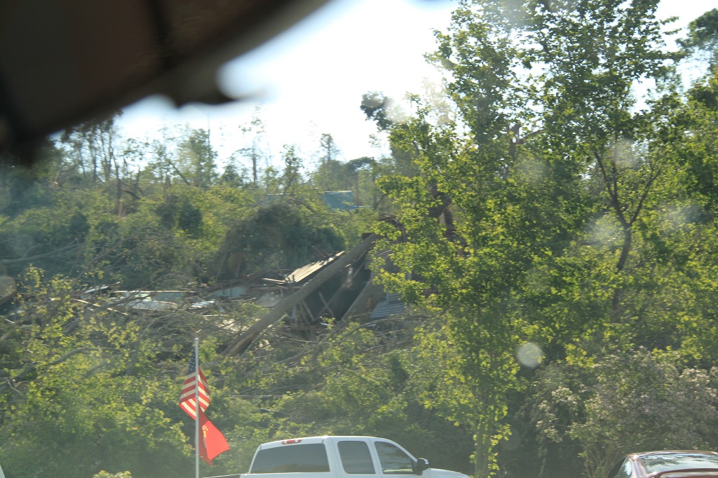
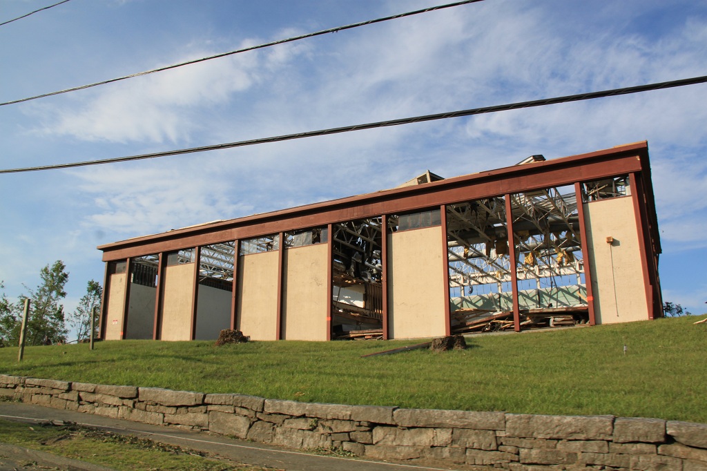
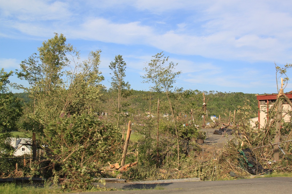
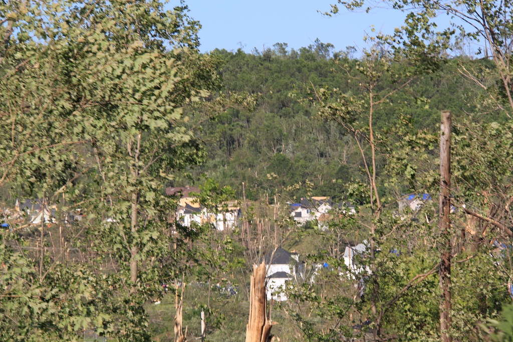
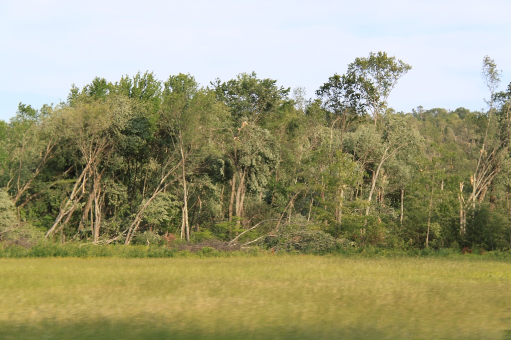
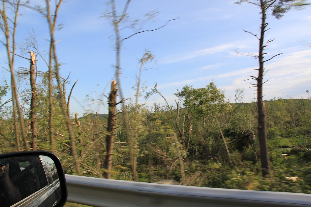
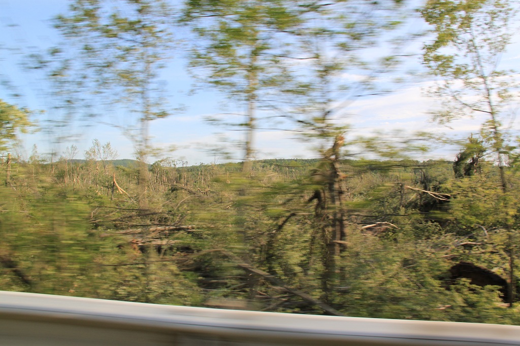
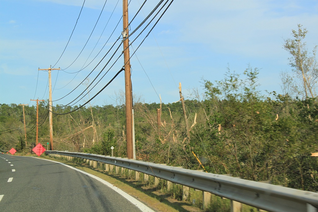
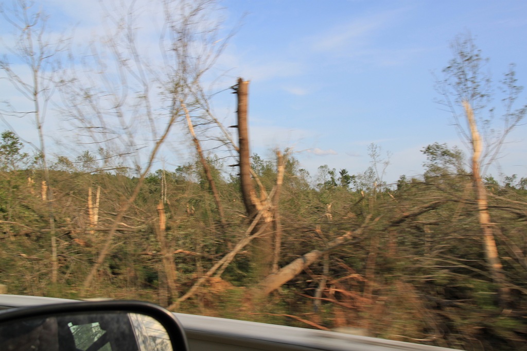
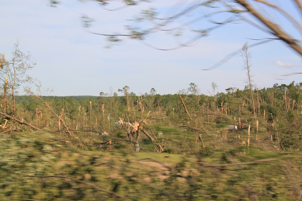
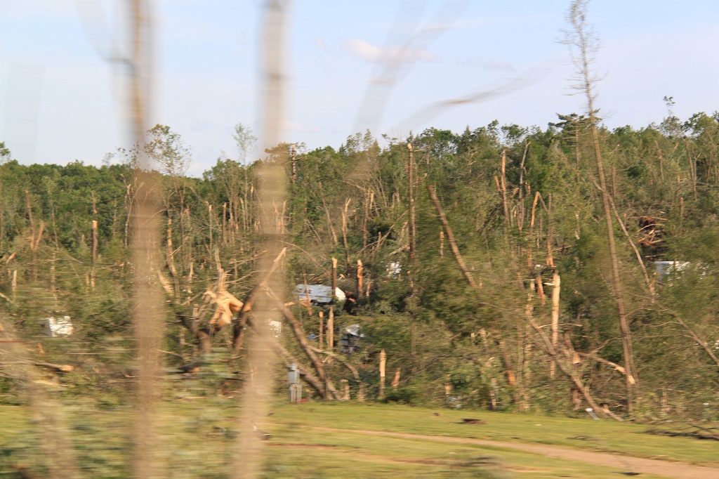
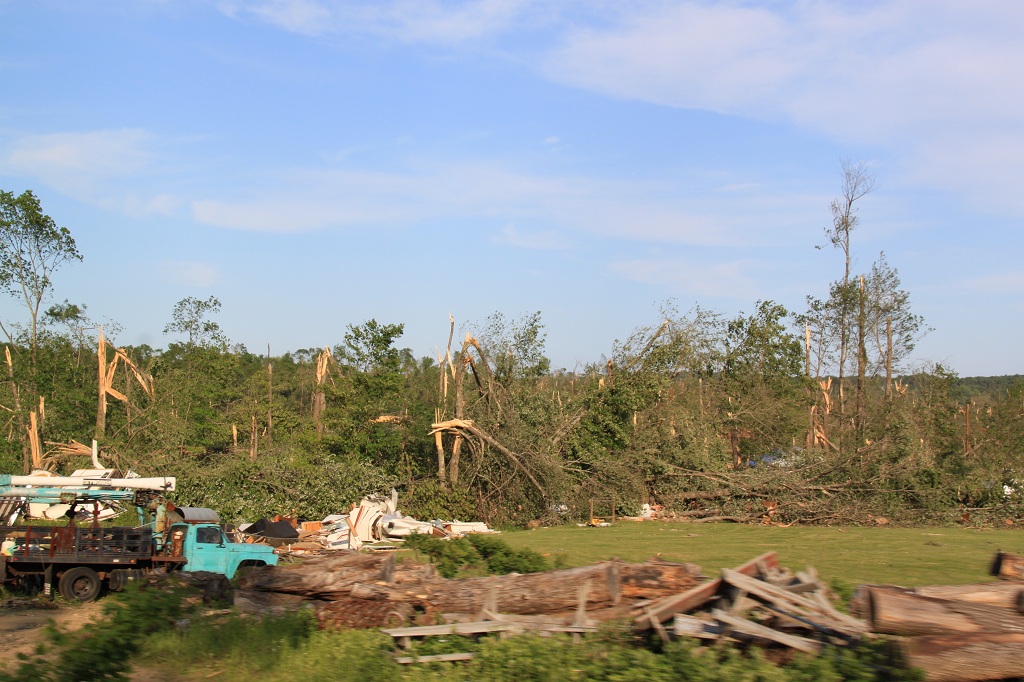
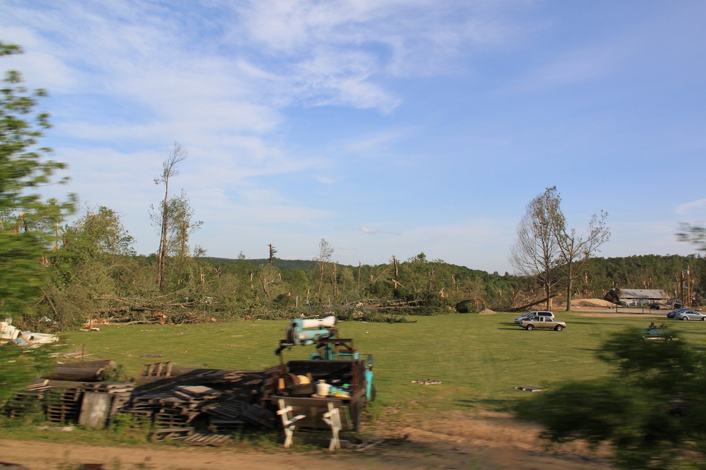
Although I wasn't able to actively chase the storm, 3 days later, on June 4th, we took a ride out of Monson and Brimfield, MA, two towns that had seen the most damage. The tornado had traveled right along Rt. 20, and the damage was intense, with literally thousands of trees destroyed. One thing you don't usually see out on the plains is tornado damage in forested areas, simply because there aren't nearly as many trees. Below are a number of pictures I took of downtown Monson, along with the damage along Rt. 20 in Brimfield. Unlike the typical tornadoes we experience in New England in any given summer, these were legitimate supercell tornadoes, as opposed to the brief tornadoes embedded in squall lines we generally see.
Here is the link to the National Weather Service summary of the events, with damage reports, radar, damage tracks, etc:
http://www.weather.gov/media/box/officePrograms/science/Springfield_Tornado_June_01_2011.pdf
There is some video of the tornado crossing the Connecticut River in downtown Springfield. From the Associated Press:
I did a couple of media appearances discussing this tornado, one with WGBH TV, and another with the NPR Boston radio affiliate:
WGBH TV, Boston, MA "Greater Boston" show: On April 28th, 2011, A day after the massive tornado outbreak in the Southeastern United States, I appeared on the "Greater Boston" show to discuss the outbreak and the conditions that caused it.
WGBH TV, Boston, MA "Greater Boston" show: On June 2nd, 2011, the day after an EF-3 long track tornado with a 39 mile damage path hit Massachusetts, I returned to the Greater Boston show to discuss that tornado and my experience in Joplin, MO about a week earlier.
SPC
Convective Outlook SPC
Tornado Prob. NOAA Storm Report Satellite Photo of the Damage Path
All pictures (C) Richard Hamel 2017.


